Market Drayton, Shropshire Union Canal, Tyrley Locks, The Four Alls and River Tern
A stroll on a towpath and country lanes near a pretty market town
Google Maps Open Source Maps| Statistics and Files | ||
|---|---|---|
| Start: St Mary's Church | Distance: 4.3 miles (7.0 km) | Climbing: 80 metres |
| Grid Ref: SJ 67657 34095 | Time: 2 hours | Rating: Easy |
| GPX Route File | Google Earth File | About Market Drayton |
| Statistics | |
|---|---|
| Start: St Mary's Church | Distance: 4.3 miles (7.0 km) |
| Climbing: 80 metres | Grid Ref: SJ 67657 34095 |
| Time: 2 hours | Rating: Easy |
| GPX Route File | Google Earth File |
Ordnance Survey Explorer Map (1:25,000)
The Walk:
There has been a settlement at Market Drayton since pre-Norman times, when it was known as 'Cair Draith Rut-Dan (Town on the Road). The Domesday Day book refers to it as 'Draiture'. Cistercian monks marketing their produce led to the town being granted a charter in 1245; since then, a market has been held here every Wednesday.
A great fire destroyed much of the thatched timber town in 1651. One survivor was the Crown Hotel. Charles I may have slept there in the Civil War; certainly his son, on becoming Charles II in 1660, ordered a nationwide collection to be made to rebuild the town.
The town's history since then is linked to the spice trade. Great stores of ginger, which at that time were second in importance only to pepper, were held here in the 17th century, and the town has been celebrated for its gingerbread since at least 1793, the first year a gingerbread maker was recorded there. Nowadays, the town vigorously celebrates its links with the trade and even boasts a popular Ginger and Spice Facebook Group.
Market Drayton's most famous son was Robert Clive, who was better known as Clive of India. He left the town at the age of 17 to journey to India with the East India Company, who controlled the spice trade.
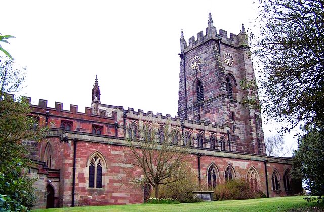 St Mary's Church, Market Drayton
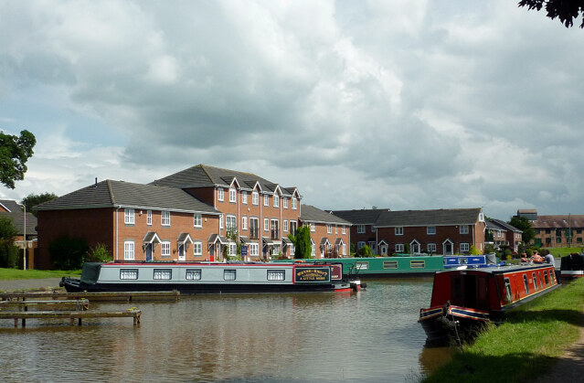 Shropshire Union Canal at Market Drayton
The walk starts at the edge of the town and explores the countryside to the south. You begin by making your way to the Shropshire Union Canal, which you join near an aqueduct, Berresford Bridge. At this point, the waterway forms the county boundary with Staffordshire.
The canal is on the top of a high embankment, reached by a flight of steps to the side of the aqueduct. As you walk along the towpath, the embankment gradually gives way to open farmland.
This peaceful stretch of water leads to a very attractive sandstone cutting in which are found at the Tyrley Locks. A canopy of trees casts deep shadows, creating a cool, moist environment in which ferns, mosses and liverworts thrive. The insects that enjoy such conditions are hunted by bats in the evenings.
At the fifth lock, you go under the bridge to Tyrley Wharf. This was the point where the local Peatswood Estate loaded farm produce and unloaded coal. It was also used by the well known chocolate manufacturers, Cadbury's, who collected the milk for their Knighton factory here. The buildings are dated 1837, and the lock cottage shows a strong Telford influence.
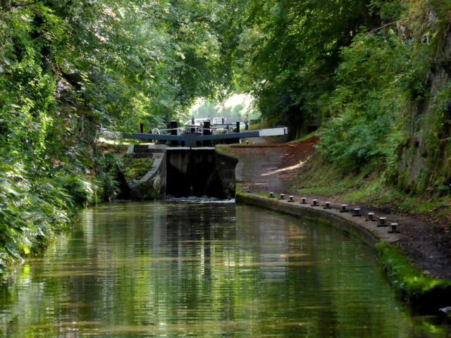 Tyrley Locks on the Shropshire Union Canal
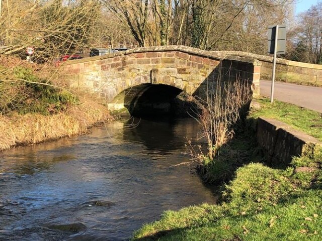 Walkmill Bridge on the River Tern
A quiet country road leads to The Four Alls public house, which dates back as far as the 16th century, though it has been extensively modernised since. Its unusual name is derived from a King who rules all, a General who fights for all, a Bishop who prays for all, and a Citizen who pays for all!
On the way back to Market Drayford, the route passes Salisbury Hill away to the left. The Earl of Salisbury's Yorkist army camped here on their way to the Battle of Blore Heath in the Wars of the Roses. Although heavily outnumbered by Lord Audley's 10,000 Lancastrian men, the men of the White Rose were victorious.
The lane emerges at Walkmill Bridge, an old packhouse bridge over the fledgling River Tern, on the outskirts of the town. It is a short walk from here back to the starting point of the walk.
Acknowledgment: Text derived from the Out and Out Series; Discovering the Countryside on Foot. Pictures courtesy of Wikipedia.


