Eccleshall, Pershall, Cop Mere and Walk Mill
Walking from a planned Norman town to a wildfowl lake
Google Maps Open Source Maps| Statistics and Files | ||
|---|---|---|
| Start: Eccleshall | Distance: 6.3 miles (10.2 km) | Climbing: 94 metres |
| Grid Ref: SJ 83158 29165 | Time: 3 hours | Rating: Easy |
| GPX Route File | Google Earth File | About Eccleshall |
| Statistics | |
|---|---|
| Start: Eccleshall | Distance: 6.3 miles (10.2 km) |
| Climbing: 94 metres | Grid Ref: SJ 83158 29165 |
| Time: 3 hours | Rating: Easy |
| GPX Route File | Google Earth File |
Ordnance Survey Explorer Map (1:25,000)
The Walk:
The curiously named River Sow drains a large area of the quiet undulating countryside of mid-Staffordshire. The main settlement on its upper reaches, Eccleshall, started out as a planned market town, then became a rural backwater and has bloomed again in recent years as a dormitory town.
The heart of the old town remains intact. The crossroads and major thoroughfares are lined with all inns, cottages and yeoman's houses, redolent of the town's Georgian heyday, when it was an important stop on the London to Chester coach route. Some of the coaching inns on the High Street encroached over the pavements; the covered walkways thus created doubled as a butter market. One of the inns, the Royal Oak, played host to King Henry VI and Queen Margaret the night before the Battle of Blore Heath, the first major conflict of the Wars of the Roses, which was fought a few miles away to the north in 1459.
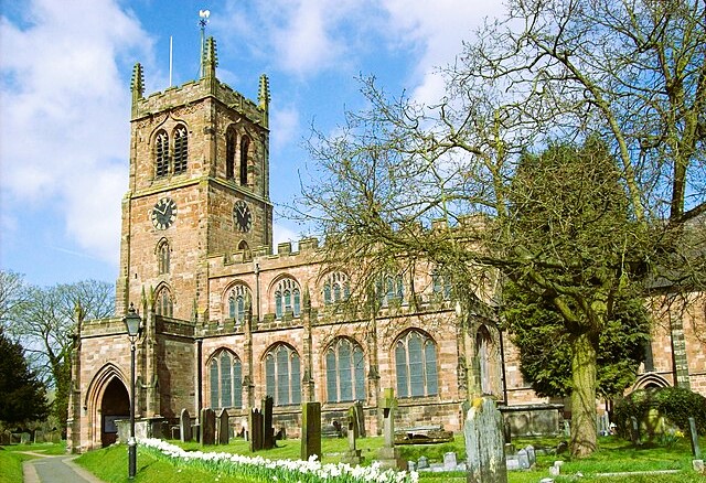 Holy Trinity Church, Eccleshall
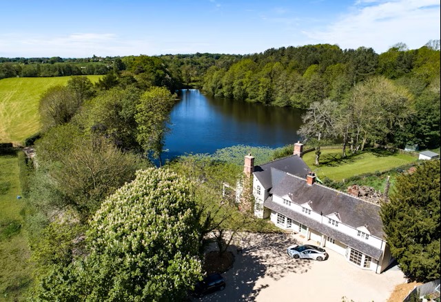 Pershall Pool
Eccleshall was planned in around 1190 by the Bishop of Lichfield, who reclaimed and extended a Saxon see. He developed a castle-cum-bishop's palace at the centre of a bishopric that extended from Chester to Coventry. The castle was destroyed in the Civil War and replaced in 1695 by an imposing mansion, built for Bishop Lloyd. Six bishops were buried in Holy Trinity Church before the diocesan centre moved to the city of Lichfield in 1867.
The vast Holy Trinity Church was comprehensively restored by the Victorians, but four of the bishops memorials remain. Two splendid alabaster chest-tombs are all but hidden in the murky twilight, beneath clerical regalia at the west end.
The route leads over higher ground known as the Leys, an area dotted with small pits and hollows. Some of these are marl holes. Others are kettle holes, dated from the Ice Age, and were created when buried blocks of ice melted, causing small collapses on the lands surface.
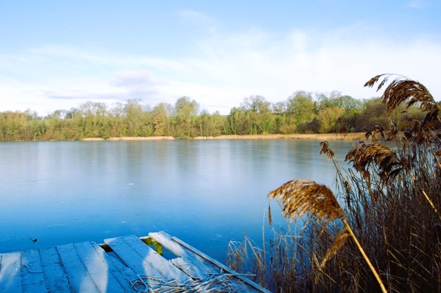 Cop Mere
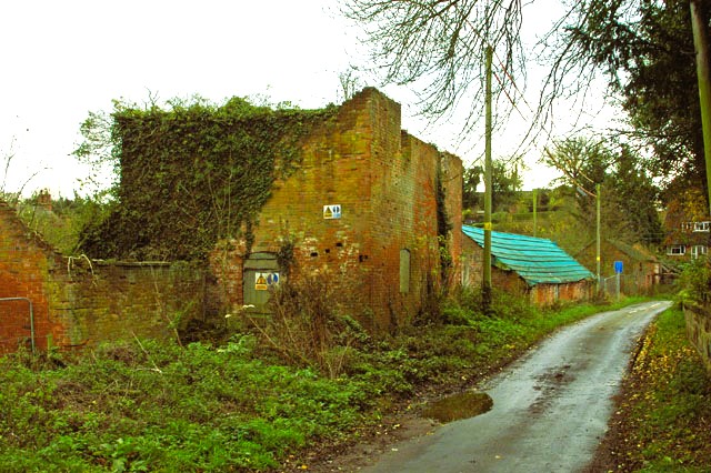 Walk Mill
You come to Cop Mere, a great water filled hollow surrounded by reeds and woodland. The smaller Pershall Pool is away to your right. These lakes were created about 12,000 years ago. Most of the county was covered by ice, which gouged out depressions in the land surface. When they actually retreated, the holes filled with melt water and were kept topped up by the rivers, in this case, the River Sow. Access to the mere side is private, but frequent gaps in the trees allow you to see the wildfold that make these waters an ornithologist paradise all year round.
The turning point of the route is Walk Mill, where the village corn mill is becoming increasingly decrepit. The immediate area is littered with old metal cogs, shafts and wheels, while a glimpse through old windows or gaps in the door reveal a complex jumble of decaying machinery.
Varied cottages and farms, both ancient and modern, line the lane for the next half mile or so. The wooded south side of Cop Mere separates the hamlet of Walk Mill from Copmere End, and the welcoming Star Inn. From here, an easy stroll, mostly along back lanes, returns you to Ecclesall.
Acknowledgment: Text derived from the Out and Out Series; Discovering the Countryside on Foot. Pictures courtesy of Wikipedia.


