Salford, Rollright Stones and Little Rollright
Standing stones and a charming hamlet in the north Cotswolds
Google Maps Open Source Maps| Statistics and Files | ||
|---|---|---|
| Start: Salford | Distance: 6.6 miles (10.6 km) | Climbing: 181 metres |
| Grid Ref: SP 28650 28047 | Time: 3 hours | Rating: Moderate |
| GPX Route File | Google Earth File | About Salford |
| Statistics | |
|---|---|
| Start: Salford | Distance: 6.6 miles (10.6 km) |
| Climbing: 181 metres | Grid Ref: SP 28650 28047 |
| Time: 3 hours | Rating: Moderate |
| GPX Route File | Google Earth File |
Ordnance Survey Explorer Map (1:25,000)
The Walk:
Salford is so named because it was one of the original Cotswold salt routes. The precious mineral was brought down the Severn Valley, then taken across the wolds by pack-horses on its way to the Thames Valley and London.
The village's church, where this walk begins, was heavily restored by the Victorian architect George Edmund Street. A relief of a centaur over the south door is the main survival from the medieval church. The route goes through the churchyard, where fig trees hang over the wall, and skirts the edge of the village before heading out across the open countryside.
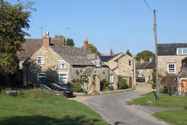 Beautiful Salford
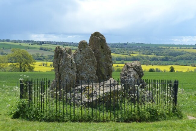 Whispering Knights
This part of the walk follows field paths through rich arable land. Many of the hedgerows have been grubbed out and growing crops can make the path difficult to follow. You climb a long field, where hares may sometimes be seen, to Brighthill Farm, then join a road that forms the boundary between Oxfordshire and Warwickshire. Its ridgetop position suggests that it is an ancient route. This is confirmed by the presence of the Rollright Stones.
The Whispering Knights stand in a conspiratorial huddle behind some railings in a field. Further on is the King Stone, an imposing monolith on a rise that commands wonderful views north, over Long Compton into Warwickshire.
On the other side of the road is a henge of low stones, the King's Men. It is supposedly impossible to count the stones and get the same result twice, though most people arrive at a number close to 76. The site has many legends, including one that the stones roll downhill at certain times to take a drink from the river. They are supposedly the remains of an invading army, petrified by a witch. The Whispering Knights, stories suggest, have lagged behind while plotting against their ruler.
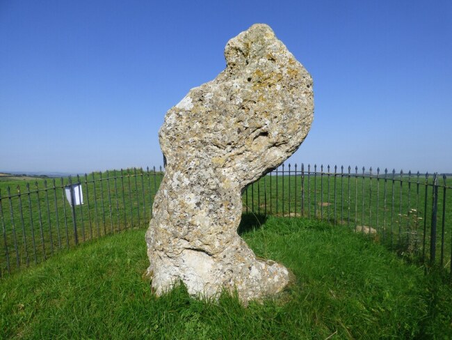 King Stone
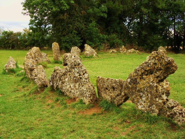 King's Men Stone Circle
You follow the old route, the Jurassic Way, to a crossroads, then turn down a quiet lane. A short way down to the right is Little Rollright, known in the Domesday Book as 'Rollandri'. There was a substantial village here, owned by Eynsham Abbey. By 1279, it had a population of 100 and a small monastery.
The village was swept away in the 16th century to make sheep pastures. Two hundred acres were enclosed in 1517. An old moat, monastic fish ponds, and a few earthquakes are all that remain of the old village.
Today, Little Rollright consists of a farm, the stone-built manor (1633), the old rectory (1640), and the church of St Philip, which has as pleasing rustic simplicity. In the chancel, which was built by the monks, are too fine large 17th century wall tombs.
You climb back through fields to the ridge-top road, then turn off on an old packhorse route to Chipping Norton, which takes you to the north end of Salford. The last section of the walk winds through the village. It has no particularly fine buildings, but there are plenty of charming cottages, and an abundance of fragrantly flowery gardens.
Acknowledgment: Text derived from the Out and Out Series; Discovering the Countryside on Foot. Pictures courtesy of Wikipedia.


