Charwelton, Fawsley and Church Charwelton
Visit a great estate and the remains of a medieval village
Google Maps Open Source Maps| Statistics and Files | ||
|---|---|---|
| Start: Charwelton | Distance: 6.2 miles (9.8 km) | Climbing: 99 metres |
| Grid Ref: SP 53763 56218 | Time: 3 hours | Rating: Easy |
| GPX Route File | Google Earth File | About Charwelton |
| Statistics | |
|---|---|
| Start: Charwelton | Distance: 6.2 miles (9.8 km) |
| Climbing: 99 metres | Grid Ref: SP 53763 56218 |
| Time: 3 hours | Rating: Easy |
| GPX Route File | Google Earth File |
Ordnance Survey Explorer Map (1:25,000)
The Walk:
This walk explodes the effect the enclosures of the 15th century had on the landscape and those who lived in it. It begins by a dry valley who slopes a corrugated with ridges and furrows. These ripples are a hallmark of the rural Midlands; they are the pattern of the 15th-century village fields that were swept away when enclosures turned the area into a huge sheep concern.
You pass Fawsley Farm, an 18th-century house in the local limestone, on the way to Fawsley Hall. This was the home of the Knightley family, lords of the manor here for several centuries, who were responsible for the local enclosures. It is set in parkland laid out by Capability Brown, much of which has reverted to farmland, though Brown's ornamental lakes survive as a reminder of its former splendour.
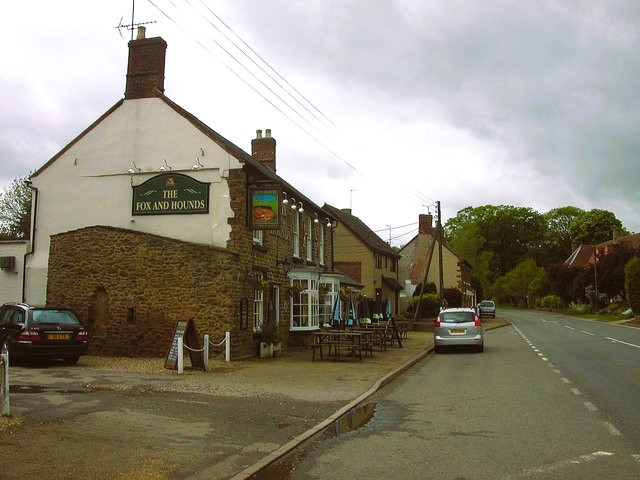 Fox and Hounds, Charwelton
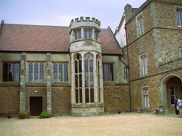 Fawsley Hall
The walk goes through the park to the church, which is richly rewarding inside. Effectively the family chapel of the Knightley's, it is crammed with their memorials and boasts a large squire's pew. There is also a fine collection of 16th-century Flemish stained glass.
A waymarked path between the lakes crosses ones of the great 'laundes', or sheep pastures. This gives a good feel of the 16th-century landscape, with sheep grazing amid the long views back over the hall, the church and the park.
Over the crest of the rise, you descend to the Charwelton road. The Valley ahead is occupied by the superbly clear earthworks of the deserted medieval village of Charwelton, the houses of which were cleared away by the early 16th century, at the behest of three generations of the Andrewes family. A former road, or holloway, runs from left to right, with remains of house platforms on either side.
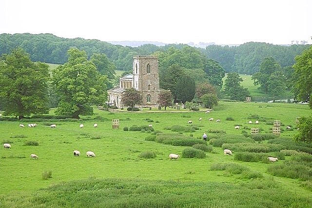 Countryside near Fawsley
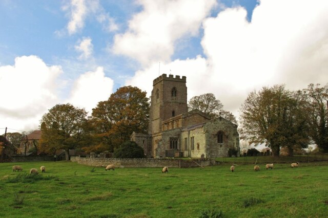 Church Charwelton
The Church of the Holy Trinity has a collection of monuments to the Andrewes family. The porch has a low stone rib vaulted roof, and its archway frames a good view of the deserted village site. Charwelton House, opposite, was built after the village was abandoned. This four square, hipped-roof, ironstone house dates from the early 18th century.
The route continues parallel to a spectacular system of ponds and islets, described on the 1847 tithe map as fish ponds, but more likely to have been provided for wildfowl.
You cross a dismantled railway into modern day Charwelton, with cottages along the lane, and a village green. At the end, the pavement crosses a narrow, two-arched, late medieval packhorse bridge. The route back to the start passes Charwelton Hall, an ironstone Georgian house with coped gables.
Acknowledgment: Text derived from the Out and Out Series; Discovering the Countryside on Foot. Pictures courtesy of Wikipedia.


