Burton upon Trent Heritage Walk
Discover the buildings and waterways of a famous brewing town
Google Maps Open Source Maps| Statistics and Files | ||
|---|---|---|
| Start: National Brewery Centre | Distance: 4.2 miles (6.7 km) | Climbing: 6 metres |
| Grid Ref: SK 24836 23539 | Time: 2 hours | Rating: Easy |
| GPX Route File | Google Earth File | Burton upon Trent |
| Statistics | |
|---|---|
| Start: National Brewery Centre | Distance: 4.2 miles (6.7 km) |
| Climbing: 6 metres | Grid Ref: SK 24836 23539 |
| Time: 2 hours | Rating: Easy |
| GPX Route File | Google Earth File |
Ordnance Survey Explorer Map (1:25,000)
The Walk:
The all-pervading aroma of beer is the first thing that strikes the visitor to Burton upon Trent. Brewing has dominated the Staffordshire town for centuries, and the student of industrial history, as well as the beer connoisseur, will find much that is of interest here. In addition, some surprisingly green pockets remain, varying the scenery considerably in the compact area covered by this walk.
In the Middle Ages, the monks of Burton Abbey realised that the area's water filtered through the local gypsum, and rich in calcium and magnesium salts, was capable of producing excellent ale. Brewing continued in Burton after the abbey was dissolved in 1744 - William Worthington a Leicestershire man, established a brewery in the High Street. William Bass did the same in 1777, and quickly established a reputation for fine quality beers.
Worthington and Bass was soon exporting their beers to the Baltic and Russia, and later to India. With the expansion of the railways in the 19th century, the Burton brewers began to exploit the home market, and beer became the national drink.
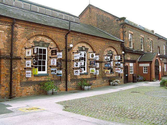 National Brewery Centre, Burton upon Trent
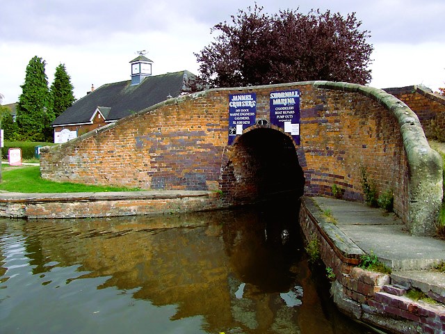 Bridge at Shobnall Marina, Burton upon Trent
At the National Brewery Centre, where the walk starts, the visitor can learn all about the history and methods of brewing in Burton upon Trent. Transport has always been an essential feature of the industry, and on display are early steam engines, vintage delivery vehicles, and the Bass shire horses, which are still used to pull drays at shows and parades.
The walk continues along busy streets, Derby Street follows the line of the Roman Icknield Street, though it is difficult to picture this today, while Victoria Road is lined with 19th-century terraced cottages built for the brewery workers.
You turn off along the towpath of the Trent and Mersey Canal. Once busy with barges carrying cargoes of beer to the ports, the canal is now a leisure waterway. Colourful narrowboats glide along between the locks, and pleasure cruisers can be hired at Shobnall Marina. The wild flowers by the water's edge, and the green expanse of fields opposite, provide a contrast with Burton's industrial face.
The route leads to the St Pauls Square, now a conservation area, which was laid out following the building of St Paul's Church in 1874. The Gothic town hall was completed in 1894 by Michael Arthur Bass, the first Lord Burton. King Edward Place was created in 19O6, after a visit by King Edward VII. Just around the corner in Wellington Street is a delightful row of alms houses, erected in 1875.
Some of the most significant buildings of Burton's industrial past line the next part of the route, which follows Borough Road and Station Street. The Midland Railway's Grain Warehouse number 2 was built in 1854. Now restored for use as offices, it retains the 'crimson lake and cream' livery of the railway in its paintwork.
The massive Bass Number 2 brewery on your right totally dominates the street. Inside the 3-foot thick walls is the famous Burton Union oom. Unions are containers in which fermentation of the beer is completed. The room is nearly a mile in length, and held 2,548 unions - averaging four barrels of beer each.
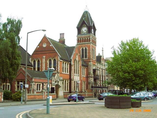 Burton on Trent Town Hall
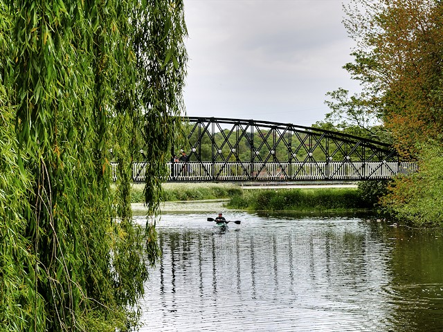 Andresey Bridge, Burton on Trent
The Market Place contains the parish Church of St Modwen, which stands on site of the Benedictine Abbey. The present church dates from a rebuilding in 1719, and has many monuments to brewers inside. The Victorian Market Hall is impressive and the weekly Thursday market, originally granted by King John in 1210, is still held.
Beyond the Market Place is a delightful green area by the River Trent, the Washington Town Park. It is possible to explore the island in the Trent by crossing one of the footbridges. The holy water from a chalybeate well on the island once attracted many pilgrims to the town.
The large water tower on the left was built in 1856 to store quantities of the precious Burton water, drawn up from wells for brewing. Further on, by the weir, is an impressive 32-arch bridge, built in 1864 to replace a medieval bridge. Burton has long been a strategic crossing point over the Trent. During the Civil War, Cavaliers and Roundheads fought almost incessantly for possession of the bridge, and Burton changed hands five times.
The last part of the route leads along Bridge Street and Horninglow Street. Nunneley House was built in 1760 by Samuel Sketchley, and later occupied by Joseph Nunneley's Brewery. The early 18th-century house nearby was Charles Leeson's brewery from 1753 to 1800. A number of other fine 18th century houses line the street of the way back to the National Brewery Centre and the starting point of the walk.
Acknowledgment: Text derived from the Out and Out Series; Discovering the Countryside on Foot. Pictures courtesy of Wikipedia.


