Stonor Park, Southend, Turville, Fingest and Skirmett
Off the beaten track to beautiful villages in the Chiltern Hills
Google Maps Open Source Maps| Statistics and Files | ||
|---|---|---|
| Start: Stonor | Distance: 8.2 miles (13.2 km) | Climbing: 372 metres |
| Grid Ref: SU 73668 88971 | Time: 4 hours | Rating: Hard |
| GPX Route File | Google Earth File | About Stonor |
| Statistics | |
|---|---|
| Start: Stonor | Distance: 8.2 miles (13.2 km) |
| Climbing: 372 metres | Grid Ref: SU 73668 88971 |
| Time: 4 hours | Rating: Hard |
| GPX Route File | Google Earth File |
Ordnance Survey Explorer Map (1:25,000)
The Walk:
This circular walk explores the less frequented hills and valleys of the beautiful stretch of beech clad Downs, the Chiltern Hills. It passes three remote villages with a curious names, Turville, Fingest and Skirmett. All three are picturesque and each has an individual charm.
The walk starts from Stonor Deer Park which is home to a gracious old house with some 800 years of history. Standing in the fold of a hill, Stonor House, and its 14th-century chapel, are seen from the path through the beech woods, across the narrow valley where deer still graze.
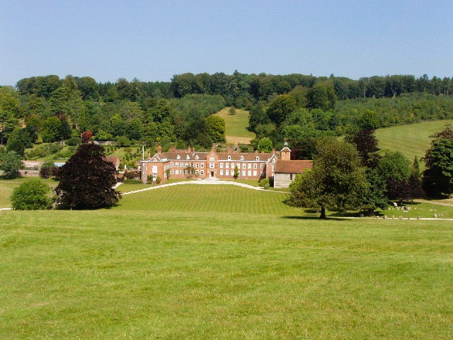 Stonor House and Deer Park
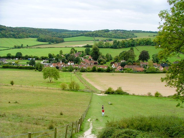 Following the Chiltern Way to Turville
Soon after leaving the woods, the county border between Oxfordshire and Buckinghamshire is crossed. At the hamlet of Southend is an old inn, now converted into a private house - The Drover. This was the former halting place of the sheep drovers who moved the Stonor sheep down Drovers Lane to the wharf at Henley-on-Thames, five miles away.
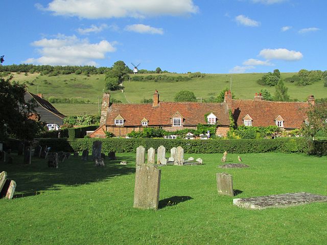
Shortly after passing Southend Farm, the high ground affords wide views over the surrounding wooded hills. Cobstone Windmill, a weatherboarded smock mill, is prominent on the hill ahead. Smock mills were developed in the 1600's. These mills were fitted with a revolving cap to which the sails were fixed, together with a fantail mechanism. The fan automatically turned the cap so that the sails always faced into the wind.
Descending through fields, the village of Turville is entered by way of a lane lined with old flint faced cottages. The lane opens into the middle of the village, and here other cottages with flower filled gardens huddle around the small village green. On one side is the village inn, The Bull and Butcher.
Completing the scene on the other side is the church with its massive squat Norman tower. (The name Turville derives from the Saxon Thyr-Feld or Thyr's field. The Normans have difficulty in pronouncing this and modified it to the French sounding Turville).
 The village of Turville
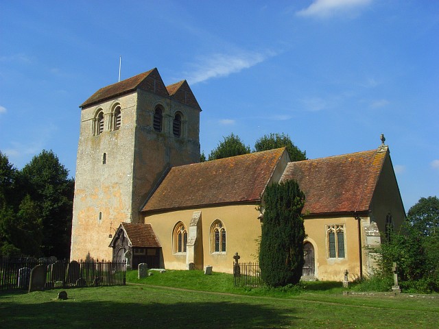 St Bartholomew's Church, Fingest
Striking uphill towards the mill, a path branches to the right across the field and contours around the slope. The stile at the top offers a good place for a pause, and a glance back down to the village, neat and compact in the little valley between the rolling hills.
A little further around the wooded Hill, another view unfolds, of a valley running southwards towards the River Thames. The path continues between a thick screen of trees to emerge most abruptly in the village of Fingest.
The village's most striking feature is its unusual church tower, which is crowned by a double gable. Opposite is the well preserved 17th century Chequers Inn. Like Turville, Fingest is an attractive ancient village; its name suggests it was once an important meeting place, formally spelled Tynghyrst, it means 'wooded field of assembly'.
A short distance along the lane is the village of Skirmett. Its Danish place name has a similar meaning - 'shire meeting place'. From the outskirts of Skirmett, an ascent is made into the wooded hills above the village. Once the trees are reached, a level path circles Poynatt's Wood.
Through the trees, the converging valleys are spread out below. A broad forest track then descends into one of these valleys and is followed for over a mile through the splendid Great Wood.
Emerging from Great Wood and passing Kimble Farm, extensive views to the south of the distant Thames Valley unfold. Soon the Deer Park is reached, and a steep path descends through the trees back to the finish in Stonor village.
Acknowledgment: Text derived from the Out and Out Series; Discovering the Countryside on Foot. Pictures courtesy of Wikipedia.


