Purleigh, Hazeleigh and Rudley Green
The Church on the Hill - A walk through meadows and fields under huge Essex skies
Google Maps Open Source Maps| Statistics and Files | ||
|---|---|---|
| Start: Purleigh | Distance: 5.1 miles (8.2 km) | Climbing: 80 metres |
| Grid Ref: TL 83817 01587 | Time: 2-3 hours | Rating: Easy |
| GPX Route File | Google Earth File | About Purleigh |
| Statistics | |
|---|---|
| Start: Purleigh | Distance: 5.1 miles (8.2 km) |
| Climbing: 80 metres | Grid Ref: TL 83817 01587 |
| Time: 2-3 hours | Rating: Easy |
| GPX Route File | Google Earth File |
Ordnance Survey Explorer Map (1:25,000)
The Walk: The walk begins at Purleigh, a delightful village on a hill which offers fine views over the Blackwater estuary to the coast at Bradwell on Sea, nearly 20 miles away. From the village the walk takes you on a five mile circuit through gentle undulating Essex countryside.
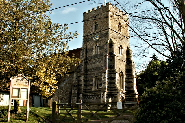 All Saints Church, Purleigh
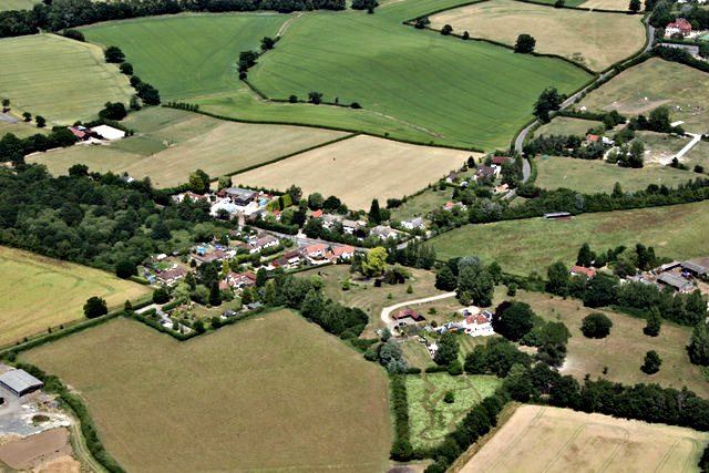 Aerial view of Hazeleigh
After walking from Purleigh via fields, a short section of Birchwood Road and along field sides by the side of Kent Wood and a couple more fields besides the route reaches the village of Hazeleigh. From here the walk continues along a green lane which was once part of a Roman road leading to Maldon. In fact when on the Hazeleigh plateau at Spar Hill you can see as far as Maldon and the River Blackwater with its boats and barges plying their way to and from the coast.
The final part of the walk from Spar Hill to Purleigh passes some of England's most established vineyards as well as passing the site of an old motte and bailey castle at Castle Mound. The site may take some seeking out, now being obscured from the path by trees.
Acknowledgments: Text derived from the Out and Out Series; Discovering the Countryside on Foot. Pictures courtesy of Wikipedia.


