Pretty Corner, East Runton and Sheringham
Norfolk Nature Walk - A varied walk through woodland and common to the North Norfolk coast
Google Maps Open Source Maps| Statistics and Files | ||
|---|---|---|
| Start: Pretty Corner | Distance: 8.7 miles (14.0 km) | Climbing: 208 metres |
| Grid Ref: TG 15366 41221 | Time: 4 hours | Rating: Moderate |
| GPX Route File | Google Earth File | About Sheringham |
| Statistics | |
|---|---|
| Start: Pretty Corner | Distance: 8.7 miles (14.0 km) |
| Climbing: 208 metres | Grid Ref: TG 15366 41221 |
| Time: 4 hours | Rating: Moderate |
| GPX Route File | Google Earth File |
Ordnance Survey Explorer Map (1:25,000)
The Walk: This walk includes much that is special about the North Norfolk coast, an area of outstanding natural beauty with a uniquely haunting atmosphere. Wide sea views, a range of local and migrant birds and a profusion of wild flowers, in a woodland and common setting, are all to be seen. The walk also takes in Roman Camp on Beacon Hill, the highest point in Norfolk; East Runton, once the target of pirates, and Sheringham, a busy little resort which has grown up around a fishing village and boasts some of the country's finest beaches as well as a full size steam passenger railway, the Poppy Line.
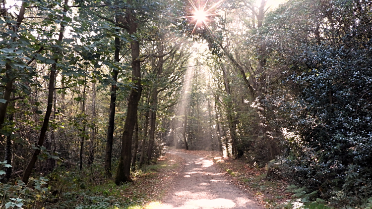 Sheringham Wood
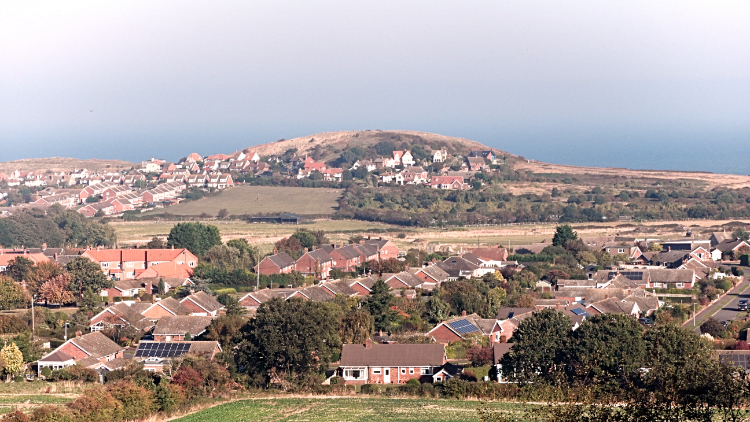 View of Sheringham from Stone Hill
Soon after its start the walk goes through natural woodland. Many plants grow beside the path, including rosebay, willowherb, bluebells, herb-robert, campion and foxgloves, depending on the season. Roman Camp is 350 (105 metres) above sea level, one of the highest points in Norfolk, and offers extensive views of the coastline. It has been used as a beacon for centuries and formed part of a coastal warning system. East Runton was at one time considered to be one of the most dangerous places on the Norfolk coast. A watch was kept here as early as 1324, not only for invaders, but also for pirates who roamed the coastline. Despite its name, there is no evidence the Romans camped here. Nevertheless, Roman finds have been dug up in the area. There is also evidence of a smelting and ironworks dating from Saxon, Norman and medieval times.
At the edge of the arable fields, there are fine views of the coast and, closer by, many wild flowers. In particular, look for field pansies, bladder campion, Jack-go-to-bed-at-noon, toadflax and green alkanet. The railway line is the British Rail line from Cromer, which links up with the North Norfolk Railway (Poppy) line at Sheringham. From Sheringham, where there is also a railway museum, several interesting steam locomotives take passengers through beautiful countryside to Weybourne and the little market town of Holt.
 Norfolk Coast Path leading to Beeston Bump
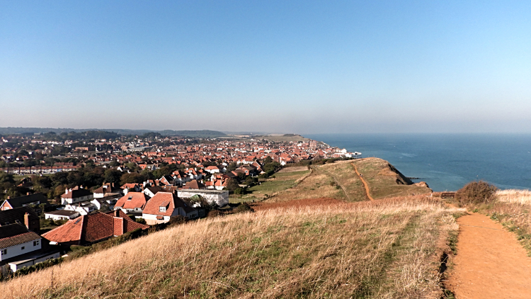
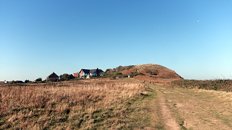 View of Sheringham from Beeston Bump
The coastal path is a good place to watch local and migrating birds, such as the purple sandpiper, great black-backed gull, kittiwake, guillemot and shag. Terns can be seen diving for fish in the sea. At the trig point on top of Beeston Bump there are panoramic views of the coast and countryside, with the roofs of the building in the seaside town of Sheringham prominent.
Soon after descending from Beeston Bump you will explore part of Sheringham and the village of Beeston Regis. First you will come to the ruins of an Augustinian priory, founded in 1216, while Beeston Regis Common has ponds, trees, shrubs and wildflowers, including orchids and monkey flowers. It is worth lingering here as there is so much to see. The flowers naturally attract many species of butterflies and birds.
Acknowledgments: Text derived from the Out and Out Series; Discovering the Countryside on Foot. Pictures courtesy of Wikipedia.


