Castle Rising
A countryside village which was formerly a sea port, a castle ruin and rural walk in west Norfolk
Google Maps Open Source Maps| Statistics and Files | ||
|---|---|---|
| Start: Castle Rising | Distance: 2.8 miles (4.5 km) | Climbing: 32 metres |
| Grid Ref: TF 66584 24858 | Time: 1-2 hours | Rating: Easy |
| GPX Route File | Google Earth File | About Castle Rising |
| Statistics | |
|---|---|
| Start: Castle Rising | Distance: 2.8 miles (4.5 km) |
| Climbing: 32 metres | Grid Ref: TF 66584 24858 |
| Time: 1-2 hours | Rating: Easy |
| GPX Route File | Google Earth File |
Ordnance Survey Explorer Map (1:25,000)
The Walk: This pleasant walk leads through the ancient town of Castle Rising, which was once a sea port and is now an inland village. The walk is easy to follow, having good paths and way markings. It also offers extensive views of the countryside with pine and birch woodland. Note, Castle Rising Castle is managed by English Heritage so for a full walk around the site of the medieval fortress an entrance fee is necessary.
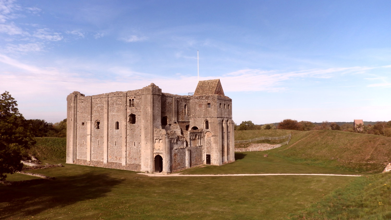 Castle Rising Medieval Fortress
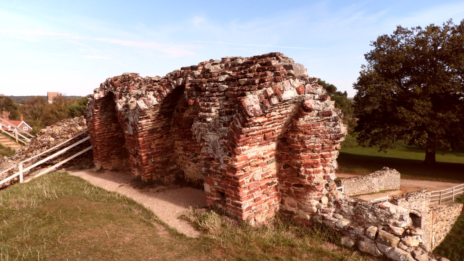 Castle Rising outer wall
In the village, the old market cross stands on what used to be the green. Until the middle ages, Castle Rising was a thriving sea port. A street called Havengate Lane is said to have been the medieval wharf where ships berthed after sailing up the Babingley River. Now the sea lies four miles away. Across the fields lies the ruined church of St Felix. it was he who brought Christianity to East Anglia in about 630 AD. On the horizon, beyond the church, lies Wollerton Wood.
Further along, the route follows the banks of the River Babingley and eventually leads to some old cottages built of Carrstone, a Norfolk soft sandstone known to the locals as 'Gingerbread Stone'. The Norman castle in the village, which has a chequered past, is now in ruins but has a decorated keep and is defended by substantial ramparts. Built by William de Albini in 1138, it passed to the Montalt family in 1331 and later to the Crown. In the 14th century a curtain wall was built around the inner bailey but this was demolished in the 18th century.
The French Queen Isabella was imprisoned in the castle for her part in the murder of her husband, Edward II. After his death, she quickly put her lover, one Roger Mortimer, on the throne, but her 15 year old son, Edward III, with his armed friends found Mortimer with the Queen and sent him to the Tower where he met with an unpleasant end.
In 1544, the Crown granted the castle to the Howards, Dukes of Norfolk. Though still owned by the family today they have bequeathed the castle to the nation by way of English Heritage since 1958. The keep is supposed to have been one of the finest in England and the castle itself was of the most elegant of county residences in the land in its heyday.
Continuing along the route, you will arrive at the crossroads to find an elegant lamp post. It has a six sided lantern atop an oak post, and was erected as a memorial to the Great War of 1914-18. Further along this road are the alms houses of Trinity Hospital. And towards the end of the walk there is the opportunity to visit the church of St Felix.
Acknowledgments: Text derived from the Out and Out Series; Discovering the Countryside on Foot. Pictures courtesy of Wikipedia.


