Hatfield Heath and Hatfield Broad Oak
A refreshing walk across rolling countryside and wild heathland
Google Maps Open Source Maps| Statistics and Files | ||
|---|---|---|
| Start: Hatfield Heath | Distance: 6.7 miles (10.7 km) | Climbing: 68 metres |
| Grid Ref: TL 52452 14954 | Time: 3 hours | Rating: Easy |
| GPX Route File | Google Earth File | About Hatfield Heath |
| Statistics | |
|---|---|
| Start: Hatfield Heath | Distance: 6.7 miles (10.7 km) |
| Climbing: 68 metres | Grid Ref: TL 52452 14954 |
| Time: 3 hours | Rating: Easy |
| GPX Route File | Google Earth File |
Ordnance Survey Explorer Map (1:25,000)
The Walk: Essex has many fine villages, large village greens and heaths and Hatfield Heath is a typical example in the county. The green here is no exception, with cricket playing on lazy summer days. The walk, with its fine open views and wide skies, embodies the feeling of remoteness that is so much the spirit of Essex.
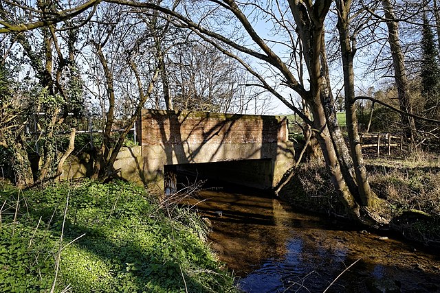 'Doune Bridge' over Pincey Brook
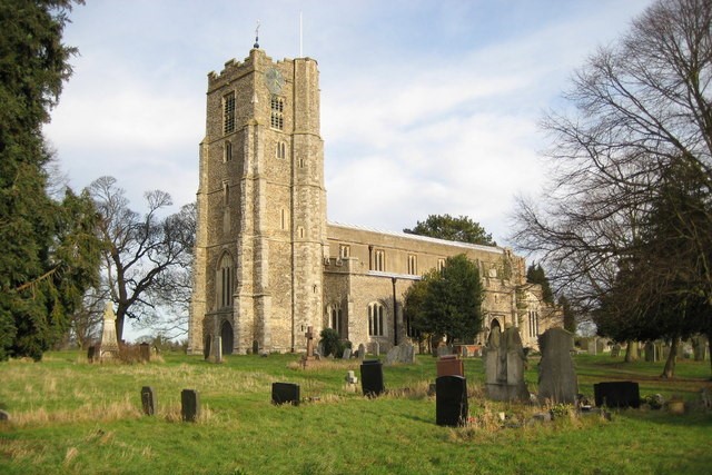 Hatfield Broad Oak Church
Starting beside the cricket pitch, the route runs downhill into a valley before following wide, grassy field edges to climb up a hill with outstanding views in all directions over rolling countryside. Here, where skylarks sing in the wide skies, it seems one can see for ever. As you climb slightly higher, the route crosses arable fields with defined footpaths to give the first view of the fine church at Hatfield Broad Oak.
Turning east, with further views to the right, the route joins the Three Forests Way, a 60 mile long distance footpath linking Hatfield Forest, Epping Forest and Hainault Forest. From here, good field edge paths lead to the neighbouring village of Hatfield Broad Oak.
The feature of this part of the walk is the large, concrete waymarks erected by Councillor Lumley of Hatfield Broad Oak. Looking at these stones, one wonders at the effort and dedication that enabled the councillor to get them on site and erect them, single handed. Here you are following in the steps of a great country lover and footpath worker whose career was so sadly ended by a car crash. However, through dedicated volunteers his work goes on.
The route continues through the delightful village of Hatfield Broad Oak, the church being what remains of a priory founded in 1135. The iron gates at the entrance to the porch were erected in memory of Councillor Lumley. There are many fine houses in the village and a curiousity to look out for is the house built over the entrance to a courtyard just before the village hall.
Leaving the village, past a line of fine poplars, you climb up out of the valley and cross delightfully wild and open countryside, a mix of fields and heath. This area is criss-crossed with paths made by the villagers of Hatfield Heath and Hatfield Broad Oak while on local walks.
Acknowledgments: Text derived from the Out and Out Series; Discovering the Countryside on Foot. Pictures courtesy of Wikipedia.


