Horsey Mere
A bracing walk by broads and beaches under the Norfolk sky
Google Maps Open Source Maps| Statistics and Files | ||
|---|---|---|
| Start: Horsey Mill | Distance: 5.4 miles (8.7 km) | Climbing: 5 metres |
| Grid Ref: TG 45728 22244 | Time: 2-3 hours | Rating: Easy |
| GPX Route File | Google Earth File | About Horsey Mere |
| Statistics | |
|---|---|
| Start: Horsey Mill | Distance: 5.4 miles (8.7 km) |
| Climbing: 5 metres | Grid Ref: TG 45728 22244 |
| Time: 2-3 hours | Rating: Easy |
| GPX Route File | Google Earth File |
Ordnance Survey Explorer Map (1:25,000)
The Walk: On this walk you can get away from it all, through a flat, often bleak but always beautiful landscape - the majority of it sky. Starting beside Horsey Drainage Mill, it skirts Braydon Marshes along Waxham Cut to Horsey Corner, continues down to and along the sea and then back to the village. The white capped Horsey wind (pump) mill rises above the grey green coloured willows and dates from the mid 19th century. Built to drain the land and the surrounding marshes into Horsey Mere, the mill was working until 1943 when it was struck by lightning. Since restoration by the National Trust an electric pump within the mill serves the vital drainage service.
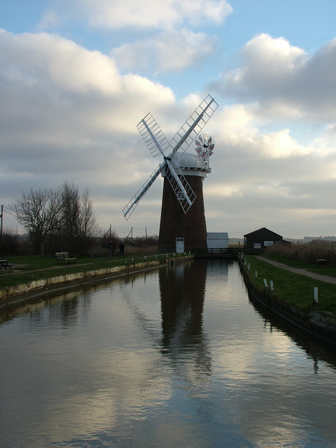 Horsey Drainage Mill
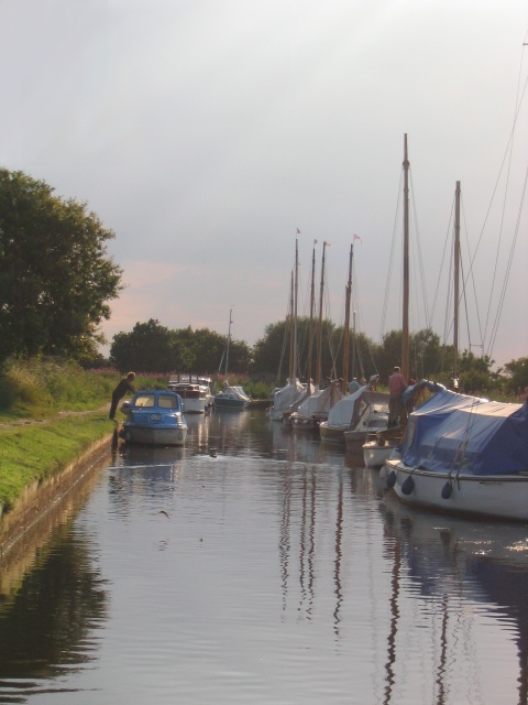 Boats on Waxham New Cut
Horsey Mere, 100 acres in area, is one of the largest, more remote and certainly one of the most beautiful of the broads. It is also the most northerly, with a water level 4-5 feet above the surrounding land. Seepage of sea water makes it brackish, with a resultant rather special plant, bird and insect life. The shallow basin of this broad, some six feet deep, has changed little in size over the past century and has been left untouched apart from the necessary annual cutting of weeds.
The walk leads to the derelict Brograve Drainage Mill and then on to Horsey Corner, a bleak hamlet set in a wind torn landscape, and eventually to the sea at Horsey Gap - a danger point for flooding when the sea blows a rage. The beach here is magnificent, stretching as far as the eye can see. It is usually utterly deserted and, as yet, unspoiled, probably because of the predominant cutting winds. After a walk along the beach adjacent to Horsey Dunes the walk returns inland leading to the village of Horsey.
Horsey church is untypical of the area. All around stand churches with full-squared flint towers, while this one, crouching in thick woodland, has a round tower brought up to the octagonal, with the nave and chancel thatched in reeds from the mere, under a sedge capping. Inside, all is brown, with thatch showing at the unceiled roof. On the wall above the parish chest are scenes of the erection of sea defences.
Horsey, 'Horse Island', was a desolate place until the turn of the 19th century, when ancient sea banks were strengthened and repaired, enabling the marshes to be drained and transformed into fertile and productive farmland.
Acknowledgments: Text derived from the Out and Out Series; Discovering the Countryside on Foot. Pictures courtesy of Wikipedia.


