Tattershall, Coningsby and Tattershall Thorpe
Around an attractive village and close to a Battle of Britain airfield
Google Maps Open Source Maps| Statistics and Files | ||
|---|---|---|
| Start: Tattershall | Distance: 4.2 miles (6.8 km) | Climbing: 10 metres |
| Grid Ref: TF 21240 57889 | Time: 2 hours | Rating: Easy |
| GPX Route File | Google Earth File | About Tattershall |
| Statistics | |
|---|---|
| Start: Tattershall | Distance: 4.2 miles (6.8 km) |
| Climbing: 10 metres | Grid Ref: TF 21240 57889 |
| Time: 2 hours | Rating: Easy |
| GPX Route File | Google Earth File |
Ordnance Survey Explorer Map (1:25,000)
The Walk: Tattershall, on the River Bain, has many connections with Ralph Cromwell, who became Lord Treasurer of England nearly 20 years after the Battle of Agincourt in 1415. He built a church, a castle and charity houses here. The village is named, though, after Robert Tateshall, who built a stone castle, the forerunner of the present brick keep, in the 13th century. The market cross is a reminder that in 1201, in exchange for a trained goshawk, King John granted Robert Tateshall a charter to hold a weekly market in the village.
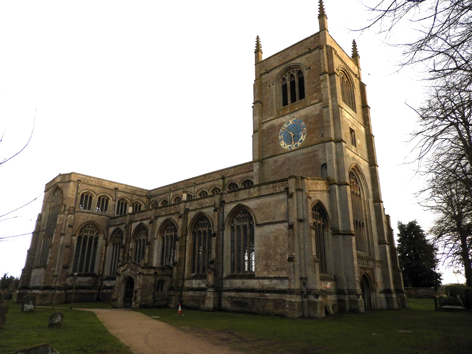 Holy Trinity Church, Tattershall
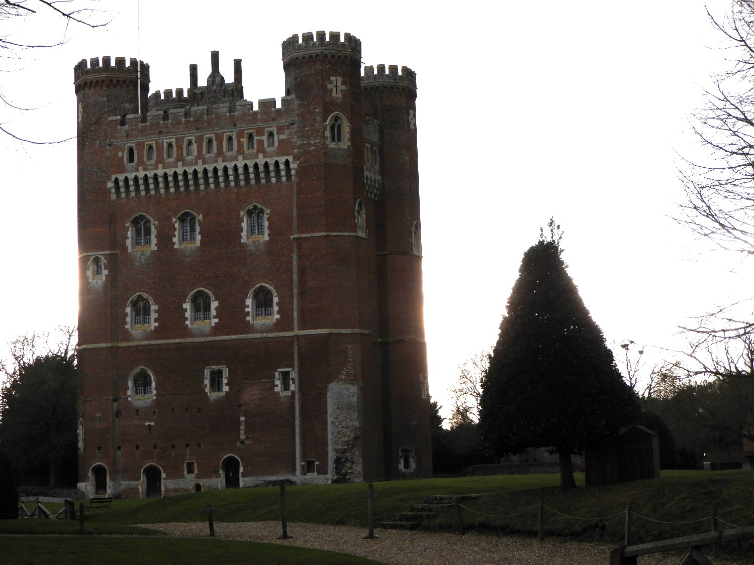 Tattershall Castle
The Bede Houses were built in the 17th century to replace Ralph Cromwell's half timbered houses. Benefits enjoyed by their tenants included cauldrons of coal and lengths of red flannel for petticoats. The Holy Trinity Church nearby was founded by Cromwell in 1439, but he did not live to see it completed. It is built of Ancaster stone.
The unique tower of Cromwell's Tattershall Castle was built in about 1445 on the foundations of Tateshall's fortress. This keep dominates the village and is a landmark for some distance over the Lincolnshire Fens. From the battlements, on a clear day, it is possible to see Boston Stump and the towers of Lincoln Cathedral.
The route follows the River Bain to the town of Coninsby and on this stretch the walk borders RAF Coninsby which served the country during World War Two and which remains an active and strategic airbase. You are likely to enjoy your own personal air show as aircraft train and deploy from the airbase on a daily basis. The town boundary of Coninsby runs along the centre of the River Bain. In the 1790's, the river was converted into a canal between Horncastle and the River Witham. At the time of the Domesday Book, Coninsby was a prosperous place with ten fisheries. Its Church of St Michael and the Angels has a 15th century tower with a pathway through it, and a one-handed clock 16.5 feet in diameter, thought to be the largest of its kind in the world.
The Route leaves the river to cross the former railway line that once served Coninsby. The line was opened in 1913 by the Great Northern Railway to speed the holiday traffic to the Lincolnshire seaside resorts of Skegness, Mablethorpe and Sutton-on-Sea. The line was closed in 1970, two years after all the stations had become unstaffed halts.
Beyond the line is Tattershall Thorpe. It was once the location for a Roman summer camp. The Blue Bell Inn here is thought to date from 1329, and was an ancient hostelry on a drove road. It's priest's hole is a relic of the civil war. Tattershall Carr and Tattershall Thorpe Carr, important ancient woodland sites, are now managed by the Woodland Trust, oases in the intensively farmed agricultural land through which the walk returns to Tattershall Market Place.
Acknowledgments: Text derived from the Out and Out Series; Discovering the Countryside on Foot. Pictures courtesy of Wikipedia.


