Burgh le Marsh, Bratoft, Gunby Hall and Orby
Across Lindsey Marsh - Through a lowland landscape to a haunt of ancient peace
Google Maps Open Source Maps| Statistics and Files | ||
|---|---|---|
| Start: Burgh le Marsh | Distance: 7.8 miles (12.6 km) | Climbing: 35 metres |
| Grid Ref: TF 50070 65043 | Time: 3-4 hours | Rating: Easy |
| GPX Route File | Google Earth File | About Burgh le Marsh |
| Statistics | |
|---|---|
| Start: Burgh le Marsh | Distance: 7.8 miles (12.6 km) |
| Climbing: 35 metres | Grid Ref: TF 50070 65043 |
| Time: 3-4 hours | Rating: Easy |
| GPX Route File | Google Earth File |
Ordnance Survey Explorer Map (1:25,000)
The Walk: The Lindsey coastal marsh, west of Skegness, is an area of meadows and drainage channels, with farm buildings, hamlets and country houses standing on the relatively high ground. This is a necessary precaution. The whole area has historically been subject to disastrous floods. One, in 1953, claimed 43 lives. This walk visits several settlements around the marsh, including a country house connected to Alfred, Lord Tennyson. It begins in the centre of Burgh le Marsh. Chartered fairs and markets were held here from 1400 to the end of the 19th century, and the Market Place has many fine Georgian and Victorian buildings.
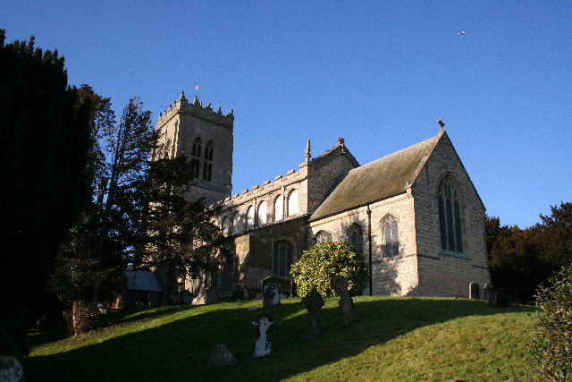 St Peter and St Paul's Church
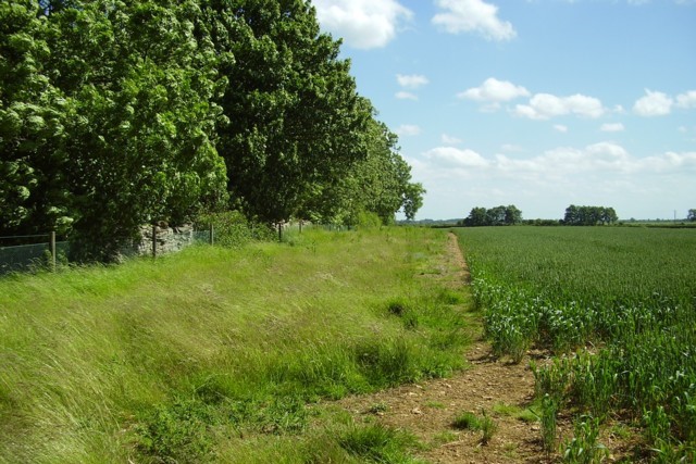 Countryside of Lindsey Marsh
The site's history stretches far back into antiquity. Stone Age flint tools have been found near Cock Hill, a grassy mound by the church that is believed to have been used for Saxon burials and which was converted into a cockpit in the Middle Ages. Not far from here, a ferry across the Wash linked up with an important Roman road, the Peddar's Way.
There are some interesting buildings, including three old hostelries - the Fleece Inn, the Bell Hotel and the White Swan pub - and two windmills. One of these, a five storey, five sailed tower mill was built in 1833. On its way out of town, the route passes the Church of St Peter and St Paul.
You walk over meadows and pastures, across dykes and along lanes to the hamlet of Bratoft. The village church, also dedicated to St Peter and St Paul, has a tower dating from 1747 and inside is a strange painting of the Spanish Armada depicted as a red dragon. On the outskirts of the village is an old lodge and just beyond that is the moated site of the original seat of the Massingberd family. The house was demolished in 1698, though the remnants of a brick bridge over the moat still survive.
The Massingberds subsequent house is next approached on the walk from Bratoft. Gunby Hall, now in the care of the National Trust, was built by Sir William Massingberd in 1700. The hall has connections to Alfred, Lord Tennyson with some of his works dispalyed on the walls and to Joshua Reynolds, whose work is also on display. If Gunby Hall is open, a diversion from the walk to visit the house and gardens is recommended. From Gunby Hall the walk continues to the site of the former Burgh le Marsh railway station which is nearly two miles from the town. A bus shuttled people from the Bell Hotel in the town to the railway station. The station was on the East Lincolnshire Railway line.
From the station a walk over meadows leads to the village of Orby, a wooded village on the edge of the marsh. It's 13th century church stands among the trees and there is an attractive vicarage and an old brick manor house. From Orby, the route heads back to Burgh le Marsh.
Acknowledgments: Text derived from the Out and Out Series; Discovering the Countryside on Foot. Pictures courtesy of Wikipedia.


