Sutton Hoo, River Deben and Sutton Heath
A walk over heath and marshland past a world famous ancient burial site
Google Maps Open Source Maps| Statistics and Files | ||
|---|---|---|
| Start: Sutton Hoo | Distance: 3.6 miles (5.8 km) | Climbing: 45 metres |
| Grid Ref: TM 29740 49054 | Time: 2 hours | Rating: Easy |
| GPX Route File | Google Earth File | About Sutton Hoo |
| Statistics | |
|---|---|
| Start: Sutton Hoo | Distance: 3.6 miles (5.8 km) |
| Climbing: 45 metres | Grid Ref: TM 29740 49054 |
| Time: 2 hours | Rating: Easy |
| GPX Route File | Google Earth File |
Ordnance Survey Explorer Map (1:25,000)
The Walk: This walk, on the east bank of the River Deben, has as its focus, the world famous Anglo-Saxon burial ground of Sutton Hoo. In addition to this heritage site, the circuit offers delightful contrasts in scenery. The wide flat fieldscapes of Sutton Heath, scattered woodlands (with sweet chestnut much in evidence) and sandy tracks with pine belts prominent against the Suffolk sky. There is also the river with its saltmarsh and mud flats.
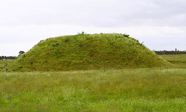 Sutton Hoo ship burial mound
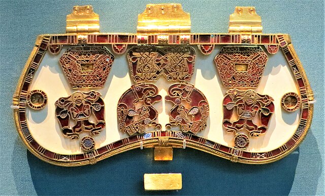 Purse lid from the Sutton Hoo ship burial
The Sutton Hoo graveyard - a group of low, grassy mounds - stands on the high spur of land above the River Deben. Excavations began in 1938 and the following year the largest mound gave up its ancient secret, a magnificent burial ship. Dating from around AD 625, the grave comprised a clinker built boat 89 feet (27 metres) long and 14 feet (4.25 metres) wide. Although the timbers had long since rotted away, the compacted sand retained the vessel's shape and all its rivets were still in place.
From the excavations, the route descends gently to the River Deben, with fine views across to Woodbridge, an old market town full of character and charm. Throughout its history, the town's fortunes have been linked to the river. For centuries, Woodbridge was a thriving port, noted for boat building, rope making and trade.
As the walk continues downstream, Woodbridge Tide Mill - with its distinctive white weather boarding and red pantiled mansard roof - dominates the quayside opposite. When it ceased production in 1957, bringing eight centuries of milling on that site to an end, it was the last working tide mill in Britain.
The route leaves the river at the ferry landing stage, opposite the mill. The ferry runs between Woodbridge and the Sutton Hoo shore when the archaeological site is open to the public.
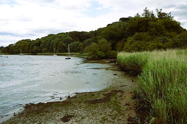 River Deben at Ferry Cliff
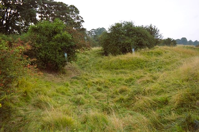 Sutton Heath and Bog
The last section of the walk crosses parts of Sutton Heath, here turned into arable fields. This area was a prime example of Suffolk Sandlings - lowland heath - but much of it has now been lost to farming and forestry.
During the 19th century, sheep farming declined, and in the 1920's with the development of fertilisers, large areas of the Sandlings were cultivated. Characteristic of this flat farmland are the pine wind-breaks which were planted to protect the fine heath soil. Some of the fields looking like vast lawns are used for the production of garden turf.
Acknowledgments: Text derived from the Out and Out Series; Discovering the Countryside on Foot. Pictures courtesy of Wikipedia.


