Paglesham Eastend, Churchend, Creek, Pool and River Roach
Along the Sea Wall - Two villages and a salt marsh along Essex waterways
Google Maps Open Source Maps| Statistics and Files | ||
|---|---|---|
| Start: Paglesham Eastend | Distance: 5.5 miles (8.9 km) | Climbing: 3 metres |
| Grid Ref: TQ 94330 92294 | Time: 2-3 hours | Rating: Easy |
| GPX Route File | Google Earth File | About Paglesham |
| Statistics | |
|---|---|
| Start: Paglesham Eastend | Distance: 5.5 miles (8.9 km) |
| Climbing: 3 metres | Grid Ref: TQ 94330 92294 |
| Time: 2-3 hours | Rating: Easy |
| GPX Route File | Google Earth File |
Ordnance Survey Explorer Map (1:25,000)
The Walk: The name of the Plough and Sail pub, at the start of this walk in the village of Paglesham Eastend, sums up its character. The first part of the walk passes through an open landscape of cultivated fields, while the last part is along the River Roach, a working waterway.
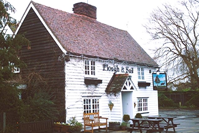 Plough and Sail, Paglesham Eastend
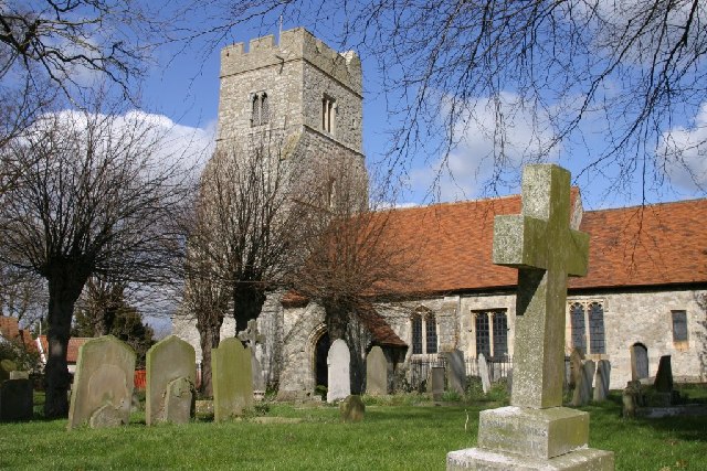 St Peter's, Paglesham Churchend
Paglesham Eastend's sister village is Paglesham Churchend. Here, St Peters, the epitome of a quiet country church, nestles among trees. There was a church on this site before the Norman conquest, although the present one is mostly 15th century. The chancel floor is paved with headstones brought in from the churchyard. One dating from 1734 has the inscription "Short was my time, the longer my rest. God took me hence, for why he saw it best".
Next to the church is Church Hall, a Georgian building that is now a farm. The walk continues through the village with its charming white weatherboard houses, and past the Punch Bowl public house, which is over 500 years old.
From Paglesham Churchend, the route goes across fields, intersected by drainage ditches, to the seawall that borders Paglesham Creek. The creek is a salt marsh, the home of salt loving flowers such as sea lavender and sea purselane.
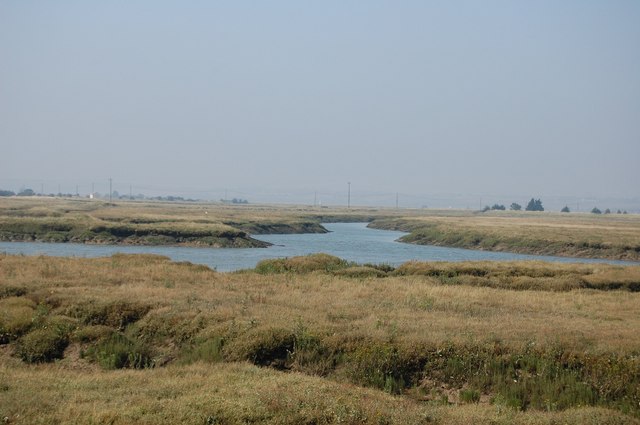 Paglesham Creek
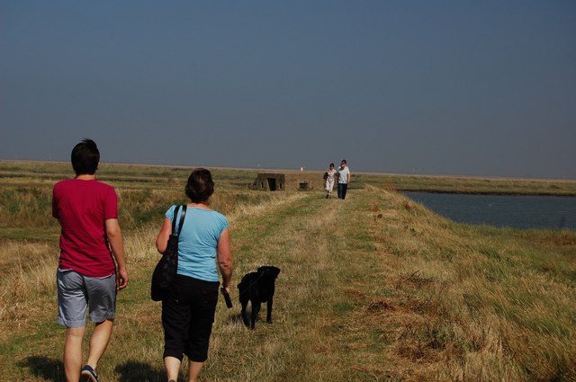 Walking alongside the River Roach
The cries of sea birds are the only sounds in this quiet landscape. There are views back towards the tower of St Peter's Church and across to Wallasea Island and Burnham on Crouch. There is little else but fields under a vast open sky.
The walk meanders slowly along the creek as it opens out into Paglesham Pool, and then joins the River Roach. Just before you reach a busy boatyard, there are oyster beds, carefully fenced off from the river and the path. This is all that remains of the oyster beds that 2,000 years ago were famous as far away as Rome.
The severe winter of 1963 nearly destroyed the local oyster industry. But now these beds are productive again, and oysters are available locally in the punch bowl and in the plough and sail between September and April.
Acknowledgments: Text derived from the Out and Out Series; Discovering the Countryside on Foot. Pictures courtesy of Wikipedia.


