Wandlebury and Babraham
To an Iron Age fort and an old village on the River Granta
Google Maps Open Source Maps| Statistics and Files | ||
|---|---|---|
| Start: Wandlebury Park | Distance: 7.6 miles (12.2 km) | Climbing: 111 metres |
| Grid Ref: TL 49184 53205 | Time: 3 hours | Rating: Easy |
| GPX Route File | Google Earth File | About Wandlesbury |
| Statistics | |
|---|---|
| Start: Wandlebury Park | Distance: 7.6 miles (12.2 km) |
| Climbing: 111 metres | Grid Ref: TL 49184 53205 |
| Time: 3 hours | Rating: Easy |
| GPX Route File | Google Earth File |
Ordnance Survey Explorer Map (1:25,000)
The Walk:
The Gog Magog Hills, rich in wildlife and history, provide the setting for this walk. These generally chalk slopes, broken up here and there with a clump of beeches, dominate the flat landscape of south-east Cambridgeshire. The origin of the 'Gog Magog' is lost in history. One legend has it that the last of Britain's giants, Gog and Magog, lie buried in the hills. (However, in Celtic mythology, Gogmagog is one giant, not two, and met his violent end in Cornwall, not Cambridgeshire).
On a similar theme, there were once enormous figures cut into the hillside. These were investigated in the mid 1950's and identified as Celtic gods. But this theory remains controversial, and the excavations are now overgrown. Another myth relates that Gogmagog, now just one giant, fell in love with the river nymph Granta, but was rejected by her and metamorphosed into a hill.
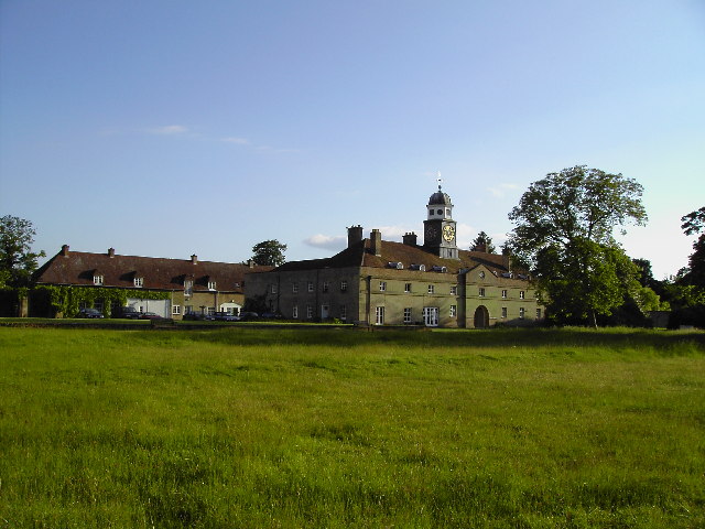 Wandlebury Stables
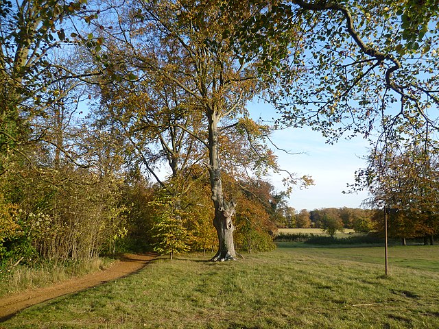 Wandlebury Park
The walk begins from the car park at Wanderbury Hill, a woodland park covering 110 acres. Over the centuries, the estate had various owners, including the Godolphin family, but in 1954 it was acquired by the Cambridge Preservation Society, who opened it to the public as a place of recreation and peace. It has since become very popular, particularly with nature lovers - there are three way marked nature trails - and walkers. The society has returned the farm fields in the estate gardens to grass and, through an extensive tree planting programme, has created a range of valuable habitats for plant and wildlife, especially insects and birds.
The hilltop at Wandlebury is the site of an Iron Age fort, now known as Wandlebury Ring. Probably erected during the 3rd century BC, it comprised a circular ditch and rampart enclosing an area about 1,000 feet (305 metres) in diameter. The enclosure held a village and had enough surplus space to take in outlying farmers and their animals when an enemy threatened. The fort was rebuilt twice, but appears to have been abandoned by the first century AD. All that remains visible today is the encircling ditch running between two banks: the inner bank, originally reinforced with timber, formed the rampart, while the outer bank was just dug-up earth.
Wandlebury Ring also has more recent historic connections. At the beginning of the 18th century, the estate passed to the Earl of Godolphin, who built a mansion and two monumental stable blocks inside the forts perimeter. The house is no longer standing but a raised lawn, with a sundial, marks its site. The stable blocks remain and have now been converted into private residences.
The cupola block today contains the Cambridge Preservation Society's offices and shop. The clock on the cupola has one hand only, and dates from the 18th century. In the archway below the cupola is the grave of a horse, a Godolphin Arabian - one of the three Arab stallions that sired the whole of England's thoroughbred racing stock in the early 1700's.
Across the raised lawn stands Tadlow Granary, a timber framed building dating from around 1415. Originally part of a farm complex at Tadlow, near the Bedfordshire border, it was re-erected at Wandlebury in the mid 1970's by the Cambridgeshire Preservation Society. Standing on brick piers, it has vertical plank walls and a crown post roof; the original timbers, as well as restored sections, are of oak.
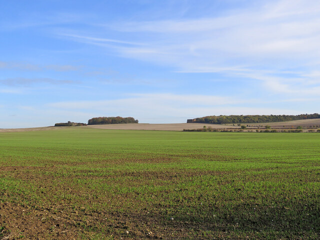 View from the Roman Road to Meg's Hill and Signal Hill
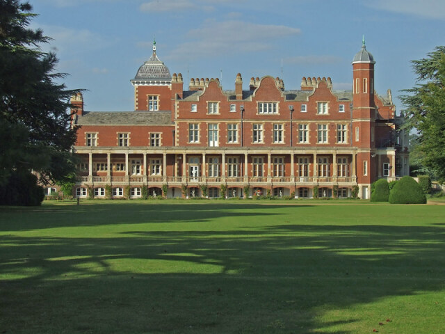 Babraham Hall
From Wandlebury Ring the route crosses chalk grasslands and wooded areas to reach the Roman road or Via Devana, which ran from Colchester to Godmanchester, if not further. It was once thought the road went as far as Deva (Chester), which would explain the name Via Devana. The road is also known variously as Wool Street - probably derived from Wolvestreet, a reminder of the time, when wolves were an everyday menace - and as Worsted Dyke, a reference to the wool trade.
Today, the Via Devana is a grassy, gently undulating track. Its hedgerows, thick with wild roses, sloe, hawthorn and hazel, give way here and there to wide views across the Cambridge countryside.
From the Via Devana, the route follows a quiet by-road, where plants and insects benefit from protected verges, down to Babraham, a mellow village in flint and brick standing on the east bank of the River Granta. Although the Granta changes to the Cam as it flows through Cambridge, it is the Granta which originally gave the city its name. The Saxons called their settlement 'bridge over the muddy river' or 'Grantabridge'. Under the Normans this became Cantabridge and later Cambridge - and the river's name changed accordingly. But here, at Babraham, the Granta retains its true identity as it flows lazily along the village. Just before it reaches the church, it passes Babraham Hall.
This grandiose Elizabethan style mansion on the site of an earlier dwelling was built in 1830 for the Adeane family. By the 1950's it belonged to the Agricultural and Food Research Council and in 1994 the hall and grounds became home to the Babraham Institute which undertakes research into cell and molecular biology. One of the 19th century's leading stock breeders, Jonas Webb, farmed at Barbraham and his statue stands in the village almost opposite the George Inn.
Babraham church, dedicated to St Peter, mostly dates from the 1400's, although the chancel and tower are older. Items of particular interest include the 15th century pews and font and the Adeane family hatchments (coats of arms belonging to the deceased).
The church's most striking feature, however, is the modern east window designed by John Piper. In rich, glowing colours, the window depicts the keys, cockerel, boat and other emblems of St Peter's life.
From Babraham, the route follows the Granta valley for about one mile, then heads back to Wandlebury and the start.
Acknowledgments: Text derived from the Out and Out Series; Discovering the Countryside on Foot. Pictures courtesy of Wikipedia.


