Wicken Fen, Upware and Wicken
A quiet walk through the old fens of Cambridgeshire
Google Maps Open Source Maps| Statistics and Files | ||
|---|---|---|
| Start: Car Park | Distance: 6.8 miles (11.0 km) | Climbing: 10 metres |
| Grid Ref: TL 56365 70526 | Time: 3 hours | Rating: Easy |
| GPX Route File | Google Earth File | About Fenland |
| Statistics | |
|---|---|
| Start: Car Park | Distance: 6.8 miles (11.0 km) |
| Climbing: 10 metres | Grid Ref: TL 56365 70526 |
| Time: 3 hours | Rating: Easy |
| GPX Route File | Google Earth File |
Ordnance Survey Explorer Map (1:25,000)
The Walk:
Fenland, green lanes and attractive villages are the main characteristics of this walk. It begins at Wicken Fen, an important National Trust property. Although the route skirts the part of the estate where an admission charge is required, a diversion can be made to incorporate this section.
Wicken Fen consists of three main areas, Sedge Fen, Adventurer's Fen and St Edmunds Fen. Sedge Fen is the only one open to the public. It is said to be nearly the only piece of primordial fenland left in approximately its own condition. It is preserved in this state by National Trust, which acquired it between 1899 and 1911.
However, the fen cannot be left completely to nature. The 'lodes', or waterways, are the ancient canals that irrigate the land and provide highways, which must be kept clear. Similarly, water must be pumped up into the fen. In ancient times, the inhabitants of Wicken village owned much of the land in strip systems. These were a source of sedge for thatching, and were also dug for peat. In recent times, the National Trust has re-established the old sedge fields.
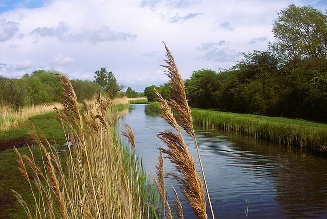 Wicken Lode
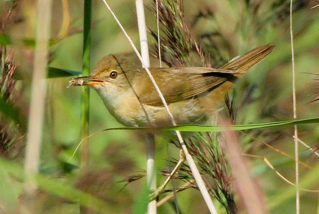 A Reed Warbler in Wicken Fen
The walk takes you along the banks of Wicken Lode, and over on the other side, where you will see Adventurers Fen. There are several fens named after adventurers. They were groups of financiers, similar to later joint stock companies, who got together to drain the fens. Adventurers Fen was dug up during World War II, and returned to the National Trust after the war. The old pumping windmill that was on it has been renovated and removed to Sedge Fen.
From the banks of Wicken Lode and Burwell Lode, you cross a bridge, and walk along the banks of the River Cam. The river rises in the south-west corner of the county, and flows north-east. Cambridge is situated on the river, some 10 miles (16 kilometres) south, and the Cam eventually flows into the River Great Ouse just south of Ely. The walk follows the River Cam a short way to Upware. This was the site of the first steam driven pumping engine used to drain in the fens. Although it is now just a patch of uneven ground buried in the small thicket by the bank of the River Cam, its main drain and outfall channel can still be seen as traces.
The original pub at Upware, 'Five Miles from Anywhere, No Hurry', burned down in the late 20th century. But a new pub has been built on the same site. This was the haunt of Fen Lightermen (who used the waterways to transport goods in their barges) and undergraduates who would row down the river from Cambridge. The University fellows formed the 'Upware Republic' group, who met at the pub to debate and drink beer.
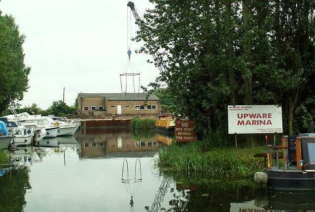 Upware Marina on the River Cam
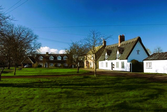 Wicken village green
From Upware, the walk leads across fields to Fodderfen Drove. Here, the Commissioners Pit is a Site of Special Scientific Interest (SSSI). The droves of the fens are the ancient roads, along which the inhabitants were able to cross the marshes. Fodderfen Drove was a link to High Fen Farm; Shaw's Drove was at one time used for driving sheep.
Just off the route is Spinney Abbey, the farmhouse where Henry Cromwell, Oliver Cromwell's fourth son, retired after the Restoration. He died here in 1674, a man of great integrity, and is buried in Wicken churchyard.
The village of Wicken, with its wide green, and interesting church dating back to the 13th century, marks the end of the walk. It also has a windmill which has been restored as a private home. Until recently, the white poppy was grown locally; in the past, the head of this flower was boiled to make an infusion which was drunk for 'Fen Ague'. From the village, the route goes down a lane to the start of the walk.
Acknowledgments: Text derived from the Out and Out Series; Discovering the Countryside on Foot. Pictures courtesy of Wikipedia.


