Dunwich, Heathland and Westleton Walks
A varied walk along cliff tops, trough woods and across heathland
Google Maps Open Source Maps| Statistics and Files | ||
|---|---|---|
| Start: Dunwich | Distance: 7.6 miles (12.2 km) | Climbing: 101 metres |
| Grid Ref: TM 47884 70658 | Time: 3 hours | Rating: Easy |
| GPX Route File | Google Earth File | About Dunwich |
| Statistics | |
|---|---|
| Start: Dunwich | Distance: 7.6 miles (12.2 km) |
| Climbing: 101 metres | Grid Ref: TM 47884 70658 |
| Time: 3 hours | Rating: Easy |
| GPX Route File | Google Earth File |
Ordnance Survey Explorer Map (1:25,000)
The Walk: The beach car park where the walk begins, is the site of Maison Dieu, one of the town's two hospitals in the Middle Ages; founded during the early 1200's, it was used for almost five centuries. From the village, the route climbs up the cliff and goes along a path that follows the line of Dunwich's medieval ramparts. Running alongside the path is the precinct wall of Greyfriar's, a Franciscan priory built in 1289 to replace an earlier foundation swept away by the encroaching sea.
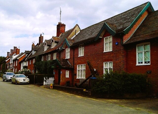 Dunwich village
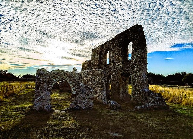 Greyfriar's Priory, Dunwich
What is left of All Saint's graveyard perches near the cliff edge. All Saint's itself, originally 13th century, was the last medieval church to perish. It finally went under the sea in 1919. Just one headstone remains in the churchyard, that of Jacob Foster, who departed this life March 12th 1796, aged 38 Years. How long it will remain before being claimed by the sea itself is unknown.
Turning inland, the path follows Middlegate, one of the main roads serving the medieval town. The bridge over Middlegate was put up in the 1800's by the Barne family, to link two parts of their estate. The Barnes built most of the present village, erecting houses with Tudor chimneys and leading lights.
About a half mile beyond the village, the route comes onto heathland with Dunwich Heath, belonging to the National Trust, off to the left. Most of the heath and woodland here belongs to Minsmere, much of which is one of the RSPB's best known nature reserves.
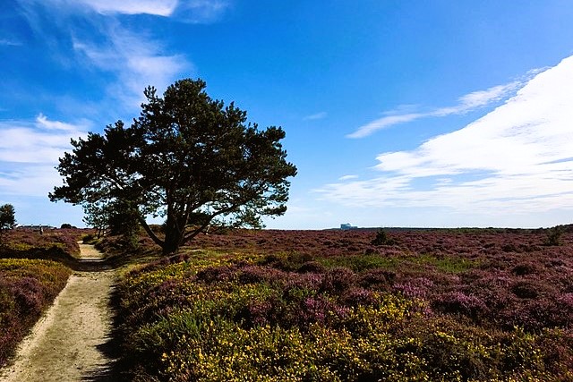 Dunwich Heath
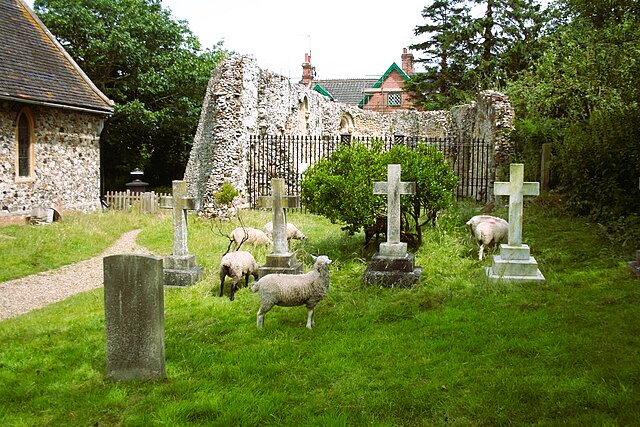 Dunwich Chapel
The route goes in a north-easterly direction through woods and heath, much of it known as the Westleton Walks - named after Dunwich's neighbouring village of Westleton - and then heads back towards Dunwich across open heathland. It eventually comes out by the parish church of St James, built in 1830 to replace All Saint's, which had already been abandoned; a buttress from the doomed medieval church stands in the graveyard. Also in the graveyard is a ruined chapel, part of the 12th century leper hospital that once occupied the site. In the Middle Ages, these hospitals - lazar houses - were very common, but their function was isolation rather than treatment.
Finally, you go through the village along St James Street. Notice the Old School on the left and, on the right, the museum and the Ship Inn, formerly the Barne Arms.
Acknowledgments: Text derived from the Out and Out Series; Discovering the Countryside on Foot. Pictures courtesy of Wikipedia.


