Worstead, Honing Bridge and the Weavers Way
Weaving a Yarn - From a medieval village to an old canal and a long-distance path
Google Maps Open Source Maps| Statistics and Files | ||
|---|---|---|
| Start: Worstead | Distance: 5.6 miles (9.1 km) | Climbing: 36 metres |
| Grid Ref: TG 30241 26083 | Time: 2-3 hours | Rating: Easy |
| GPX Route File | Google Earth File | About Worstead |
| Statistics | |
|---|---|
| Start: Worstead | Distance: 5.6 miles (9.1 km) |
| Climbing: 36 metres | Grid Ref: TG 30241 26083 |
| Time: 2-3 hours | Rating: Easy |
| GPX Route File | Google Earth File |
Ordnance Survey Explorer Map (1:25,000)
The Walk: The historic village of Worstead, were worsted cloth was first produced, marks the start of this walk. The village still has several old weaving houses. These are large and spacious because the weaving looms were 12 feet (3.6 metres) high. Each house also had a cellar with wooden beams interlacing the ceiling, so the wool could be stored at a cool and even temperature. Most of the weavers were Flemish in origin; a steady trickle of migrants from the Low Countries brought weaving to East Anglia from the Norman conquest onwards.
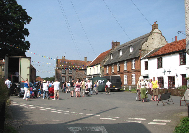 Church Plain, Worstead
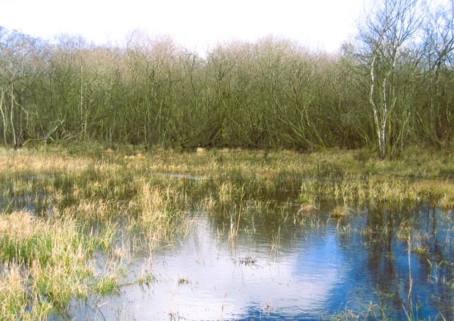 Broad Fen, Dilham
From Worstead, the walk leads east along footpaths and farm tracks. Summer flowers such as Campion, Hawkweed and Creeping Thistle grow along the way. The thistle has a sweet, musky smell that is very attractive to butterflies. Scentless Mayweed, despite its name, flowers from July onwards. May is derived from the Old English word meaning 'maiden'.
The path turns north and at Broad Fen, Dilham briefly follows a waterway. This is the old North Walsham and Dilham Canal, which was opened in 1826. It closed after only a few years because it proved too shallow for any vessel other than Norfolk barges (wherries), which had a draught, when fully loaded, of 3 to 3.5 feet (1 metre). The sailing wherry was unique to Norfolk and mostly sailed on the Broads. It was a square-rigged, single masted, open boat, clinker built of oak with a double-ended tarred hull. There was one long hold for cargo, protected by hatch covers from the weather. Wherries usually had a black sail, positioned well forward, and spread by a heavy gaff.
 Honing Bridge
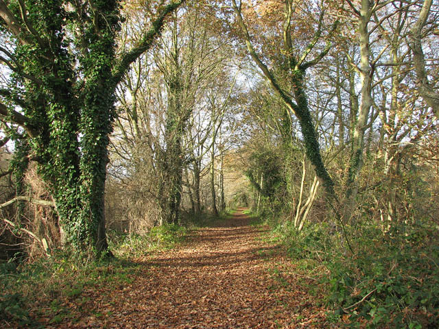 Weavers Way from Honing to Briggate
The return to Worsted is along the Weaver's Way, a 56 mile (90 kilometre) long distance footpath, between the coastal towns of Cromer and Great Yarmouth. It follows the course of an old railway line which closed in 1959. Like many other disused lines, it is a haven for wild plants.
Soon after crossing the canal, the old platform of Briggate station can be seen, half hidden in the undergrowth. A little further along, there is the site of a disused windmill.
The walk re-enters Worstead past the 14th century, St Mary's church, whose magnificent proportions reflect the medieval wealth of the village. There are richly carved, over-restored screens, in the chancel and chapels, and the remains of some medieval wall paintings and texts. The Saint Mary's Guild of Spinners, Weavers and Dyers, who work at the church, have produced a tapestry of the Baptism of our Lord, which hangs in a rare painted frame in the reredos behind the altar. In the North Chapel, on certain days, the weavers can be seen producing cloth from the local sheep's wool.
Acknowledgments: Text derived from the Out and Out Series; Discovering the Countryside on Foot. Pictures courtesy of Wikipedia.


