Horsham St Faith, Newton St Faith and Horsford
A walk through the countryside around a historic village
Google Maps Open Source Maps| Statistics and Files | ||
|---|---|---|
| Start: Horsham St Faith | Distance: 5.0 miles (8.1 km) | Climbing: 36 metres |
| Grid Ref: TG 21607 15074 | Time: 2-3 hours | Rating: Easy |
| GPX Route File | Google Earth File | Horsham St Faith |
| Statistics | |
|---|---|
| Start: Horsham St Faith | Distance: 5.0 miles (8.1 km) |
| Climbing: 36 metres | Grid Ref: TG 21607 15074 |
| Time: 2-3 hours | Rating: Easy |
| GPX Route File | Google Earth File |
Ordnance Survey Explorer Map (1:25,000)
The Walk: Horsham St Faith, lying only a short distance from the bustling city of Norwich, is a quiet rural village. It grew up around a stream known to the Saxons as 'Hor' (River Hor). The stream served two mills and was later a source of osiers (willows with whippy branches) for making baskets. Until the 19th century, when work passed to large mechanisms, weaving was another industry that thrived here. Many cottages had their own looms and produced fabric, furniture coverings and uniforms from horsehair.
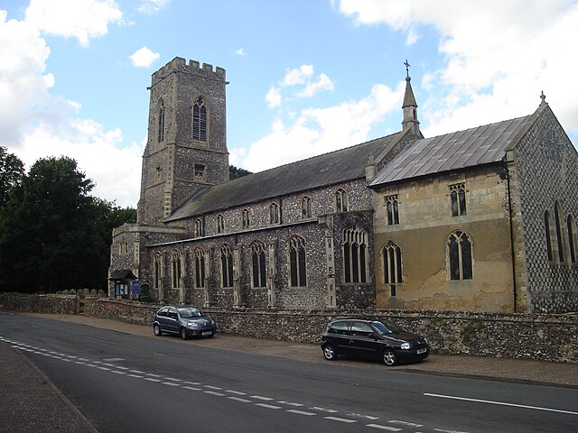 Horsham St Faith Church
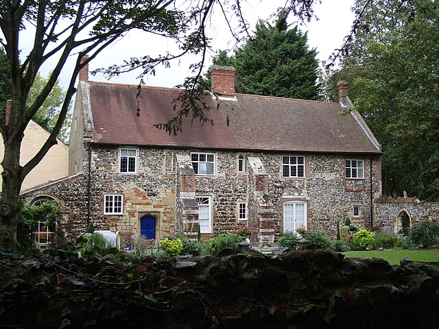 Horsham St Faith Priory
A visit to possibly the village's greatest treasure, a 12th century Priory, is saved for the end of the walk. You begin by exploring the countryside that surrounds it. A rough track to the north of Horsham St Faith leads into a meadow where many wildflowers grow, including creeping thistle, yarrow and water mint.
Gipsywort, which is also found here, looks like a nettle, but is related to the mint family. In the 16th century, it was used as a dye to colour silk and wool. Devil's-bit scabious, with its lovely violet flower, grows here in profusion. The story goes that the Devil was so vexed by the plant's healing properties that he bit away a part of its root. The plant has a particularly shallow root system.
Beyond the meadow, the route passes through arable farmland. Sugar beet, wheat, barley and beans for cattle fodder are grown here. Also here, especially at the edges of the fields, are flowers such as fat hen, red shank and corn marigolds.
The northern extreme of the walk lies the small village of Newton St Faith. Heading south-west, you come to Black Park. This natural woodland, mainly of oak, silver birch, holly and rowan, dates from the 15th century or earlier, and was originally a deer park. Today, foxes live in the wood, and their musky smell may fill the air.
Horsford's 14th century church stands to the south of its village, not far from the Georgian Horsford Hall. The church has a fine and rather unusual window, painted by the German artist Zetler. The window depicts three angelic figures who are journeying in search of the cure for tuberculosis. The scene is set against the background of Egyptian and Swiss landscapes.
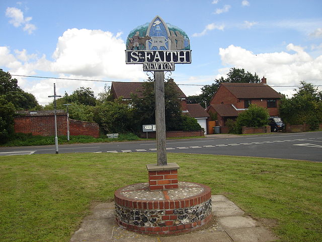 Newton St Faith
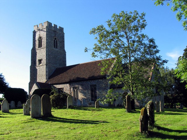 Horsford Church
Heading east along the lane, you ascend a long hill, from where you can see Norwich Airport. Originally built in 1939 as an RAF station with a grass runway, it was used successfully by Bomber Command and the US Air Force in World War Two, at which time concrete runways were laid. It was closed as a base in 1963, but purchased by Norwich City Council, who altered the city boundary to include it and open a civil airport there in 1970. Adjacent to the airport is the home of Norwich Aviation Museum.
Further along the road, the route diverts to Castle Hill, the site of a motte and bailey castle, built in the 11th century by Walter de Cadomo, and one of about 40 castles erected in East Anglia in the 12th century. Robert Fitzwalter lived there with his wife, Sybil. It was here that they first began to build St Faith's Priory.
The priory was eventually built much closer to Horsham. Founded in 1105, it has a chequered history, including use as a retreat and a guest house. It is now a private residence.
To the south of the priory lies the parish church, which is dedicated to St Mary and St Andrew. The church boasts some fine features that spans the years, including a 14th century painted oak pulpit, a fined 15th century octagonal font and a 16th century painted screen.
Beyond the church, you passed the King's Head pub, built in 1740. It originally catered for drovers bringing cattle, some from as far away as Scotland, to the village fair, which was one of the largest in England. It was held annually from the time of Henry I (1100-1135) up until 1872. The occasion took place on October 6th, St Faith's Day, in celebration of the saint who inspired the growth of the community that gathered here after the priory was founded.
Acknowledgments: Text derived from the Out and Out Series; Discovering the Countryside on Foot. Pictures courtesy of Wikipedia.


