Houghton, Hemingford Abbots, Hemingford Grey and St Ives
A walk along the valley of the Great Ouse to St Ives
Google Maps Open Source Maps| Statistics and Files | ||
|---|---|---|
| Start: Houghton | Distance: 5.5 miles (8.8 km) | Climbing: 4 metres |
| Grid Ref: TL 28135 72008 | Time: 2-3 hours | Rating: Easy |
| GPX Route File | Google Earth File | About Houghton |
| Statistics | |
|---|---|
| Start: Houghton | Distance: 5.5 miles (8.8 km) |
| Climbing: 4 metres | Grid Ref: TL 28135 72008 |
| Time: 2-3 hours | Rating: Easy |
| GPX Route File | Google Earth File |
Ordnance Survey Explorer Map (1:25,000)
The Walk: The walk begins in the pretty village of Houghton, which has a village green with an unusual Gothic-style pump. There are also some interesting Victorian buildings in the village, including the Union Chapel and Houghton House. The parish church, St Mary's, has a 14th century steeple with a fine, delicate outline. Houghton's finest architectural treasure is the 17th century Houghton Mill, occupying a site that has been used for milling for more than a thousand years. The route goes past the mill and over one of the many meadows lining the flat-bottomed valley of the River Great Ouse.
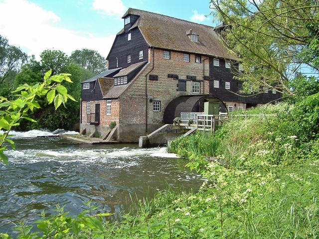 Houghton Mill and the Great Ouse
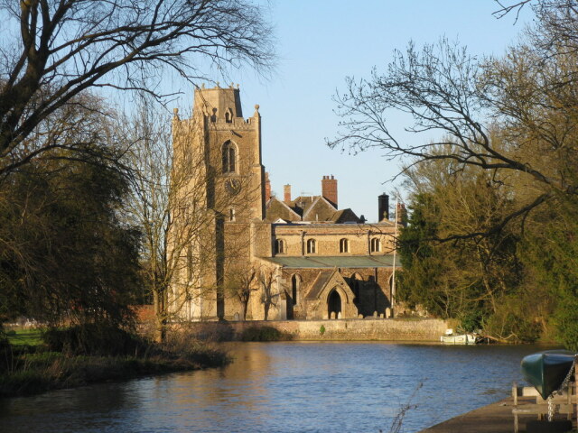 St James Church, Hemingford Grey
On the far side of the valley, the route crosses the disused track bed of the Ely and St Ives Railway, which opened in 1847. It was a picturesque line, but never very efficient. As it crossed and recrossed the River Great Ouse, it ran over a number of weak wooden bridges that could only take light steam engines. And there was a constant risk of fire. The speed limit on many of the bridges was only 10 mile per hour, and the antique locomotives running the route never got above 40 mile per hour, even on the fastest stretches of the track. The line was closed to passenger traffic in June 1959.
On the far side of the track is the village of Hemingford Abbots, where the newer residential buildings mix rather attractively with the old cottages. Beyond the village, the route follows the course of the Great Ouse. The river rises in Northamptonshire, flows through Buckinghamshire and Bedfordshire, and then enters Cambridgeshire at the town St Neot's.
Never particularly vigorous by this stage, the Great Ouse has become a slow and meandering river, and loops lazily through lush water meadows to St Ives. From there it flows across the Fens to Ely and Downham Market and runs into The Wash at Kings Lynn. The river was an important trade route from the time of the Roman occupation, when Kings Lynn was first developed as a port, to the 1960's, when commercial traffic left the water in favour of the roads and lighters gave way to pleasure cruisers.
The river path takes you round the northern edge of the village of Hemingford Grey, which has many interesting buildings. The route passes the best of them, a moated manor house built of stone in the 12th century. It is one of the oldest inhabited houses in England. It has fine Norman windows and a handsome chimney piece with the central chimney having been added in the 16th century.
The walk continues along the river, passing one of the biggest plane trees in England, planted in 1702. You soon reach St James Church, which stands in a handsome setting beside the Great Ouse. Most of the church was built in the 13th and 14th centuries, though the tower is later. Thew spire is truncated, having been destroyed by a storm in 1741 and never rebuilt.
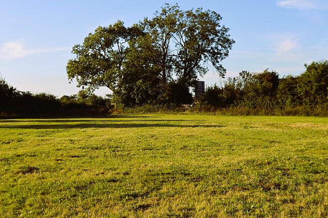 Hemingford Grey Meadow
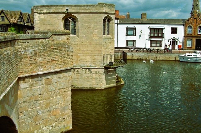 St Ives Bridge and Chapel
The town of St Ives rises up on the north Bank of the river, beyond Hemingford Grey Meadow. The town grew up around a medieval priory dedicated to St Ive. The prior was granted the right to hold an annual fair in 1110. Over the centuries, the stalls of the market place between the church and priory have been replaced by permanent shops and streets. The town was well established by the 16th century. You enter St Ives across St Ives Bridge, a delightful stone built, six arched bridge, which has a Chapel built on it. The bridge dates from 1415, and is one of only a few of its kinds still standing in Britain.
Oliver Cromwell lived and farmed near the old town of St Ives for 5 years, and his statue stands in the market place. The riverside Church of All Saints, which marked the western edge of the old town still remains, though it has been much restored. It contains a massive organ that was built by Sir Ninian Comper. A reminder of the old priory is its eastern boundary wall, now ruined, which stands next to modern office buildings.
The return journey takes you past the Norris Museum, the County Museum of Huntingdonshire, which traces the history of the former county from fossil remains some 160 million years ago to its disappearance into Cambridgeshire. The museum stands in a pretty riverside garden.
You leave the town along a good path through St Ives Thicket, an area of woodland on a steep slope. After emerging from the trees on to Thicket Road, you come to Houghton Meadows Nature Reserve. Managed by the Bedfordshire and Huntingtonshire Wildlife Trust, the reserve contains a fine example of ridge and furrow field systems, dating from the Middle Ages.
Also here is one of the best traditional hay meadows in East Anglia. It has over 140 species of plant, including cowslip, yellow rattle, salad burnet and meadow cranesbill. Frogs, toads and the harmless grass snake also find a home here, and some 200 species of moth have been recorded.
Acknowledgments: Text derived from the Out and Out Series; Discovering the Countryside on Foot. Pictures courtesy of Wikipedia.


