Buckden and Grafham Water
From an ancient coaching town to a man-made lake
Google Maps Open Source Maps| Statistics and Files | ||
|---|---|---|
| Start: Buckden | Distance: 6.9 miles (11.2 km) | Climbing: 33 metres |
| Grid Ref: TL 19125 67528 | Time: 3 hours | Rating: Easy |
| GPX Route File | Google Earth File | About Buckden |
| Statistics | |
|---|---|
| Start: Buckden | Distance: 6.9 miles (11.2 km) |
| Climbing: 33 metres | Grid Ref: TL 19125 67528 |
| Time: 3 hours | Rating: Easy |
| GPX Route File | Google Earth File |
Ordnance Survey Explorer Map (1:25,000)
The Walk: The little town of Buckden owes its historic importance to its position on the Great North Road. The modern equivalent, the A1, now bypasses the town. But the way north used to go along the High Street, where the walk begins.
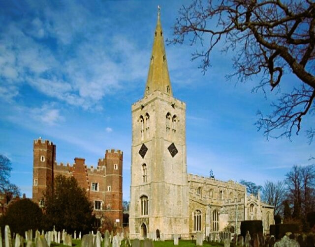 Great Tower and St Mary's church, Buckden
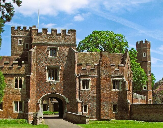 Buckden Palace Gatehouse
The town was a major staging post, and this is reflected in the number of coaching inns along the High Street. When it was built at the height of the coaching boom in the 18th century, the George was a truly impressive building, three storeys high and 15 windows wide, with a large archway leading from the road to the stables behind. Now it is considerably reduced, with much of the original building divided into houses and shops.
The inn opposite the George predates the era of the stagecoach, and was used in the 15th century as an outer guest house to the Bishops Palace. Formerly known as the 'Lion and Pennant and the Lamb', its name is now reduced to 'The Lion and Lamb'. The archway entrance to the rear is still apparent, although it has now been blocked up. Other old inns in the town include the Vine and the Spread Eagle.
Just off the road to the right is the parish church of St Mary, built mainly in the perpendicular style. There is a two-storied porch with some fine carvings and a rich Jacobean pulpit. The tower has a graceful steeple, but this is overshadowed by the 15th century brick tower of Buckden Palace. So close are the buildings that the church tower had to be buttrusted to stop it from falling into the palace moat.
The first permanent house was built in the 13th century, and the Great Tower was raised sometime between 1472 and 1480 by Bishop Scott. Many bishops lived here, and several are buried in the parish church. When the diocese was divided up in 1837, the palace was no longer needed. Much of it was demolished and the remainder became a Catholic Church.
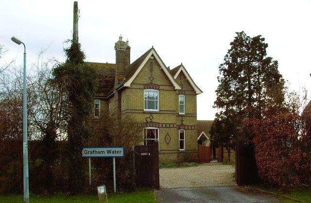 Village Farm, Grafham
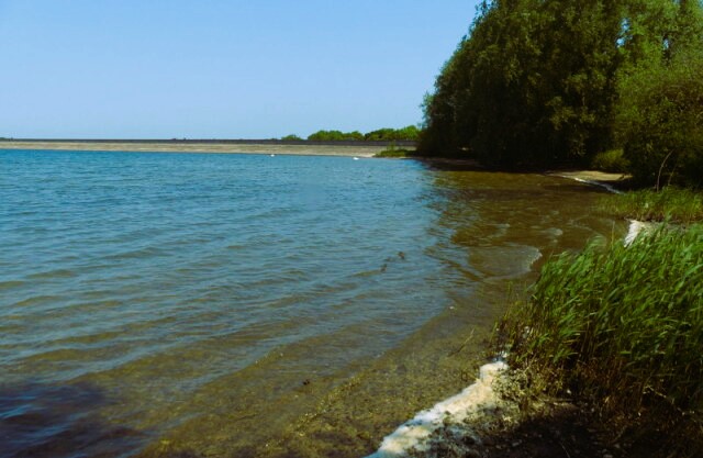 Grafham Water
Across pleasant farmland lies the pleasant village of Grafham. Once a remote and little known village, it now stands on the banks of Grafham Water, and has a busy road and cycle track. Its tiny whitewashed church, All Saints, has a chancel dating from the 13th century and a 14th century effigy of a priest in the South Porch.
You walk past the church to the banks of the reservoir, which was built between 1962 and 1968. When full, it covers 1,570 acres. The water is drawn from the Great Ouse near Offord D'Arcy, three miles upstream of Huntingdon. From Grafham Water the route follows field paths and quiet lanes back to Buckden.
Acknowledgments: Text derived from the Out and Out Series; Discovering the Countryside on Foot. Pictures courtesy of Wikipedia.


