Fen Ditton, Fen Rivers Way, Clayhithe and Horningsea
A riverside stroll through historic sites north of Cambridge
Google Maps Open Source Maps| Statistics and Files | ||
|---|---|---|
| Start: Fen Ditton | Distance: 9.1 miles (14.6 km) | Climbing: 16 metres |
| Grid Ref: TL 48265 60340 | Time: 4 hours | Rating: Easy |
| GPX Route File | Google Earth File | About Fen Ditton |
| Statistics | |
|---|---|
| Start: Fen Ditton | Distance: 9.1 miles (14.6 km) |
| Climbing: 16 metres | Grid Ref: TL 48265 60340 |
| Time: 4 hours | Rating: Easy |
| GPX Route File | Google Earth File |
Ordnance Survey Explorer Map (1:25,000)
The Walk: Cambridge has long been famed for its university, but its importance as a centre of trade is not so well known. There was a thriving industry here during the Roman occupation, while in the Middle Ages and later, the city housed an enormous international trade fair. This walk along the banks of the River Cam recalls the city's mercantile past, as well as visiting the scene of one of the university's most popular annual events.
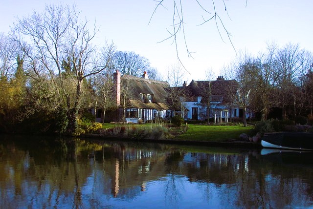 Fen Ditton and River Cam
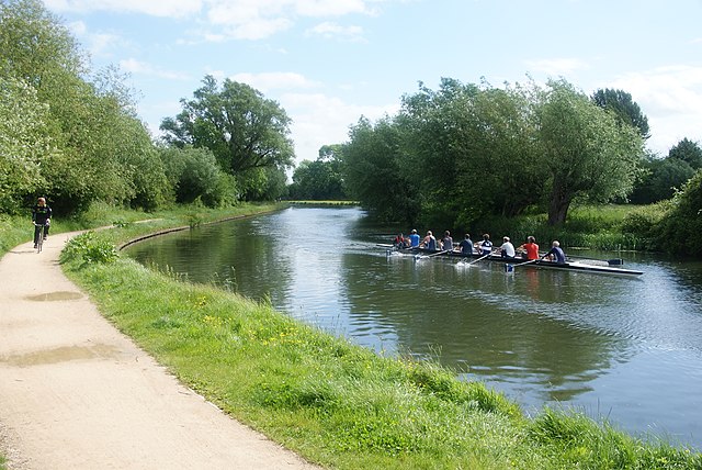 On the
Fen Ditton, where the walk begins, is strategically sited where the Fleam Dyke meets the Cam. Fleam Dyke was one of a series of monumental defensive earthworks built around 6 AD, and runs east for 4.5 miles (7.2 kilometres) to Balsham. The line of the dyke along the High Street and the aptly named Highditch Road is now flattened out, and built over with cottages and houses, including some interesting 17th century examples. The old red brick Hall opposite the church has at its core, a medieval timbered house, and what seems to be a Roman defensive vallum in its garden.
Fen Ditton's church, St Mary's, has an early 14th century tracery in its chancel and a 15th century porch. The king-post roof boasts some massive timbers, while the carved 14th century font is from Ely Cathedral. The church was extensively restored in 1881. The tower sports a weathervane in the shape of a rowing eight, and Ditton Meadows is a favoured spot for watching the May Bumps, the annual college boat races.
The May Bumps end by Stourbridge Common, which was the site of an annual fair that often lasted for three weeks. Stourbridge Fair was one of the greatest trading fares in Europe. It was granted in 1211 by King John for the benefit of the nearby St Mary Magdalene Hospital for Lepers, and was held in a reduced form into the 20th century.
Hundreds of booths and makeshift stores sold everything under the sun. Goods were brought by packhorse and by boat from all over the country, along with more exotic imported wares such as silks, lace, precious stones and spices.
The fair was graphically described by Daniel Defoe in 1722. He told of London hackney coaches and wherries being brought on wagons to cope with the volume of people and goods that needed to be moved about and taken up and down the river. The fair is widely supposed to have been the model for Vanity Fair in John Bunyan's 'Pilgrims Progress'.
The scene of all this bustle is now a lush and muddy meadow. Here the route crosses a bridge and turns north, following the course of the Fen Rivers Way up the banks of the Cam, the very essence of an English riverside. Pollarded willows lined the towpath, and stately ash and alder dip towards the river, while fluffy clouds of may blossom edge the water meadows. Pretty riverside villages line the higher banks, out of the reach of floods, above narrow boats and motor cruisers bobbing at their moorings.
The calls of swans, ducks and children float across the water, while the coaches of rowing eights school their crews by cycling up and down the towpath, bellowing instructions through a megaphone.
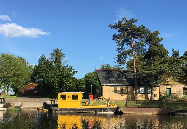 River Cam Conservators, Clayhithe
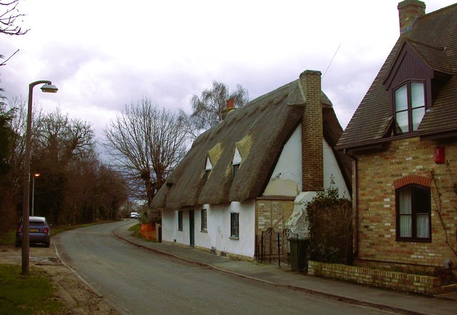 Thatched cottage in Horningsea
The walk becomes more rural after you pass under the noisy A45. A ferry once provided a crossing here, joining Milton to Horningsea on the east bank, its church set well back on the slope and closely guarded by the surrounding houses and cottages. Further on, there is a quiet meadow that was once the site of a thriving Roman pottery. Domestic ware for the communities in a wide area of the southern Fens and beyond was produced here.
After crossing the former tollbridge at Clayhithe Waterbeach, the walk leads along field paths and a road into Horningsea. Dock Lane is a reminder that the village used to be a busy port, probably as far back as the time of the Roman occupation, and the pretty village green reinforces the Roman connections with a sign showing a potter at work.
The parish church of St Peter is an impressive building. It has remains of an Anglo-Saxon work, and a chancel built of clunch, a tough clay. There is a canopied pulpit with splendid Elizabethan carving. The Roman estates at Horningsea were eventually taken over by the Bishops of Ely, who established Biggin Abbey to the south of the village in the 14th century, and St Peter's may well have been a minster church. The abbey building, which you pass just beyond Horningsea, has rendering on its exterior that masks its early origins.
Beyond Biggin Abbey, the route rejoins the riverbank and follows it onto Church Lane. This leads past the mellow red brick of Fen Ditton's Old Rectory, and back to the church where the walk began.
Acknowledgments: Text derived from the Out and Out Series; Discovering the Countryside on Foot. Pictures courtesy of Wikipedia.


