Boxworth, Lolworth, Childerley and Knapwell
Along ancient paths to visit the sites of five villages
Google Maps Open Source Maps| Statistics and Files | ||
|---|---|---|
| Start: Boxworth | Distance: 6.3 miles (10.1 km) | Climbing: 61 metres |
| Grid Ref: TL 34769 64198 | Time: 3 hours | Rating: Easy |
| GPX Route File | Google Earth File | About Boxworth |
| Statistics | |
|---|---|
| Start: Boxworth | Distance: 6.3 miles (10.1 km) |
| Climbing: 61 metres | Grid Ref: TL 34769 64198 |
| Time: 3 hours | Rating: Easy |
| GPX Route File | Google Earth File |
Ordnance Survey Explorer Map (1:25,000)
The Walk: In the Middle Ages, some villages grew in importance, while others declined. This walk visits five medieval villages of various fates; some of all but disappeared, while others contain some pretty and interesting buildings. Boxworth, where the walk begins, was quite large at the time of the Domesday Book (1086), but is now small and scattered. The High Street was once part of the main road to Cambridge, but traffic was rerouted in the first half of the 19th century to join the Roman road. Now the A604, to the north-west.
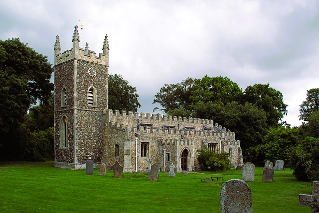 Boxworth Church
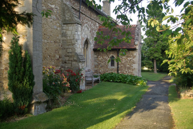 Lolworth Church
Boxworth's church was founded in Norman times, but largely remodelled after suffering severe storm damage in 1636. The oldest part of the village is the area about 150 yards north-east of the church. Much of Boxworth was already enclosed by 1650, though in 1794 there were still 900 acres of open fields.
The route follows the course of the old Cambridge road through fields to Lolworth, a scattered and rather unrevealing remnant. The original nucleus of the village may have been between the church and the Grange to the east, where a spring would have given a water supply. The church lost its aisle in a late 14th century storm and fire, and was rededicated in 1406.
While in Lolworth you may be forgiven for thinking you are in a place of special significance. The Prime Meridian passes through the village, around just 160 feet (50 metres) to the west of the crossroads in the centre.
The Green Lane that forms the next part of the route was the original road between Lolworth and Childerley. Great Childerley and Little Childerley were two separate parishes in 1086. They were reunited in about 1489. Great Childerley was depopulated by a Sir John Cutt during the reign of Charles I in order to enlarge his deer park. A private chapel replaced the two parish churches, the incomes of which were diverted to the manor in spite of protests from the church authorities.
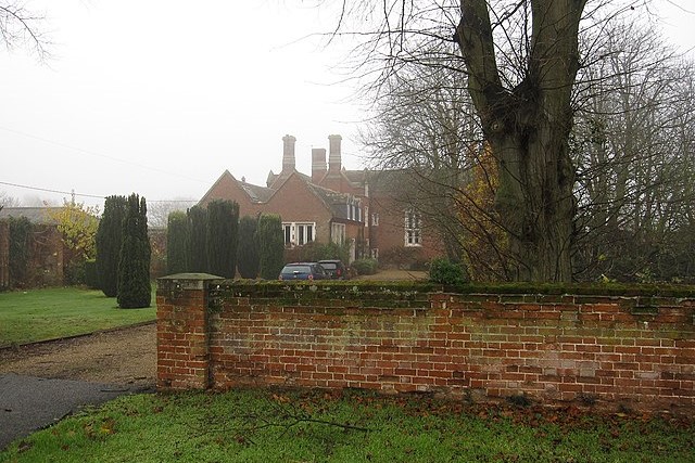 Childerley Hall
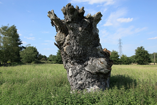 Remains of one of 'the Dodds' Field Elms
Apart from the occupants of Childerley Hall and one or two estate cottages, the parish is now without inhabitants. Childerley Hall was acquired by the Cutt family in the reign of Henry VII. Charles I was confined at the hall by Oliver Cromwell one night in June 1647.
The route skirts a farm, then takes an old, straight path through a site of Little Childerley. The remaining earthworks of the village were completely destroyed by ploughing between 1955 and 1959.
Knapwell is the next village on the route. The village was also known as Little Wellesworth. Knapwell Plantation, to the east of the village was already privately owned in 1775, when the parliamentary enclosure of the parish took place. Much of the village had fallen into ruin by that time.
In the 19th and 20th centuries, Knapwell was known for a number of pollarded Field Elms, which marked the old boundaries, closes and lanes of the larger medieval village and which were known locally as "the Dodds". The trees grew both in the fields bordering the main street and amongst the houses of the modern village. The trees succumbed to Dutch Elm Disease in the 1980s.
Off to the right of the path in Knapwell are the Red Well and the site of Overhall Manor. The Red Well gets its name from the high iron content of its water. Pottery dating from the 11th to the 14th century has been found on the manorial site. From here, it is an easy stroll back to Boxworth and the start of the walk.
Acknowledgments: Text derived from the Out and Out Series; Discovering the Countryside on Foot. Pictures courtesy of Wikipedia.


