Needham Market, Barking, Darmsden and the Gipping Valley
Explore the villages and countryside of the tranquil Gipping Valley
Google Maps Open Source Maps| Statistics and Files | ||
|---|---|---|
| Start: Railway Station | Distance: 5.6 miles (9.1 km) | Climbing: 86 metres |
| Grid Ref: TM 09092 54875 | Time: 2-3 hours | Rating: Easy |
| GPX Route File | Google Earth File | Needham Market |
| Statistics | |
|---|---|
| Start: Railway Station | Distance: 5.6 miles (9.1 km) |
| Climbing: 86 metres | Grid Ref: TM 09092 54875 |
| Time: 2-3 hours | Rating: Easy |
| GPX Route File | Google Earth File |
Ordnance Survey Explorer Map (1:25,000)
The Walk: The Gipping Valley is a gentle country of high hedged lanes, half hidden villages, random woodlands and patchwork crop fields. The River Gipping itself winds its unhurried way down to Ipswich, where it changes nature and name to become the wide, estuarine River Orwell.
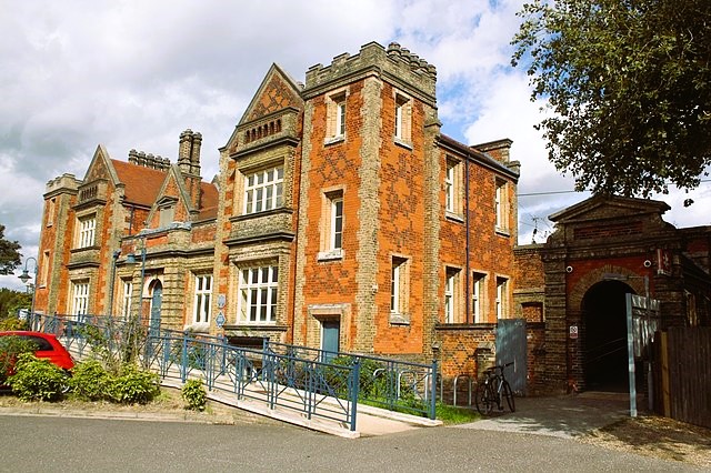 Needham Market Railway Station
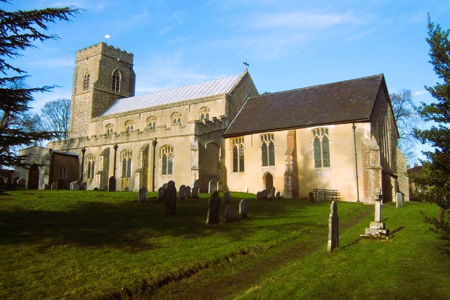 Church of St Mary, Barking
In Saxon times, Needham Market, where the walk starts, was a hospice for pilgrims bound for Bury St Edmunds. In 1245 Needham was granted a weekly market. For the next 400 years, the town flourished. Devastated by plague in the 1680's however, Needham never regained its prosperity or its market.
One of the most important of the town's many historic buildings is its church of St John the Baptist. Unusually, this is not aligned to the east and does not have a churchyard; its flint walls butt onto the street. Built as a chapel of ease for nearby Barking in the late 1400's - and much restored in 1880 - St John's is famous for its hammerbeam roof, widely considered the best of its kind in the country.
From Needham, the route to Barking goes along the Causeway, which, for most of its length, is a shaded green lane. The name is possibly a corruption of 'corpseway': before Needham had its own graveyard, burials took place at Barking. The Causeway emerges by Barking Rectory, built in 1819. A little further on is the Church of St Mary. Originally Saxon, the present church is mainly 14th century, with a 13th century south porch. Notable medieval features include gargoyles, a tie-beam roof, a rood screen, chapel screens, and doors.
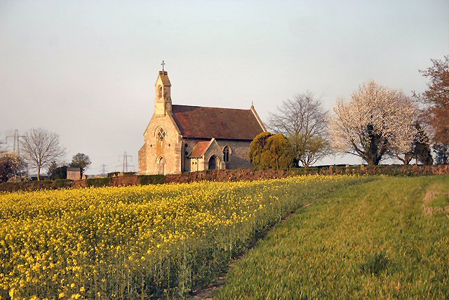 Countryside of Darmsden and Church of St Andrew
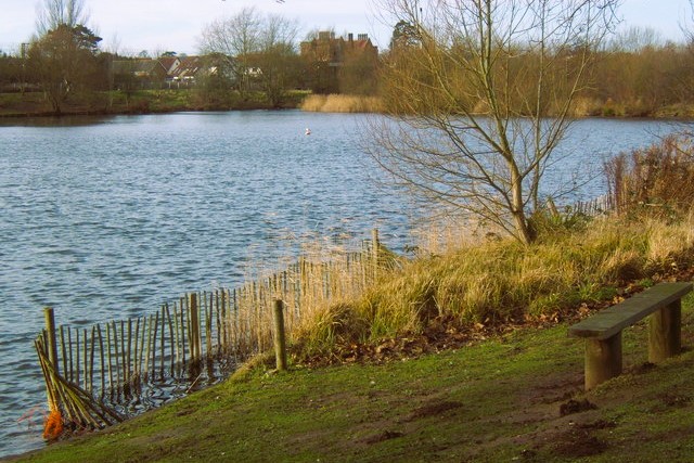 Needham Lake in the Gipping Valley
The walk crosses fields to the tiny hamlet of Darmsden. The Little Neo-Gothic Church of St Andrew has had a chequered history. By the second half of the 19th century, the original church had become so dilapidated that it had to be demolished. The present church was built in 1880 but closed in 1973.
Though the church was declared redundant in 1979, a trust was formed that year to preserve St Andrews as a place of Christian worship, and services are again held there from time to time. From the church a quiet lane winds down through Darmsden. The kiln attached to Kiln Cottage was once used for drying chicory.
The return to Needham Market follows the old tow path alongside the River Gipping. The Gipping has always been navigable, and served as a highway for the ancient peoples that settled in the area. There is evidence of Stone, Bronze and Iron Age occupation in the valley, as well as a Roman site.
The river was in commercial use by the 12th century. By the end of the 1600's so many mills had been built on the Gipping that it was virtually unnavigable. An act was passed to canalise the river, and work began in 1790. Mills were bypassed, 15 locks were built, and the river was dredged, widened, and straightened. The coming of the railway signalled a steady decline, however, and barge traffic ceased in 1929.
Needham Lake, near the end of the walk, was a gravel and sand pit in the 1970's, providing aggregate for the nearby A45 dual carriageway. The area has been since developed by the District Council, and facilities include a nature trail and picnic site.
Acknowledgments: Text derived from the Out and Out Series; Discovering the Countryside on Foot. Pictures courtesy of Wikipedia.


