Saltfleet and Skidbrooke
Exploring the dunes and drained fields around a former port
Google Maps Open Source Maps| Statistics and Files | ||
|---|---|---|
| Start: Car Park | Distance: 4.0 miles (6.4 km) | Climbing: 3 metres |
| Grid Ref: TF 44875 95199 | Time: 2 hours | Rating: Easy |
| GPX Route File | Google Earth File | About Saltfleet |
| Statistics | |
|---|---|
| Start: Car Park | Distance: 4.0 miles (6.4 km) |
| Climbing: 3 metres | Grid Ref: TF 44875 95199 |
| Time: 2 hours | Rating: Easy |
| GPX Route File | Google Earth File |
Ordnance Survey Explorer Map (1:25,000)
The Walk:
Saltfleet is a peaceful place, with little hint of its bustling trade in days gone by. One of the few natural harbours in Lincolnshire, it was once a royal port, supplying Edward III with men and ships for his invasion of Brittany in 1359.
The harbour, Saltfleet Haven, is the estuary of the Great Eau. The narrow, muddy river, still provides moorings for small vessels, and boats can be launched two hours either side of high tide. On Sunday mornings, there is a stall at the head of the Haven, selling fresh fish, crabs and other shellfish.
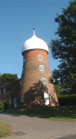 Saltfleet Mill
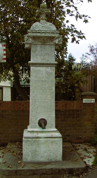 Skidbrooke Memorial Village Pump
The short but varied ramble leads you from neighbouring Skidbrooke through the well drained fields of the open countryside before returning you to the heart of Saltfleet village. Then the walk continues along a remarkable flat shoreline. You will have to walk a long way out across the sands for a paddle in the sea.
The route leaves the shore car park to head out across the rich farmlands of Lincolnshire. This area of the county used to be renowned for raising excellent carthorses and a regular market and horse fair at Saltfleet attracted farmers and horse dealers from neighbouring counties.
The landscape of fields crisscrossed by drains is very flat. Beneath the wide open skies there are distant views of the Lincolnshire Wold. As you walk alongside the Sunderfleet Eau, with cows and sheep grazing either side, you can see a church standing quite alone in the fields to your right. This is St Botolph's, Skidbrooke. The building is still maintained, although no longer used for services.
You join the road back into Saltfleet. The village is overlooked by a tall brick mill, which has recently been renovated. In the centre of the village is the 17th century Manor House. Its gable faces the street, while its remodelled five-bay front faces south. Oliver Cromwell is said to have stayed at the manor, which is reputed to have a tunnel to the beach (now blocked). The house next door sports an unusual chimney which twists into a spiral.
Opposite is the 18th century New Inn, an old style pub. The tall, handsome brick building, is surrounded by old trees, which lean away from the prevailing wind. When the pub was built, the first floor would have looked out on ships at sea, and fishing boats beached on the sands. Today, the view is of holidaymakers strolling around the dunes and salt marshes, pausing to look at plants or wildlife and enjoying the fresh sea air.
In Skidbrooke, there is a striking water pump, with a memorial to a brave local man. It commemorates Trooper Frederick Alan Freshney who gave his life on 20 May 1906 because of wounds sustained in the Anglo-Boer War (1899-1902).
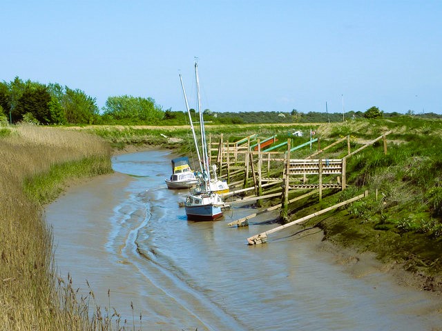 Saltfleet Haven
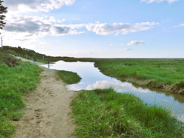 Saltfleet Marsh
From the village, the walk continues along the shoreline; the chief feature being the sand dunes. These form part of the Saltfleetby Theddlethorpe Dunes National Nature Reserve, which covers over 1,000 acres and also takes in tidal sand, mudflats and marshes.
The shoreline changes constantly as the sea deposits sand and the wind whips it into dunes. They stabilise only when plant colonies have established themselves.
Among the wildflowers to be seen in the summer are yellow-wort and bee and pyramidal orchids. In July and August, the salt marshes are studded with massive clumps of mauve sea lavender. This is also a popular place for people in the know to collect marsh samphire.
Birds that breed here include the whitethroat, the linnet and the yellowhammer, while woodcocks and hen harriers are regular winter visitors. The dunes are also one of the last remaining habitats of the Natterjack Toad, which can be recognised by the yellow stripe down its back. Part of the reserve is adjacent to Ministry of Defence land, but all danger areas are marked.
Acknowledgments: Text derived from the Out and Out Series; Discovering the Countryside on Foot. Pictures courtesy of Wikipedia.


