Surlingham Church Marsh and River Yare
A walk through marshes and fens beside the River Yare
Google Maps Open Source Maps| Statistics and Files | ||
|---|---|---|
| Start: Saint Mary's | Distance: 4.9 miles (8.0 km) | Climbing: 68 metres |
| Grid Ref: TG 30545 06490 | Time: 2 hours | Rating: Easy |
| GPX Route File | Google Earth File | About Surlingham |
| Statistics | |
|---|---|
| Start: Saint Mary's | Distance: 4.9 miles (8.0 km) |
| Climbing: 68 metres | Grid Ref: TG 30545 06490 |
| Time: 2 hours | Rating: Easy |
| GPX Route File | Google Earth File |
Ordnance Survey Explorer Map (1:25,000)
The Walk: This route through marshes is particularly interesting for its many wild flowers, including the yellow iris and marsh marigolds, with their bright golden flowers in spring. Look across to your right to see Wheatfen, a nature reserve which was once managed by Phyllis Ellis, widow of the famous naturalist Ted Ellis.
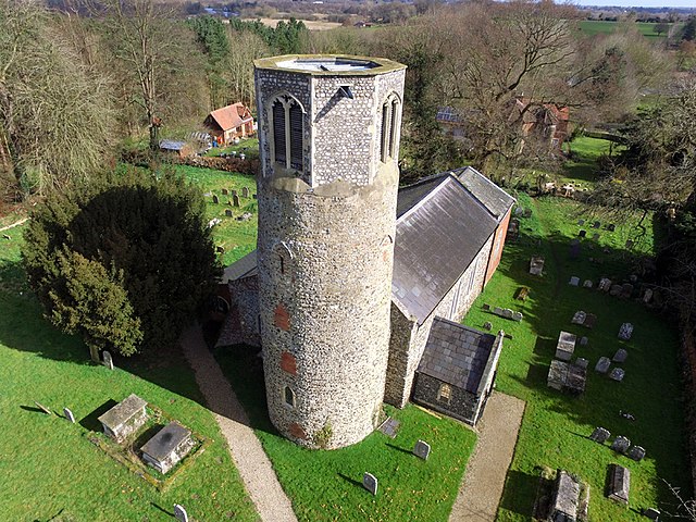 Saint Mary's Surlingham
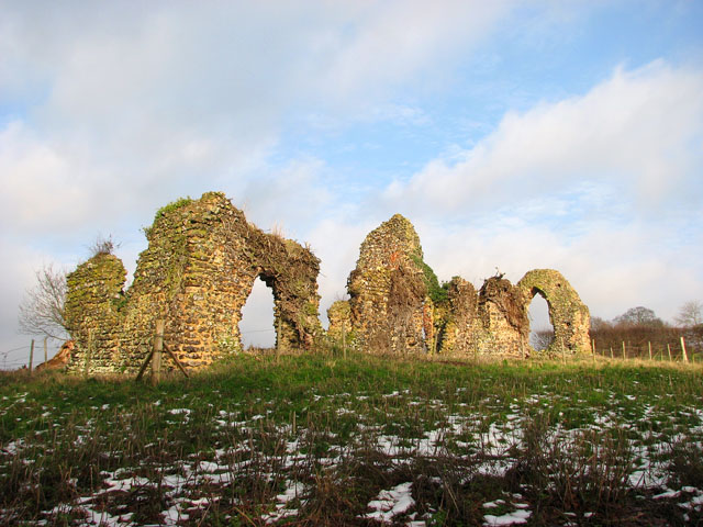 St Saviour's Church Ruins
The walk begins at the imposing church of St Mary in Surlingham, which is one of famous round-tower churches in Norfolk. From the start, the route follows a north-east course to the Surlington Broads. On the way, the church ruins of St Saviour's church are passed. Originally built in the 11th century, the church has a remarkable history.
From Surlingham Broads, the walk reaches the River Yare at the attractive 19th century Ferry House Inn. It is a favourite place for the numerous boats that ply the Yare in summer; the river is a busy holiday route to and from Great Yarmouth.
From the Ferry House Inn the route follows the River Yare inland (westwards). Soon, on the left, are the RSPB public bird watching hides that overlook RSPB Surlingham Church Marsh. The public are welcome to walk within the reserve and the main entrance is reached on foot from Surlington Church. Various spicies of birds can be found in the reserve, including kingfisher, bittern, little grebe, marsh harrier and reed, sedge and grasshopper warblers.
Many wetland plants thrive on the marshes, including bogbean, marsh orchids, sow thistle and the red flowered marsh cinquefoil, whose name comes from the French word meaning 'five leaves'.
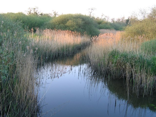 Surlingham Church Marsh
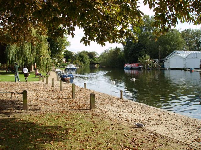 River Yare
Frogbit is a floating plant with white flowers and is a wild cousin of the water soldier found in garden ponds. All these and other plants attract dragonflies, especially the large winged hawkers in late summer. Along this part of the route there are panoramic views of the countryside.
The walk continues through woodland to the Waters Edge Inn. This was built in 1884, and its frontage leads down to the river's edge. On the river, there are usually plenty of waterfowl to be seen, such as swans, ducks and the great crested grebe that dives and swims under the water for food.
From the Waters Edge Inn, the route turns away from the river where, along the banks, red campion grows. The route continues through woodland which is carpeted with bluebells in May. White Dead Nettle can also be found along here, so-called because, unlike the ordinary nettle, it does not sting.
Before the route turns back to the finish, which includes a section retracing your steps back along the river, you will see to your right, Bramerton Hall, a late Georgian House built in 1830.
Acknowledgments: Text derived from the Out and Out Series; Discovering the Countryside on Foot. Pictures courtesy of Wikipedia.


