Walberswick and Southwold
By a river estuary on the Suffolk coast
Google Maps Open Source Maps| Statistics and Files | ||
|---|---|---|
| Start: Walberswick | Distance: 5.7 miles (9.2 km) | Climbing: 30 metres |
| Grid Ref: TM 50017 74977 | Time: 3 hours | Rating: Easy |
| GPX Route File | Google Earth File | About Walberswick |
| Statistics | |
|---|---|
| Start: Walberswick | Distance: 5.7 miles (9.2 km) |
| Climbing: 30 metres | Grid Ref: TM 50017 74977 |
| Time: 3 hours | Rating: Easy |
| GPX Route File | Google Earth File |
Ordnance Survey Explorer Map (1:25,000)
The Walk: Walberswick is typical of the Suffolk coastline, a scene of wheeling gulls and estuary masts, yellow gorse, blackbirds, artists and ornithologists. The sea is not readily evident, but the lighthouse at Southwold hints of its presence.
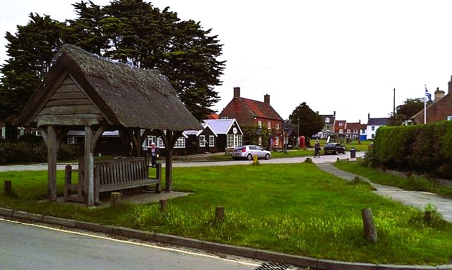 Walberswick
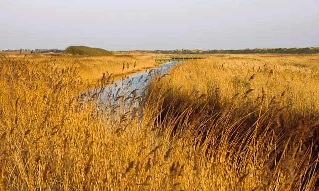 Dunwich River near Walberswick
The River Blyth enters the North Sea at Soul Bay. The Blyth estuary is part of the Suffolk Heritage Coast. Erosion has formed a bar across the harbour, hampering access to the sea. There is a lifeboat station near the Harbour Inn. The hinterland of heath, marsh and farmland provides a rich habitat for vast numbers of migrating birds. The reeds and rushes alongside the Dunwich River form Dunwich Marshes.
Water levels were once maintained with wind-powered pumps. An old brick tower is near the walk and another is across the mud flats from Tinker's Bridge. This is now a bridleway linking Walderswick and Southwold, but from 1879 to 1929 it carried a railway line. Vehicles must go the long way via Blythburgh and Reydon
St Andrews Church in Walberswick provides evidence of a more prosperous past. The current church consists of the south aisle of a larger 15th century church, built with napped flint. The Church of the Sacred Heart in Southwold is made from dressed blocks of stone, rather than local materials, and contrasts with St Edmunds Church.
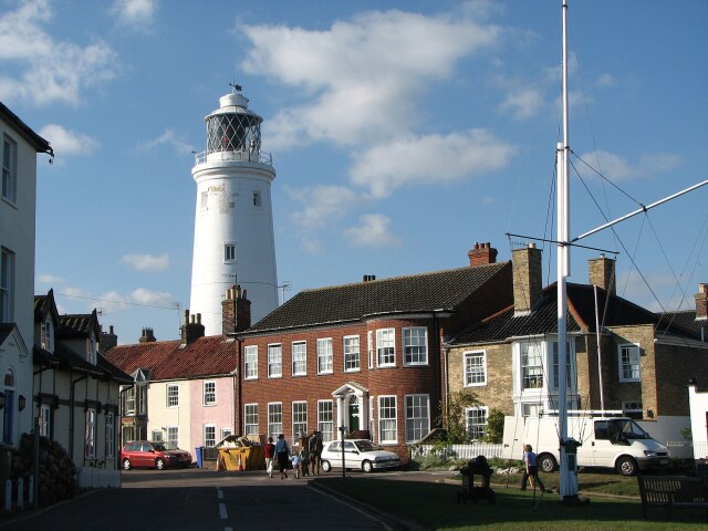 Southwold Lighthouse
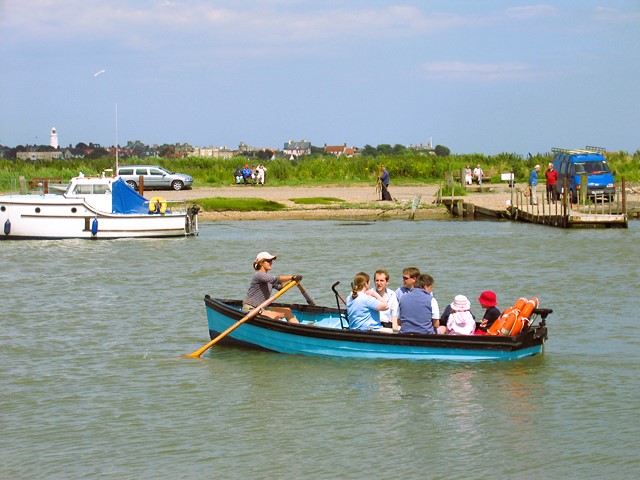 The way back by Walberswick Ferry
In Southwold, East Street leads to High Street, the two being separated by Market Place. Here is the town pump dating from 1873, and the Town Hall.
On Gun Hill, there is a row of cannons, a gift from the Duke of Cumberland who put ashore at Southwold on his return from Culloden. They were fired on by enemy guns, supposing them to be part of the town's defences, during World War One.
Return to the start of the walk is by way of Walberswick Ferry. If this is not available, the walk is extended by walking inland along the River Blyth to the crossing you used getting from Walberswick to Southwold. The return, thus, is back along the other side of the river to the ferry point.
Acknowledgments: Text derived from the Out and Out Series; Discovering the Countryside on Foot. Pictures courtesy of Wikipedia.


