Saltburn by the Sea
Along the Cleveland Coast, a walk on the clifftop above Saltburn by the Sea
Google Maps Open Source Maps| Statistics and Files | ||
|---|---|---|
| Start: Saltburn by the Sea | Distance: 3.0 miles (5.0 km) | Climbing: 240 metres |
| Grid Ref: NZ 66675 21586 | Time: 2 hours | Rating: Easy |
| GPX Route File | Google Earth File | About Saltburn |
| Statistics | |
|---|---|
| Start: Saltburn by the Sea | Distance: 3.0 miles (5.0 km) |
| Climbing: 240 metres | Grid Ref: NZ 66675 21586 |
| Time: 2 hours | Rating: Easy |
| GPX Route File | Google Earth File |
Ordnance Survey Explorer Map (1:25,000)
The Walk:
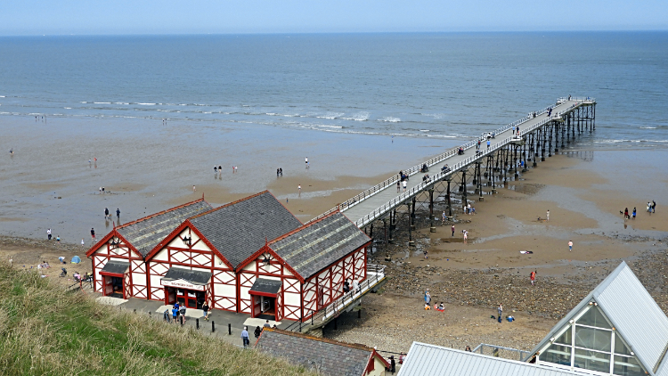 Saltburn Pier
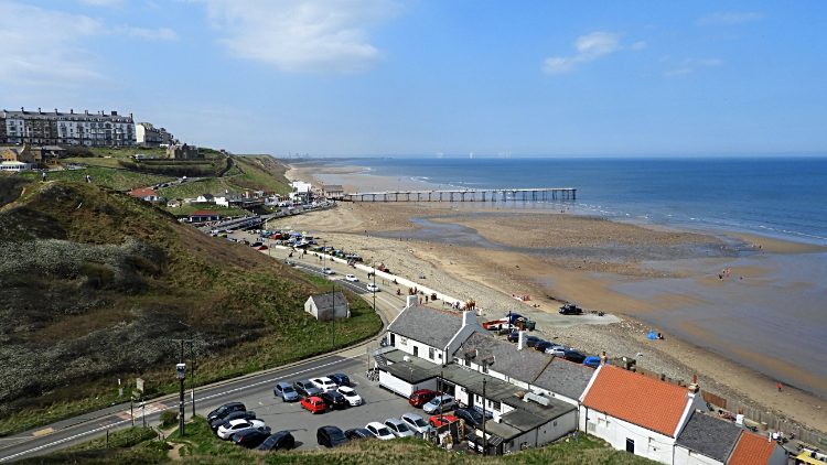 View of Saltburn Sands from the cliff top
Perched on the edge of the North York Moors National Park, Saltburn nestles beneath the 105 metre high Hunt Cliff. In Roman times the cliff was used as a lookout post for raiders, and later a small community of fisherman grew up around the Ship Inn. In 1861, when the railway arrived, a holiday resort was quickly built above the valley. Today Saltburn remains quiet and unspoilt.
The walk begins on the promenade above the pier which juts out across Saltburn Sands. The pier was opened in 1869, since then being damaged by a series of storms and reduced to its present length in 1974. If time permits you can take a walk down to the pier and then get the cliff lift back up to the top before setting off on this walk.
 View back to Saltburn from Hunt Cliff
 Saltburn Sands
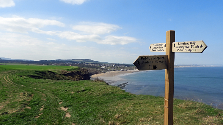
From the start make your way down to the sands and then look out for the Cleveland Way signs pointing up towards the cliffs. Steps lead the way up. Once on the cliff top walk in an easterly direction for about a mile to reach the northmost point of Hunt Cliff. These days during the cliff walk the eyes may be drawn looking to the sea and the vast onshore windfarm near Middlesbrough.
Near the point where the walk turns back towards Saltburn is the curve of the old railway line. Check it out if you like before returning; there are some interesting local sculptures thereabout. Coming back you have the choice of retracing your steps along the cliff top path or to turn inland to follow the lane by Brough House Farm and past Ladgates. Both routes lead back into Saltburn. time for tea or ice-cream?
Acknowledgments: Text derived from the Out and Out Series; Discovering the Countryside on Foot.


