Alston, Bleagate and South Tyne Trail
Ramble by woods and streams through the South Tyne Valley
Google Maps Open Source Maps| Statistics and Files | ||
|---|---|---|
| Start: Alston | Distance: 3.6 miles (5.7 km) | Climbing: 102 metres |
| Grid Ref: NY 71969 46293 | Time: 2 hours | Rating: Easy |
| GPX Route File | Google Earth File | About Alston |
| Statistics | |
|---|---|
| Start: Alston | Distance: 3.6 miles (5.7 km) |
| Climbing: 102 metres | Grid Ref: NY 71969 46293 |
| Time: 2 hours | Rating: Easy |
| GPX Route File | Google Earth File |
Ordnance Survey Explorer Map (1:25,000)
The Walk: Alston is the highest market town in England. With magnificent views over the South Tyne valley towards the highest Pennine fells, the walk passes 18th century hill farms which are still in use, ancient drystone walls and fields grazed by hardy sheep. The route crosses a delightful wooded gill and returns along a section of the Pennine Way.
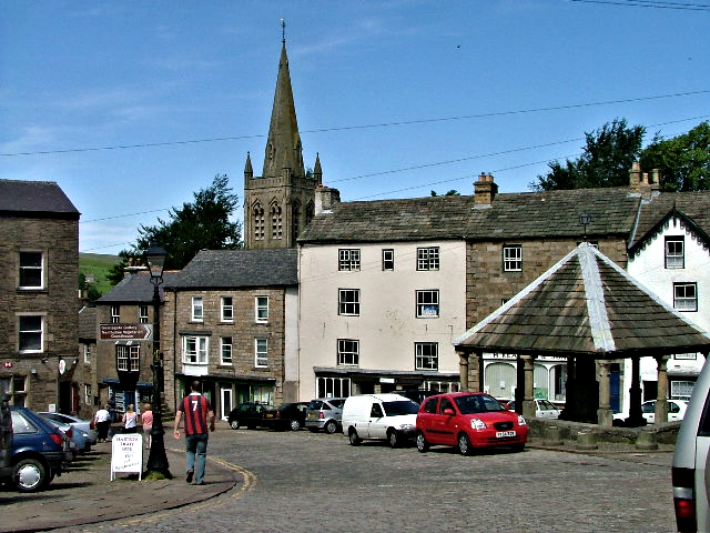 Alston
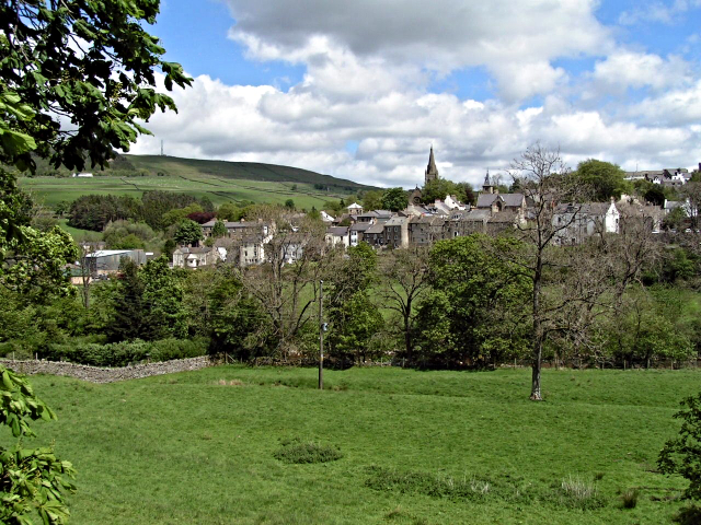 View of Alston from the west
From the top of Alston's main street a narrow lane le3ads out of the town between the drystone walls and a few outlying cottages. The path reaches Fairhill Cottages, which were once almshouses, and then follows a track to Fairhill Farm. Annat Walls, another farm, is next passed before continuing due south to cross Nattrass Gill where waterfalls tumble gently through the sheltered woods of rowan, hazel, sycamore and birch. The path climbs steeply out of the wooded gill and back into open countryside, continuing to its southern extremity at Bleagate.
The return northbound journey follows the Pennine Way across fields and to another crossing of Nattrass Gill, as was the first time, via a footbridge, before continuing back across more fields and country lanes to Alston.
Acknowledgments: Text derived from the Out and Out Series; Discovering the Countryside on Foot. Pictures courtesy of Wikipedia.


