Uppermill, Saddleworth, Diggle, Castleshaw, Delph and Dobcross
A walk exploring gritstone villages on the edge of Saddleworth Moor
Google Maps Open Source Maps| Statistics and Files | ||
|---|---|---|
| Start: Uppermill | Distance: 7.2 miles (11.5 km) | Climbing: 363 metres |
| Grid Ref: SD 99609 06606 | Time: 4 hours | Rating: Moderate |
| GPX Route File | Google Earth File | About Uppermill |
| Statistics | |
|---|---|
| Start: Uppermill | Distance: 7.2 miles (11.5 km) |
| Climbing: 363 metres | Grid Ref: SD 99609 06606 |
| Time: 4 hours | Rating: Moderate |
| GPX Route File | Google Earth File |
Ordnance Survey Explorer Map (1:25,000)
The Walk: Uppermill, on the upper reaches of the River Tame in the north-east corner of Greater Manchester, is a typical gritstone village. Until 1974, this was part of the West Riding of Yorkshire, and until recently, people born in the area still considered themselves native-born Yorkshiremen, eligible to play for the country's cricket team. Throughout this walk there are reminders of the industrial heritage that created these communities on the moorland edge.
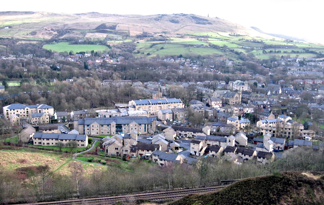 Uppermill
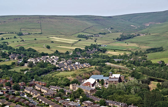 Diggle
The walk starts by the Wool Road Transhipment Shed. Bales of wool, worsted, cotton and other goods from Manchester were once unloaded from narrowboats here, and transferred to strings of packhorses, which took them over the Pennines. The packhorse traffic lasted just 12 years, from the opening of the Huddersfield Narrow Canal in 1799 to the completion of the Standedge Tunnel, which took the boats under the moors, in 1811.
You cross the canal near the Brownhills Visitor Centre, which provides information about the region's natural and industrial history, and climb gradually towards neighbouring Saddleworth's parish church, St Chad's, on the hillside above the village. It marks the height of the original hamlet of Saddleworth, built when the valley below was still densely wooded. The current gritstone building is a Victorian replacement for the Norman church founded here in 1200.
In the churchyard, a gravestone bears an inscription recording the brutal 19th century murder of a pub landlord and his son. The killer was never caught, but the funeral drew an audience of around 10,000, swelled by the intense interest generated by the regional press; upwards to 30,000 people are said to have visited the site of the killings within days of the event.
Further on is the hamlet of Diglea, an outskirt of the larger village of Diggle. In Diglea there is a glorious survival of weaver's cottages and yeoman's houses. Several mills operated here. Just to the north lies Standedge Canal Tunnel.
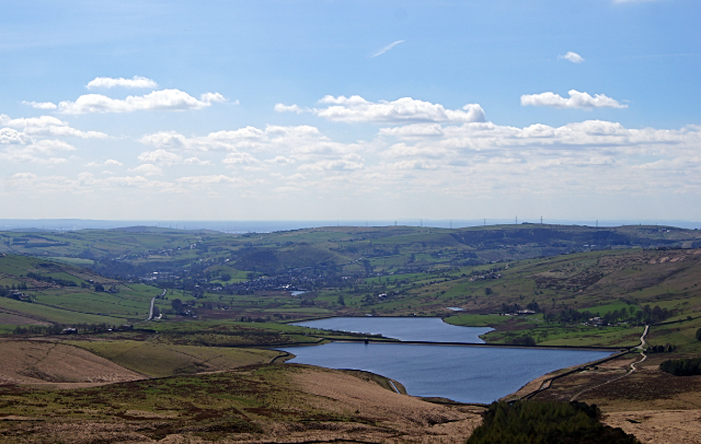 Castleshaw Reservoirs
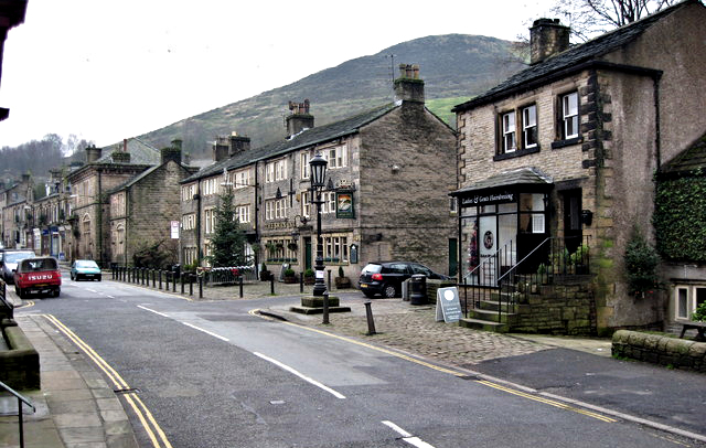 Delph
Delph
Following Harrop Brook, the walk becomes gradually steeper. at Brun Barn, there are extensive views down the Tame valley. Ahead and to your right is a spoil tip topped by a large circular brick structure. This marks the course of the railway tunnel; the bricks are the top of the ventilation shaft.
Behind the Horse and Jockey Inn, the walk reaches its highest point, at around 1,000 feet (300 metres), before descending gradually to the site of Castleshaw Roman Fort. This lonely, windswept outpost of the Roman Empire was commissioned by Agricola about AD79 and abandoned in AD120. Little remains, but information boards detail the history of the site.
The route crosses Castleshaw Lower Reservoir Dam and then passes two millponds. These waters are very popular with a variety of waterbirds, as well as dragonflies in summer.
To the south of the village of Delph, set in a deep valley, is Shore Mill, a scribbling mill where raw wool was combed to make it easier to work. You climb along Harrop Edge to reach Dobcross, the oldest village in the area. Its maze of back lanes and passages was used in the Hollywood film Yanks and also in well known bread advertisements. If any place typifies a Pennine gritstone village in all its glory, this is it.
Acknowledgments: Text derived from the Out and Out Series; Discovering the Countryside on Foot. Pictures courtesy of Wikipedia.


