Marple, Strines, Brook Bottom, Marple Bridge and Compstall
A waterside and countryside ramble around the empire of a Georgian industrialist
Google Maps Open Source Maps| Statistics and Files | ||
|---|---|---|
| Start: Marple Wharf | Distance: 9.3 miles (15.0 km) | Climbing: 432 metres |
| Grid Ref: SJ 96203 89094 | Time: 4-5 hours | Rating: Moderate |
| GPX Route File | Google Earth File | About Marple |
| Statistics | |
|---|---|
| Start: Marple Wharf | Distance: 9.3 miles (15.0 km) |
| Climbing: 432 metres | Grid Ref: SJ 96203 89094 |
| Time: 4-5 hours | Rating: Moderate |
| GPX Route File | Google Earth File |
Ordnance Survey Explorer Map (1:25,000)
The Walk: Set squarely within Greater Manchester, with its beginning and end in suburbia, this is a surprisingly rural walk. It winds along the wooded banks of a canal before climbing to the bleak escarpment of Cobden Edge, where there is a fine panoramic view of the whole area. Marple has an industrial history in which cotton manufacture and hat making loom large. The town was very much shaped by an 18th century entrepreneur, Samuel Oldknow, who began developing the cotton mills and related industries. His work is encountered more than once during the walk.
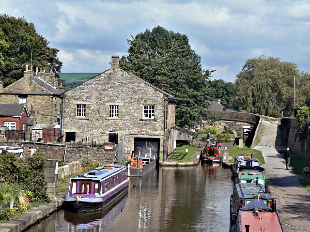 Marple Wharf
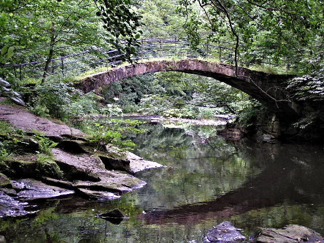 Footbridge over the River Goyt
The route out of Marple follows the Peak Forest Canal. Mallard and tufted duck scavenge for food around the locks, pleading for titbits from passers by. They are often accompanied by mute swans, which cruise regally up and down the canal between the narrowboats.
These locks are part of a famous flight of sixteen, which lift the canal 209 feet (63 metres). At between thirteen and fourteen feet (3.9 and 4/2 metres) each, they are the second deepest locks in the country. In places, they are so narrow that it is possible to leap from one side to the other, though each lock has a small bridge so the operator can cross safely to open the gates.
The canal was opened in 1800, but the locks were not completed until 1804, owing to poor funding. In the meantime, a temporary tramway was built to carry goods from the bottom of the hill to what is now Top Lock.
At bridge number eighteen, the canal goes through a short tunnel, where the barges were walked through by leggers. The horses were unhitched and led through a horse sized tunnel alongside. The bridge is known as Posset Bridge; the navvies morale was flagging with the continuing delays, and Samuel Oldknow spurred them on to completion with supplies of ale posset (a drink made from alcohol and curdled milk) from the nearby Navigation Inn.
Oldknow had sunk a great deal of money into the canal and was its chief promoter, relying on it for the transport of both raw materials and finished goods. He personally owned fifteen barges, each of which cost the princely sum of £140 and could carry 25 tons of produce.
His mills created a great deal of employment for women and children, whom he housed in the town. To provide work for the menfolk, he established a lime burning concern, bringing the lime from Doveholes in Derbyshire. The limekilns were designed to resemble a Gothic church so as to not spoil the view from Oldknow's house, Mellor Lodge.
The canal enters a wooded section, where great spotted woodpeckers can be heard hammering in rapid bursts on the trunks of mature trees. If you are fortunate, you may catch a glimpse of one as it darts through the woodland, its striking black and white plumage highlighted by a blood red patch under its tail. In spring, nuthatches display by their chosen nesting holes, and are the natural highlight on this section of the walk.
 Goyt Way fingerpost near Strines
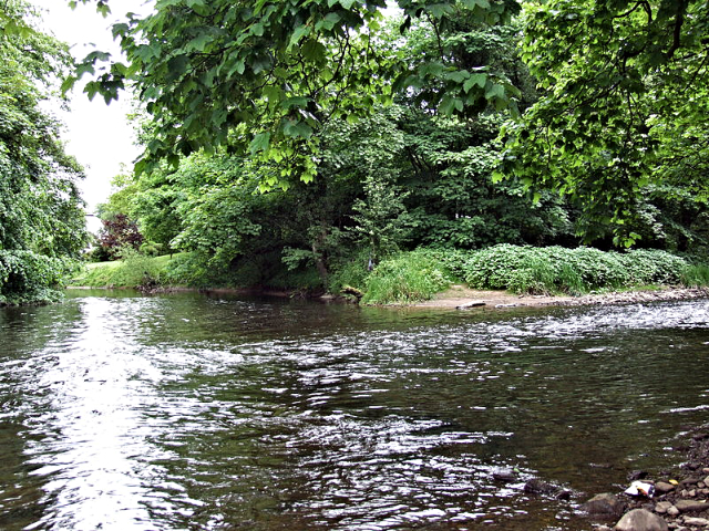 River Goyt, Brabyns Park
On the outskirts of Strines, the route crosses the valley of the River Goyt, passing a reservoir that originally served the nearby Strines Print Works. In the centre is an unusual dovecote. This is now a listed building. A steep path leads to Brook Bottom, a quaint little cluster of cottages complete with pub and primitive Methodist chapel. The whole hamlet is now registered as a conservation area.
The style of the countryside changes dramatically as you climb Cobden Edge, on the borders of the Peak District. Ravens can be seen on these heights, persecuting any passing birds of prey unwise enough to hunt over their patch.
From a huge wooden cross, erected in 1970 by a group of churches, there are splendid views of Kinder Scout and Chimney Churn in the Peak District to the east, over the sprawl of Manchester to the north-west, and to the fertile Cheshire Plain in the south.
The route drops through a golf course back into the sphere of influence of Samuel Oldknow. Bottom's Hall, the centre of his agricultural interests, was where he trained apprentices in farming techniques. Poverty stricken child workers were housed in an orphanage nearby.
Just beyond Bottom's Hall you will be able to see the Roman Lakes through the trees. Originally millponds, they served Oldknow's giant Mellor Mill, which was opened in 1790. The mill made Oldknow the country's major producer of muslin, and continued to provide employment in the town until it was levelled by a fire in 1892.
Afterwards the walk follows the Midshires Way by riverside through parkland to Marple Bridge and then into Brabyns Park before crossing Compstall Bridge and after another stretch of delightful wooded parkland rejoining the canal, following it south to Marple Aqueduct before returning to the start of the walk near to Marple Station.
Acknowledgments: Text derived from the Out and Out Series; Discovering the Countryside on Foot. Pictures courtesy of Wikipedia.


