Holmfirth, Wooldale, Hole Bottom, Jackson Bridge and New Gate
Last of the summer wine country, a walk through a deep Pennine valley
Google Maps Open Source Maps| Statistics and Files | ||
|---|---|---|
| Start: Holmfirth | Distance: 5.2 miles (8.3 km) | Climbing: 258 metres |
| Grid Ref: SE 14242 08309 | Time: 3 hours | Rating: Moderate |
| GPX Route File | Google Earth File | About Holmfirth |
| Statistics | |
|---|---|
| Start: Holmfirth | Distance: 5.2 miles (8.3 km) |
| Climbing: 258 metres | Grid Ref: SE 14242 08309 |
| Time: 3 hours | Rating: Moderate |
| GPX Route File | Google Earth File |
Ordnance Survey Explorer Map (1:25,000)
The Walk: The Pennine town of Holmfirth could not be more typical of the West Yorkshire scene, with its stone walls, steep streets and moorland setting. Its distinctive character made it an ideal choice for the location in many of the episodes of the television series 'Last of the Summer Wine', first shown in 1972. The walk includes visits to a number of the places seen regularly in the series.
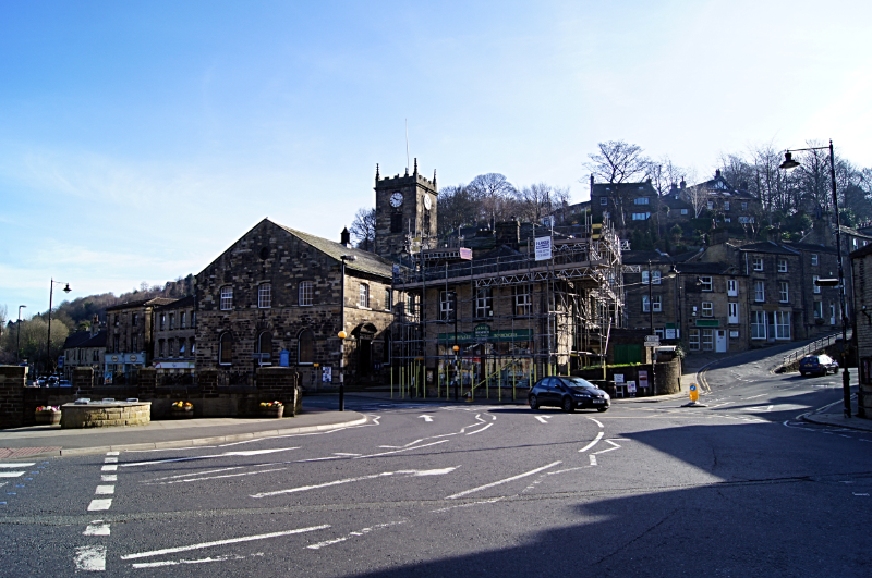 Holmfirth
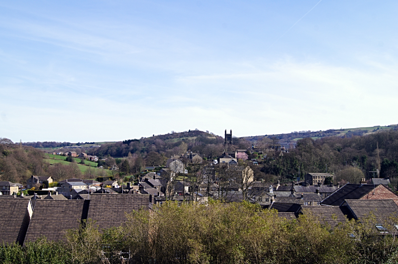 View of New Mills from Wooldale
The buildings in Holmfirth and made and roofed with local stone, and some still retain weaver's windows on the upper storey that allowed more light to reach the hand looms. There are several split level four-storey houses set on hillsides, with a two-storey section on the lower level and another above, reached from the upper level. In the wooded valleys around the town are mills which once once powered with water from a stream.
In Holmfirth itself, a walk up Cooper Lane gives a good view back over the rooftops. To the left of the church tower, you will see a terrace of three houses with pointed lintels. This was used as Clegg's home in the television series, with Pearl and Howard living at the other end of the lane. At the foot of Cooper Lane, in a basement, is the Last of the Summer Wine Exhibition. This includes some of the gadgets used by Seymour and photographs from the filming of the series.
At the Postcard Museum, there is a display of postcards selected from a collection of over 30,000 cards. The museum was opened in 1987. A video presentation shows some films from the early days of the cinema, and there is a Victorian post-box that can be used to mail the reproduction cards on sale, all of which require a special collector's stamp.
A section of the museum is also devoted to the 1852 Holmfirth Flood Disaster, when the Bilberry Dam burst. The dam, which stood some 3.5 miles (5.6 km) further up the valley, had been constructed 15 years earlier. After heavy rain on 4th February, the dam was full and the retaining wall collapsed at about 1 o'clock the following morning, 86 million gallons (390 million litres) of water swept down onto the town, carrying with it bales of wool, masonry, uprooted trees and even steam boilers.
That night 81 inhabitants of the valley lost their lives, a 7 bridges, 21 industrial buildings, 27 cottages and 7 shops were totally destroyed. Because of Holmfirth's geological location - it lies on a steep sided valley surrounded by high moors - Holmfirth has always been at risk from flood, and more serious floods also occured here in 1771, 1821 and 1944.
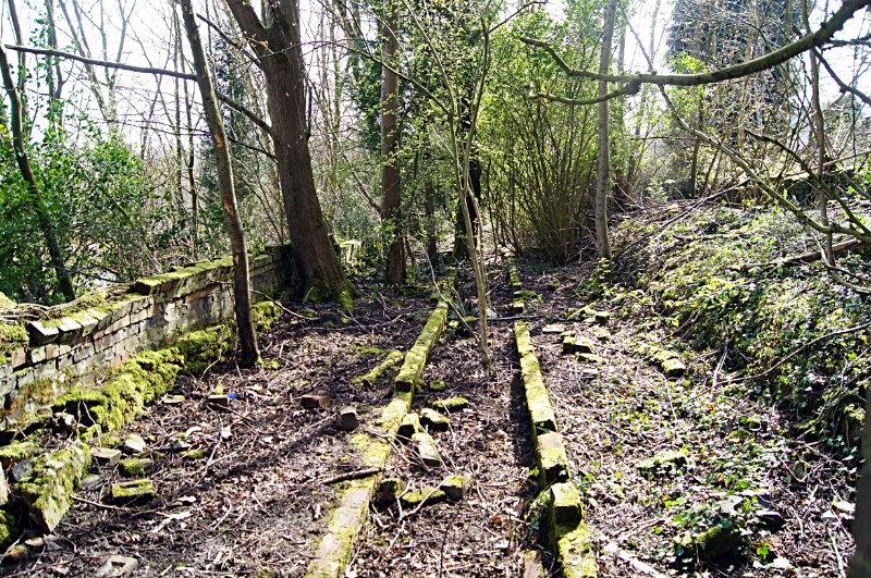 Site of old workings at Jackson Bridge
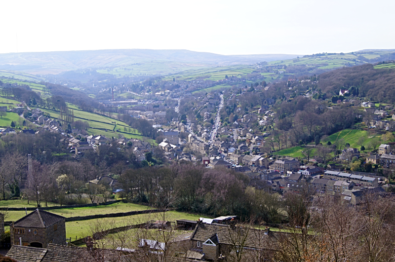 View of Holmfirth from New Gate
The Toll House Bookshop stands on the site of the former toll house. The original building was washed away in the 1852 flood, drowning the occupants, Samuel Greenwood and his wife and child. The toll house was use to collect tolls on the Enterclough Bridge on the Woodhead turnpike road. The road climbs to a height of 1,718 feet (524 metres), before descending to the hamlet of Woodhead in neighbouring Derbyshire. Acts to establish turnpike roads could be obtained from Parliament by trustees who could then charge tolls and improve the roads. Toll paying was taking so seriously that anyone found guilty of damaging or pulling down a toll gate could be transported for seven years.
When you reach the Upper Bridge, look upstream to see the row of houses on the right hand side that were used as the home of Last of the Summer Wine's Nora Batty and Compo, who lived in the basement of the house. On the left of the bridge is the Elephant and Castle, a former coaching inn standing beside the turnpike road. On the side of the second door is a brass plaque indicating the height reached by flood water after a cloudburst on Whit Monday, 29th May 1944.
Standing on the paved churchyard of Holy Trinity Church, Sid's Cafe has appeared in nearly every episode of the television series. For filming scenes inside the cafe, the wooden panelled interior had been reproduced in a studio set.
Another familiar landmark from the television series is the exterior of the White Horse Inn. Inside the inn are over 250 photographs of the stars, taken during filming. The inn makes an excellent refreshment point for the walk.
Above and to the right of the inn are buildings with weaver's windows on the upper storeys. Weaving was once a cottage industry in the area, but declined with the opening of large mills. a boost was given to the sale of local cloth in the 19th century when a treaty was signed to mark the Peace of Amiens.
The tall stone pillar known as T'owd Genn, was erected in 1802 to commemorate the short lived peace after the war with France. The pillar also bears a plaque showing the height reached by the water after the bursting of the Bilberry Dam in 1852.
From Holmfirth the walk is an exciting adventure of visits to neighbouring small communities, in turn those being Wooldale, Hole Bottom and Jackson Bridge. Folk of these small places kept similar trades to those of Holmfirth as is evidenced by the small mills scattered around. Some still stand, turned into smaller shopping enterprises or converted into homes. On the final leg of the walk, returning from Jackson Bridge to Holmfirth, and when on the stretch from Paris to New Gate, the views back down to Holmfirth are sumptuous. Take a break, a deep breath, and enjoy the glorious view of the town and of the Holme Valley.
Acknowledgments: Text derived from the Out and Out Series; Discovering the Countryside on Foot. Pictures courtesy of Wikipedia.


