Ilkley and Ilkley Moor
A walk across open moor with breaktaking views on the edge of a famous Yorkshire town
Google Maps Open Source Maps| Statistics and Files | ||
|---|---|---|
| Start: Ilkley Bridge | Distance: 5.3 miles (8.5 km) | Climbing: 296 metres |
| Grid Ref: SE 11711 47979 | Time: 3 hours | Rating: Moderate |
| GPX Route File | Google Earth File | About Ilkley |
| Statistics | |
|---|---|
| Start: Ilkley Bridge | Distance: 5.3 miles (8.5 km) |
| Climbing: 296 metres | Grid Ref: SE 11711 47979 |
| Time: 3 hours | Rating: Moderate |
| GPX Route File | Google Earth File |
Ordnance Survey Explorer Map (1:25,000)
The Walk: Ilkley Moor is a nationally famous area of open moorland, its fame in part due to the Victorian popular song 'On Ilkla Moor Baht At' - sometimes described as Yorkshire's national anthem. The history of Ilkley goes back to iron Age times. Then it was a riverside settlement by a ford (Llecan) where the Romans built a camp (Olicana) to guard their road crossing of the River Wharfe, downstream from the present 17th century packhorse bridge where the walk starts. Remains of Olicana Camp can be seen behind Ilkley's medieval church, which has three magnificent carved Anglo-saxon gravestone crosses inside the tower. The Tudor Manor House nearby contains many Roman archaeological finds. From the late 18th century onwards Ilkley enjoyed fame as a spa town.
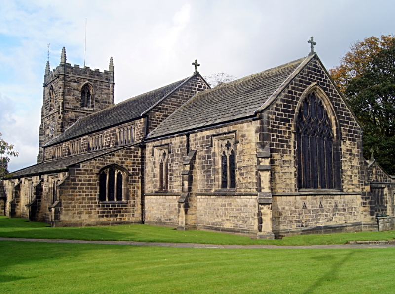 All Saints Parish Church, Ilkley
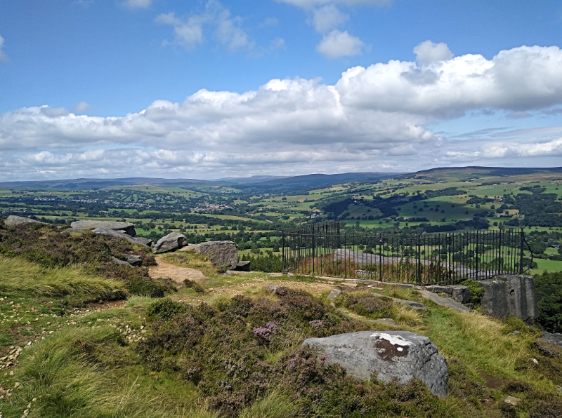 Swastika Stone on Ilkley Moor
Ilkley College was originally built in 1865, as White Wells Hydropathic Hotel. This architecturally outstanding building and park now houses the Ilkley Campus of Bradford and Ilkley Community College.
Further on the route is a narrow wooded valley, Heber's Ghyll (see my walk) with ornamental paths and bridges, landscaped in typical late Victorian style. It takes its name from an old Ilkley family, the Hebers, of nearby Hollin Hall. The ghyll is noted for its ferns, oak and birch woods, and a series of waterfalls.
On the moor itself is the Swastika Stone. The mysterious carving on this moorland boulder is in fact a 'folyfoot'; this is an ancient Indo-European symbol of eternal life. The carving has a modern replica alongside it. The original, protected within iron railings, probably dates from some 2,500 to 3,000 years ago.
Ilkley Moor is particularly rich in archaeological remains, including literally scores of mysterious cup and ring marked stones. There are stone circles on the moor too. Ilkley Moor, especially the north edge, is a marvellous viewpoint across and into the centre of Wharfedale and the Yorkshire Dales National Park.
 View from Ilkley Moor to Wharfedale
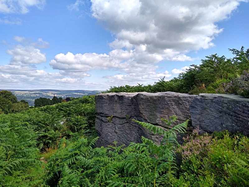 Outcrop and fern near White Wells
Further east, along the moor edge, is White Wells, which was built as a small bath-house in the 1760's by Squire Middleton of Ilkley. Situated over Ilkley Moor's most famous spring, it only took a few years before wealthy, gouty invalids were coming from all over England to be carried by donkey from their Ilkley lodgings to be plunged into the clear, icy waters. The wells have been beautifully restored and are open to the public, complemented by a small museum and tea rooms.
Below White Wells are the Tarns, which were landscaped from moorland pools to add to their picturesque effect. Much of the traditional moorland heather and bilberry, richly purple in late summer, had been lost through overgrazing and trampling but in recent years steps have been taken to restore the colourful display to its natural peak.
Acknowledgments: Text derived from the Out and Out Series; Discovering the Countryside on Foot. Pictures courtesy of Wikipedia.


