Burton upon Stather, Julian's Bower and Alkborough
Along an inland cliff top beside the River Trent to an ancient village
Google Maps Open Source Maps| Statistics and Files | ||
|---|---|---|
| Start: Burton upon Stather | Distance: 6.5 miles (10.4 km) | Climbing: 150 metres |
| Grid Ref: SE 87132 18765 | Time: 3 hours | Rating: Easy |
| GPX Route File | Google Earth File | About Julian's Bower |
| Statistics | |
|---|---|
| Start: Burton upon Stather | Distance: 6.5 miles (10.4 km) |
| Climbing: 150 metres | Grid Ref: SE 87132 18765 |
| Time: 3 hours | Rating: Easy |
| GPX Route File | Google Earth File |
Ordnance Survey Explorer Map (1:25,000)
The Walk: Although not nationally known as a good walking area, South Humberside has some charming countryside, with splendid views and interesting villages. This walk follows a delightful path leading along the top of an escarpment to the village of Alkborough. It begins on the north edge of neighbouring Burton upon Stather, and first heads south along a wide green track to the village and then leads north-west down a road to the Ferry Inn besides the River Trent. Next, it is a climb north-eastwards to the Armada Beacon. This was part of the 'Fire over England' chain of beacons, lit on 19th July 1988 to mark the 400th anniversary of the defeat of the Spanish Armada.
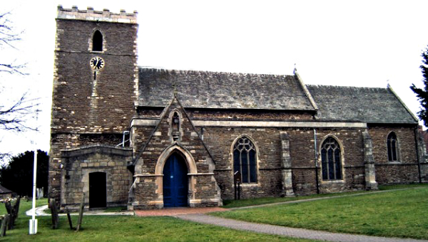 Church of St Andrew, Burton upon Stather
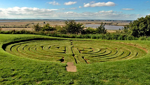 Julian's Bower
From the Armada Beacon, the route continues north along the beginning of the Nev Cole Way, a 57 mile long distance footpath from Burton upon Stather to Nettleton, near Caistor, where it joins the Viking Way.
The footpath here gives fine views across the River Trent and over the Isle of Axholme. The cooling towers of three power stations, Ferrybridge, Eggborough and Drax used to be seen too but their numbers are diminishing as the power stations are decommissioned and the towers demolished. In time, none will remain. What will remain in sight though and seen on a clear day is York Minster, visible on the far horizon 26 miles away to the north-west. In season, cranesbill, enchanter's nightshade, red campion, white campion and wild strawberry grow along this elevated way.
As the path reaches the village of Alkborough, it passes Julian's Bower, a turf maze that was first recorded in 1697. It was ancient then, and thought to date from Roman times. Recently, because of its likeness to a pattern found in medieval French churches, it has been suggested that the maze was cut by monks from Walcot in the 16th century. The true age and origin of the maze remain unproven.
A stone replica of the Bower may be found just along the way in the porch of Alkborough's parish church. Outside the church is an unusual cross, believed to be Saxon in origin. The side nearest the church bears deep indents caused by the sharpening of arrows: all men were once required by law to learn to use the longbow, and Alkborough's butts were just behind Front Street.
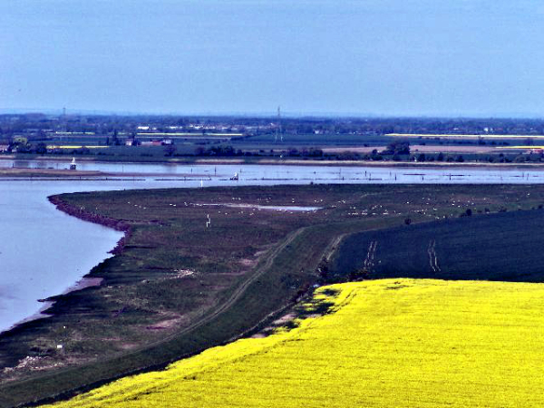 Alkborough Flats
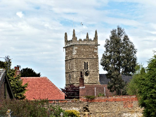 St John the Baptist Church, Alkborough
On the other side of Alkborough is the site of a Roman earthwork, commanding the route to the Trent. The line of the vallum or ditch, enclosing an area of 300 feet square, can still be traced.
The route continues to Walcot. This place name indicates that the area was settled by Britons in Saxon times: the natives were known as 'wealas' (foreigners) to the Saxon invaders. On the right is Walcot Hall, whose owners have planted 1,000 cherry trees in the grounds.
Beyond Walcot, a bridlepath runs beside some woodland. A tangle of hawthorn, wild rose, cherry and elder grows among the oaks, beech and holly. The path leads back to the cliff top at Kell Well, a remarkable spring issuing from the cliff and overhung with trees. It is known for the 'star' or 'hag' stones (stones with holes through their centres) found in its channel. Similar stones were carried by the ancients as amulets or charms.
From Kell Well, the walk back along the cliff top allows you more fine views across the River Trent.
Acknowledgments: Text derived from the Out and Out Series; Discovering the Countryside on Foot. Pictures courtesy of Wikipedia.


