Barley, Pendle Hill and Lower Black Moss Reservoir
A walk up Pendle Hill and over Lancashire's moorlands
Google Maps Open Source Maps| Statistics and Files | ||
|---|---|---|
| Start: Barley | Distance: 4.7 miles (7.6 km) | Climbing: 352 metres |
| Grid Ref: SD 82338 40274 | Time: 3 hours | Rating: Moderate |
| GPX Route File | Google Earth File | About Pendle Hill |
| Statistics | |
|---|---|
| Start: Barley | Distance: 4.7 miles (7.6 km) |
| Climbing: 352 metres | Grid Ref: SD 82338 40274 |
| Time: 3 hours | Rating: Moderate |
| GPX Route File | Google Earth File |
Ordnance Survey Explorer Map (1:25,000)
The Walk: The whaleback hump of Pendle Hill stands alone, dominating the plains surrounding Burnley, Nelson and Colne. It's distinctive profile can be viewed from Yorkshire, Lancashire and Cumbria. The walk starts at the village of Barley. Back in 1324 it was known as Barelegh, meaning the infertile lea, or meadow. The area depended on agriculture until the early 18th century when the textile industry developed. It became normal to install a hand loom in the home as an extra source of income. There was also a cotton mill in Barley, with 200 looms, but in the 1880's a flood destroyed the business. Ironically, the building is now owned by the water company, United Utilities.
 Upper Ogden Reservoir
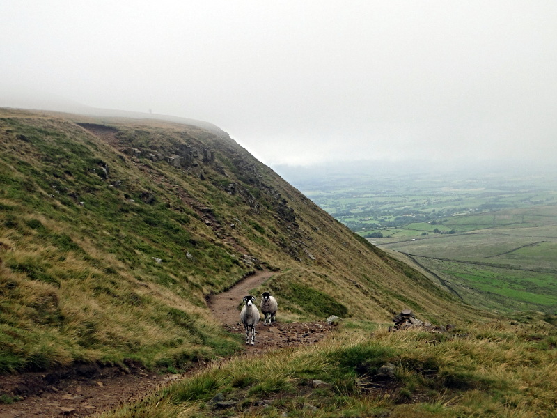 Big End, Pendle Hill
Pendle is a plateau of high, airy moors, covering an area of twenty square miles (52 square kilometres). To the north and east are steep escarpments, and there are several cloughs - narrow valleys or ravines - that cut into the moor. Ogden Clough provides the water catchment for the Ogden reservoirs, which you can see to the south from the top of Pendle Hill.
The 1,827 foot (557 m) summit is marked by a triangulation point at the mount known as Big End, or the Beacon. This refers to a fire beacon which was used to signal a warning or news of an important event. A lookout was posted at the Beacon, to watch for approaching bad weather at haymaking time. Nowadays, walkers can appreciate the summit for the panoramic views it offers of coastline and hills, agricultural plains and the industrial landscape of the cotton towns.
The hill is bare of trees and bushes, but supports tough mountain grasses, clubmosses and cotton-grass, as well as the insect catching butterwort. You may also find bilberry and cloudberry, a cousin of the raspberry. Pendle's core is composed of limestone and millstone grit, dating from the Carboniferous period. The first settlements here were during the Bronze Age and remains of their 3,000 year old stone huts have been found.
The name Pendle derives from the Celtic 'pen' meaning hill. Another intriguing name tells us more about the past. Salt Pie Farm, near Upper Black Moss Reservoir, is named after the mounds of salt provided by Cheshire mines. The salt pies were delivered by packhorse to local farms, where the salt was used to preserve meat during the winter months.
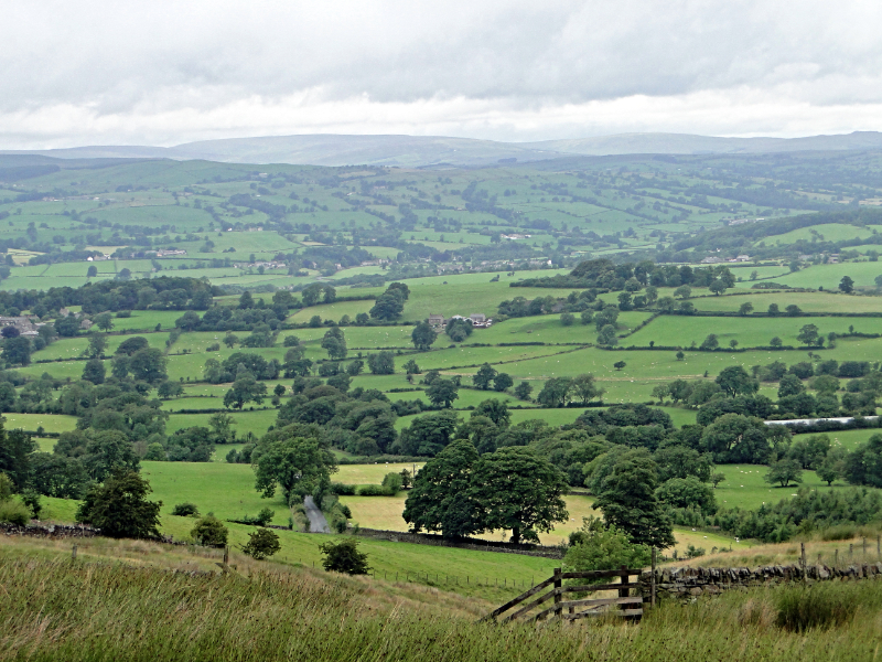 Lancashire countryside view from Pendle Hill
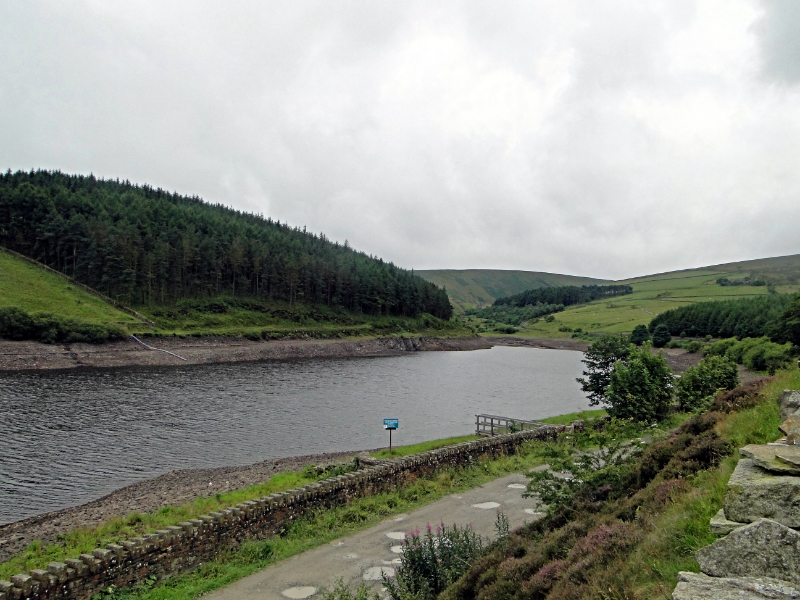
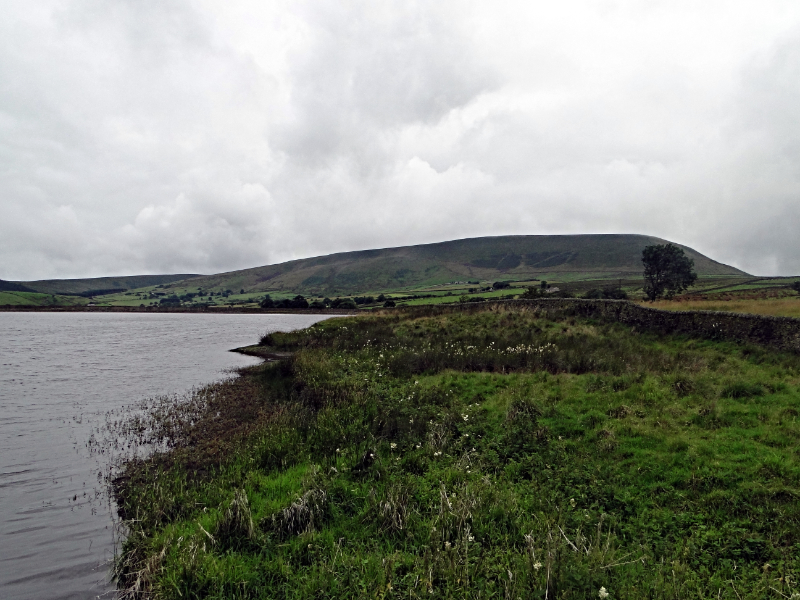 Lower Black Moss Reservoir
Windy Harbour Farm, on the site of a former deer enclosure, dates to the time when the area was appropriated as part of a royal deer forest. 'Brasts', or waterquakes, have, on occasion, burst Pendle's hillside open under the pressure of water. The worst of these created Brast Clough. These natural events were sometimes attributed to sorcery.
When the winter snows thaw, leaving the deep snow behind in the northern gullies, the shape of a witch is formed, complete with pointed hat and flowing robes - an eerie reminder of the superstitions surrounding this area.
In 1652, a little after the time of the notorious Pendle Witches, Pendle Hill was climbed by George Fox, founder of the Religious Society of Friends, or Quakers. He was a Puritan who became disillusioned with organised religion, thus developing the idea of a religious service which involved waiting in contemplative silence for guidance.
Fox records in his diary that he climbed Pendle Hill 'with much ado' as it was so steep. On top of the hill he had a vision of a great number of people who were 'waiting to be gathered'. Modern day Quakers often climb Pendle Hill in a spirit of pilgrimage.
East of Pendle Hill, the Black Moss reservoirs have been dug from beds of shale. They hold more than 100 million gallons (450 million litres) of water for the nearby town of Nelson. United Utilities have planted forests around the reservoirs in the area, mainly of sitka, spruce and beech.
Acknowledgments: Text derived from the Out and Out Series; Discovering the Countryside on Foot. Pictures courtesy of Wikipedia.


