Anglezarke, Yarrow, Rivington and High Bullough
Exploring naturalised Victorian reservoirs on the edge of moorland
Google Maps Open Source Maps| Statistics and Files | ||
|---|---|---|
| Start: Anglezarke | Distance: 5.4 miles (8.7 km) | Climbing: 266 metres |
| Grid Ref: SD 62088 16065 | Time: 3 hours | Rating: Easy |
| GPX Route File | Google Earth File | About Anglezarke |
| Statistics | |
|---|---|
| Start: Anglezarke | Distance: 5.4 miles (8.7 km) |
| Climbing: 266 metres | Grid Ref: SD 62088 16065 |
| Time: 3 hours | Rating: Easy |
| GPX Route File | Google Earth File |
Ordnance Survey Explorer Map (1:25,000)
The Walk: Known locally as the 'Little Lake District' the countryside around Anglezarke has been profoundly influenced by Liverpool's need for water. The series of 19th century reservoirs here are among the most beautifully naturalised man-made features in the country. During the winter months, they play host to a wide variety of waterfowl including whooper swans, wigeon, tufted duck and the occasional diver and cormorant. Summer sees a multitude of songbirds nesting in the dense undergrowth that has been created by conservation conscious rangers, while families of herons compete with hoards of anglers for fish.
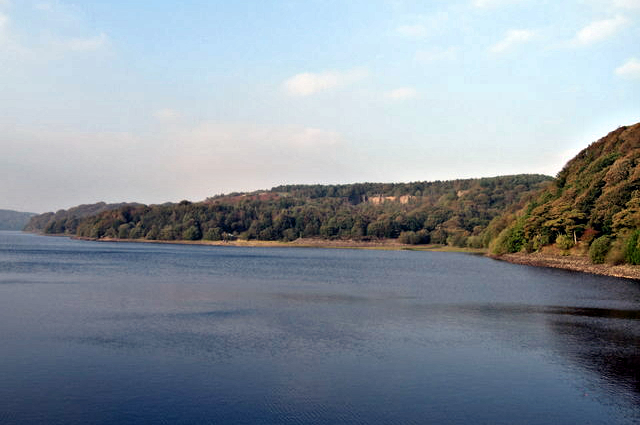 Anglezarke Reservoir
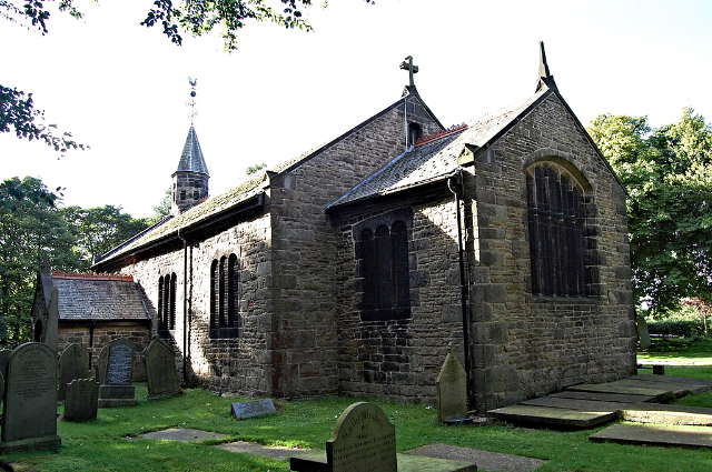 Rivington Church
The walk begins near the southern end of Anglezarke Reservoir, the second largest of the group and perhaps the most interesting of them all, with many secluded corners that can only be reached by footpaths. A succession of wood anemones, bluebells, foxgloves and willowherbs line the banks, which are dotted at intervals with carrs (boggy copses) of alder and stunted oak trees.
Soon you come to an overflow channel known as the 'By-wash'. This leads from the higher Yarrow Reservoir, an open water which attracts plenty of ducks during the winter. After heavy rain, water tumbles noisily and with great force over a series of large steps. During the height of summer it may dry up completely.
From here, sandy lanes lead down to the edge of the village of Rivington. The village green is flanked by ancient drinking troughs and crowned by a set of restored stocks. Beyond it, you turn onto a path and down a set of 39 steps to a wooded avenue. Most of the woods along the route are relatively young, having been established since the lakes were created in the middle of the 19th century. The notable exception is Dean Wood, a jealousy guarded remnant of ancient woodland in the depths of a plunging ravine.
In the damp valley bottom, barely discernible through the hazel and bramble scrub, rare and luxuriant ferns, mosses, liverwort and fungi grow in almost total seclusion. Studied in detail only by the most determined, permit holding naturalists, the valley of Dean Wood does not give up its mysteries easily.
The route crosses the edge of Anglezarke Moor beneath Noon Hill, the site of a primordial burial ground. The very name Anglezarke evokes a mysterious past for these bleak moorlands (it means 'Anuf's Heathen Temple') and, even now, primitive rituals are still enacted on the moors.
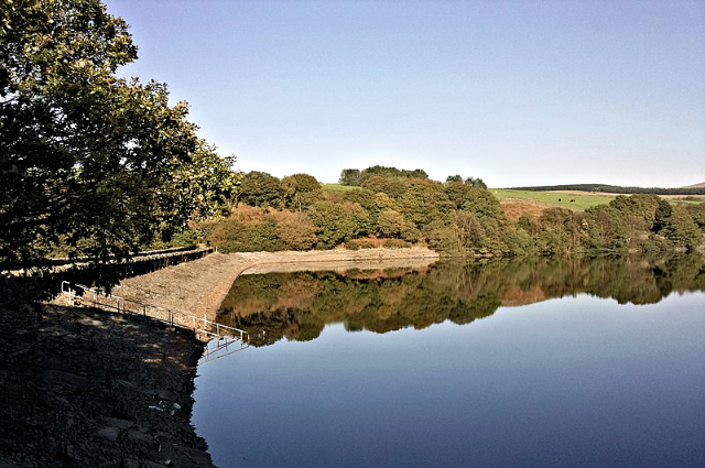 Yarrow Reservoir
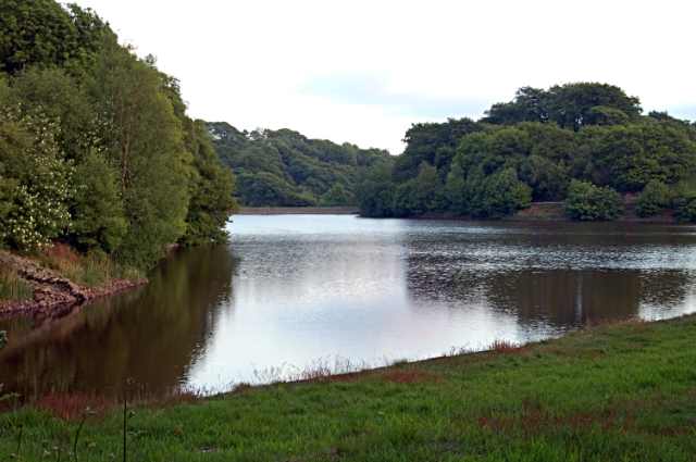 High Bullough Reservoir
You descend again, with Yarrow Reservoir sparkling below to your left, into the pleasant valley of Limestone Brook, a swift flowing moorland stream graced by several small but attractive waterfalls. Dippers and grey wagtails dance from stone to stone chasing the many water-borne insects that mature in the stream.
In the 17th century, Limestone Clough was the site of lead mining. Several of the disused workings have been restored by conservation groups, and a waterwheel pit, pump shaft and many other relics can be seen. Signposts and information boards will guide you around the small valley if you wish to leave the route to explore it.
A winding set of stone steps weaves up the hillside to a stone memorial. It commemorates the crew of a Wellington bomber that crashed on the moorlands during World War Two, killing all on board.
The next section of footpath follows a straight track, thought to be of Roman origin, leading to the Manor House, an imposing stone dwelling with decorative black and white barge boards. The age of the oldest part of the building is unknown though a datestone confirms that extensions were added in 1604.
You now descend a steep, narrow path to the banks of the smallest and most secluded lake, High Bullough Reservoir. Shrouded by mature woodland, it resounds with bird calls at dusk and dawn. After skirting the northern edge of the reservoir, you climb to the Knoll. Here identification boards have been placed at intervals to help you assimilate the surrounding area.
Afterwards, after emerging from a beech wood you arrive at the site of a disused quarry. It was first used to provide stone for the reservoirs embankments, and was a major source of employment in the area. After the completion of the reservoirs, the stone was used to make millions of cobbles which people have trod on for years since in the conurbation of Manchester and surrounding towns. From the quarry a short walk leads you back to the start.
Acknowledgments: Text derived from the Out and Out Series; Discovering the Countryside on Foot. Pictures courtesy of Wikipedia.


