Helmshore, Musbury Heights and Musbury Tor
A moorland walk in a former textile area above the Rossendale valley
Google Maps Open Source Maps| Statistics and Files | ||
|---|---|---|
| Start: Helmshore | Distance: 4.7 miles (7.4 km) | Climbing: 228 metres |
| Grid Ref: SD 77777 21557 | Time: 2-3 hours | Rating: Easy |
| GPX Route File | Google Earth File | About Helmshore |
| Statistics | |
|---|---|
| Start: Helmshore | Distance: 4.7 miles (7.4 km) |
| Climbing: 228 metres | Grid Ref: SD 77777 21557 |
| Time: 2-3 hours | Rating: Easy |
| GPX Route File | Google Earth File |
Ordnance Survey Explorer Map (1:25,000)
The Walk: This is a scenic walk through millstone grit country, above the mill towns of the Rossendale area of Lancashire. In between the millstone grit are beds of softer shale, which erode more easily; this creates the spectacular landscape seen today. The walk begins by the side of the B6235 road in the village of Helmshore, near the former mill town of Haslingden.
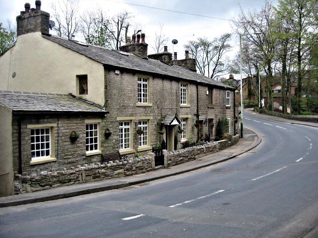 Helmshore
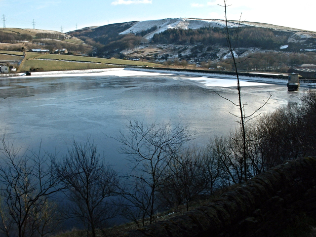 Ogden Reservoir
The first part of the route goes uphill past sturdy, stone farms and rough pasture. Farming has always been important here, although the land has never been very fertile. Oats, beans and peas are grown in the valleys, and small farmers kept pigs and poultry, but most of the area was devoted to cattle and sheep. Bigger landowners also bred horses. Today, hardy Dalesbred sheep graze the rough pastures.
Most families needed other work to supplement the meagre income they derived from agriculture, and work was provided on a small scale by quarrying. In the 19th century it became a major industry; thousands of tons of stone dug out at Musbury Heights made setts, kerbs and flagstones for Lancashire's streets.
The walk passes through the spoil heaps of the old Musbury Heights Quarry. The chimney remains are part of the scribbling mill where flagstones were dragged round and round to smooth their surface. The finished stone was brought down the hillside in tubs supported by a steel rope, on a long, straight incline.
The immediate area flourished until the turn of the 20th century, when it fell victim to the growing demand for drinking water from the mill towns below. Three reservoirs were created here, the Haslingden Grane Reservoirs, and the hillside was depopulated to ensure the purity of the run-off water.
Beyond the quarry is moorland, where you may spot skylarks and curlews. There are colourful lichens on the grey gritstone walls, and various types of mosses in the banks. The acid, peaty soil of the moor supports tussocks of tough grasses, mosses and rushes. All along the way are crumbled ruins of farmhouses abandoned when the reservoirs were built.
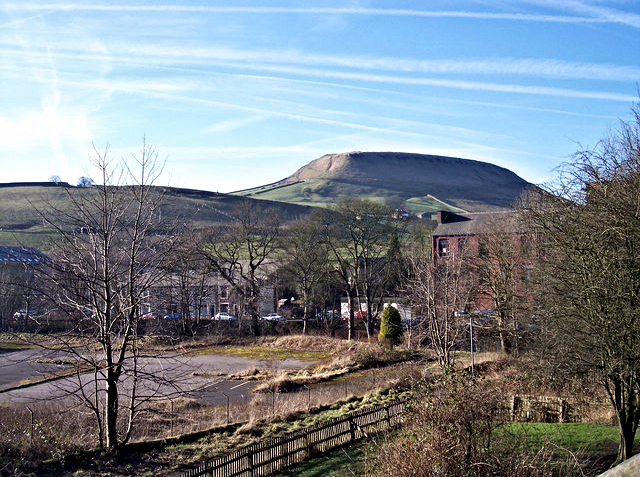 Musbury Tor
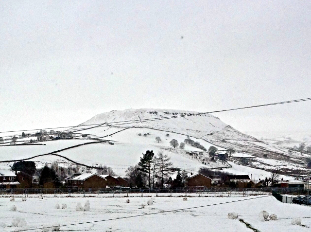 Musbury Tor covered in snow
The path runs along a bank next to a deep gully, part of the boundary of the old Musbury Deer Park. The park was enclosed in 1304 on the orders of Henry de Lacy, then Lord of the Manor. The area was reserved for hunting until Tudor times, when tenants were encouraged to lease and farm the lands.
In the 16th century, people earned extra money by spinning, bleaching and weaving wool in their homes, and selling the cloth. The trade involved almost every family on the moorlands of Lancashire. Later, mills were built in the valleys, and people moved down from the high moors for work.
The last stage of the walk leads over the shoulder of the prominent round of Musbury Tor, and returns along a walled green lane, an old packhorse route. Two mills have been converted to textile museums. Higher Mill was built in 1789 for 'fulling', a process where wool is beaten to interlock its fibres.
In the 18th century, cotton began to arrive from America. Whitaker's Mill was built next to Higher Mill to spin cotton after Richard Arkwright's water frame made large-scale power spinning a possibility. The working museum contains early examples of textile machinery, including James Hargreaves's Spinning Jenny.
Acknowledgments: Text derived from the Out and Out Series; Discovering the Countryside on Foot. Pictures courtesy of Wikipedia.


