Formby, Sefton Coastal Footpath and Formby Point
Seek out rare species where land and sea battle for supremacy
Google Maps Open Source Maps| Statistics and Files | ||
|---|---|---|
| Start: Formby Beach | Distance: 7.9 miles (12.6 km) | Climbing: 52 metres |
| Grid Ref: SD 27483 08235 | Time: 3-4 hours | Rating: Easy |
| GPX Route File | Google Earth File | About Formby |
| Statistics | |
|---|---|
| Start: Formby Beach | Distance: 7.9 miles (12.6 km) |
| Climbing: 52 metres | Grid Ref: SD 27483 08235 |
| Time: 3-4 hours | Rating: Easy |
| GPX Route File | Google Earth File |
Ordnance Survey Explorer Map (1:25,000)
The Walk: This walk explores, the shifting coastline around Formby Point, where wind and waves have created an area of constant flux. No sooner do trees or grasses manage to colonise and stabilise the dunes, than a storm buries them all again beneath the sand. The efforts of man to reclaim land for agriculture have often met with the same fate. These natural processes, which can be seen in action, at many points of the walk have led to the creation of a variety of habitats that house some of Britain's rarest species.
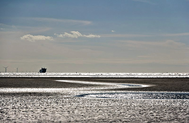 Formby Beach
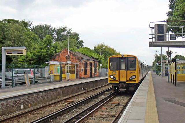 Freshfield Railway Station
The route begins by heading Inland to Freshfield and past Freshfield Railway Station before leaving the habitation in search of unusual plants in a conifer woodland where it follows the Woodlands Walk Trail. During late spring and early summer, various species of helleborine (orchid) can be found growing in the shade of the Scots, Corsican and Austrian Pines, while late autumn brings out the fungi; waxcaps, russulas and earthstars are reasonably plentiful.
Fortunately for the wildlife - and for walkers - the trees are well spaced, letting sunlight penetrate to the woodland floor. This encourages the flora and contributes to a pleasant, airy atmosphere, very different from the dank gloom typically associated with conifer plantations.
Dobson's Ride bridleway returns you from this unusual woodland onto the start of the aptly named Fisherman's Path, originally trodden by anglers on bait digging trips. On the right of the path is an excellent illustration of the different vegetation to be seen in the gradual transition from a beach to a soil based environment.
First in among the alien conifers is a thick growth of silver birch, alder, and sycamore. These trees could not grow on the sandhills, but rely on the soil laid down by the next zone of vegetation. Creeping willow, dewberry and various coarse grasses, thrive on the fixed dunes. Their mat-like roots help lock the sand in place. When their leaves die, they rot down to provide the rich humus vital to the advancing deciduous trees.
Closer to the sea, marram grass, planted to stabilise the shifting sands of these mobile dunes is about the only plant able to survive. Its roots go deep and can resist the winds that sweep away the sand. In very blowy conditions, a plume of sand trails from the crests of the dunes to be caught and held from the fixed dunes further inland. In between the dunes, boggy pools and areas of fresh water form. These wet slacks are vitally important environments, providing a habitat for many plants, including pyramidal and bee orchids.
Here, too, live Natterjack toads, jocularly known as Lancashire nightingales, from their singing on muggy spring nights. Their high pitched voices create a frenzied cacophony as a passionate males to try to attract mates. Natterjack toads have occupied these slacks for centuries and are found almost nowhere else in Britain. They are strictly protected by law.
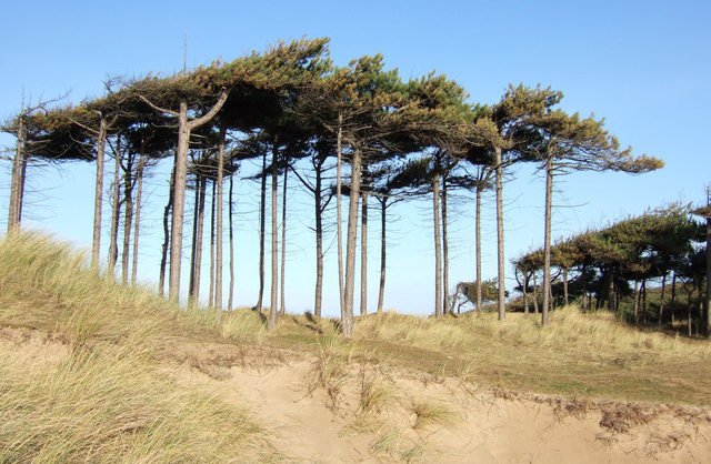 Formby Hills
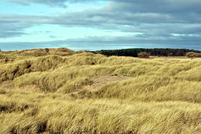 Grassy sand dunes at Raven Meols
As you step out of the shelter of the towering dunes onto the usually deserted foreshore, you will probably feel the force responsible for sculpting them. A stiff breeze rushes in off the Irish Sea on most days, whipping the dry sand into snakes that coil on your feet. If the tide is out, the sea is no more than a thin silver line on the horizon, but at high tide, the feet of the dunes are washed and licked by the waves.
Just as the trees attempt to colonize the dunes, so the woods have in several places along the shore been overcome by the sea and sand; Gypsy Wood is an example of this. As you approach. Formby Point, look out for dark bands of humus, potent reminders of fixed dunes that existed when the zone of mobile dune's was on land now permanently below the sea.
Behind you, you may be able to pick out Blackpool Tower across the Ribble Estuary with the Cumbrian mountains behind. In the last century, local landowners tried to stabilise the dunes enough to allow a resort on the same scale as Blackpool to be developed at Formby, but the elements proved too powerful. If the horizon is clear and the sky bright, the peaks of Snowdonia will be clearly visible across the sea and the Isle of Anglesey clearly outlined ahead and to the right.
The Beach Walk leads eventually to the foundations of Britain's first Lifeboat house built in 1776. The boat served the local coastline until 1918, when the sands swept over the area and a team of horses was needed to drag the lifeboat to sea on wooden rollers.
At the top of Lifeboat Road, Saint Luke's Church stands defiantly on the site previously occupied by a 12th century. chapel that was totally buried by the sands. Some artifacts recovered from it are now housed in the new 'little church of the sandhills'. These include a Norman font, numerous tombstones and memorial tablets, including one to Richard Formby - an armour bearer to Henry IV - whose family gave their name to the town.
In the graveyard are the old village stocks and the 'godstone' which held the market square cross before it fell into disrepair. The cross was made of wood sheathed in lead, and held a pool of vinegar in which residents left coins in return for goods in times of plague. The vinegar was believed to make the money safe to handle.
The path leads back to the start through asparagus beds reclaimed from the sandy landscape. Several huge beds of nettles nearby mark old tobacco leaf dumps, relics of the trade for America to nearby Liverpool. Another import from the Americas, the potato was grown here for the first time in Britain.
Incidentally, if you spot a lovely furry animal on the walk, do not be surprised. Formby is within the North Merseyside and West Lancashire Red Squirrel Stronghold, one of a few refuges left for red squirrels across the UK. Anytime you walk through the woodland areas you are likely to see a red squirrel.
Acknowledgments: Text derived from the Out and Out Series; Discovering the Countryside on Foot. Pictures courtesy of Wikipedia.


