Housesteads Fort and Hadrian's Wall
Exploring rugged Northumberland around Housesteads Fort and Hadrian's Wall
Google Maps Open Source Maps| Statistics and Files | ||
|---|---|---|
| Start: Housesteads Fort | Distance: 5.8 miles (9.3 km) | Climbing: 253 metres |
| Grid Ref: NY 79378 68421 | Time: 3 hours | Rating: Moderate |
| GPX Route File | Google Earth File | About Hadrian's Wall |
| Statistics | |
|---|---|
| Start: Housesteads Fort | Distance: 5.8 miles (9.3 km) |
| Climbing: 253 metres | Grid Ref: NY 79378 68421 |
| Time: 3 hours | Rating: Moderate |
| GPX Route File | Google Earth File |
Ordnance Survey Explorer Map (1:25,000)
The Walk:
An ancient frontier of the Roman Empire, Hadrian's Wall, although man-made, still has the atmosphere of a natural barrier. The craggy ridge it is built on divides the empty pastures north of the wall from the gentler country to the south. This walk explores Housesteads Fort and Hadrian's Wall, one of Europe's finest archaeological sites. It also gives a taste of the wide open spaces of Northumberland, the most sparsely populated county in England, and one of the most beautiful.
As the route passes through spacious pastureland, there are some superb views of distant scattered farmhouses, loughs (lakes) and moors, leading to the edge of huge forests which run to the modern boundary with Scotland. The final section of the walk follows one of the best preserved sections of the wall which offers magnificent views in all directions, before returning to Housesteads Fort.
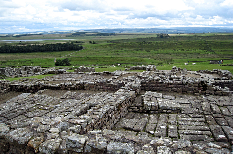 Housesteads Fort
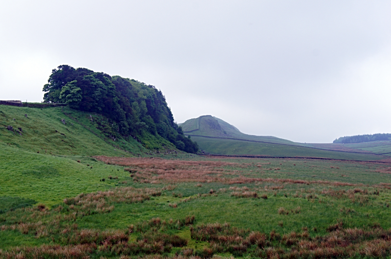 Cuddy's Crags
Along Hadrian's Wall, Roman forts housed the defending garrisons. The great fort of Housesteads (Borcovicium) is grandly situated on the vast rocky ridge known as Great Whin Sill, and is probably the best known. The site, covering 5 acres (2 hectares) has been well excavated and contains the remains of the barracks, the Commanding Officer's house, the granaries, the latrines and the only remains of a Roman hospital in Britain.
The Great Whin Sill is one of the best known geological features of northern England. This scarp extends from the north Northumberland coast to the south-west of the county. 'Whin' is a local term for basalt or dolerite rock, and the Whin Sill, as it is called, is particularly dramatic along the central section of Hadrian's Wall.
The ascent of Sewingshields Crags leads on to the triangulation point - one of the highest points of the Whin Sill, at 1,066 feet (325 metres) above sea level. This is well worth reaching as the views of the wall stretching in either direction, and of Broomlee Lough below are superb. The highest point is a little further on and is unmistakable to a walker who is approaching from the direction of King's Wicket.
Over the wall from King's Wicket the northern horizon is dominated by large tracts of coniferous forest planted by the Forestry Commission to supply sawmills and pulpmills. In summer, the pastures are a mass of buttercups, thistles and grasses, grazed by hardy breeds of sheep and cattle. The air is full of birdsong - meadow pipit, skylark, curlew, lapwing, rook and jackdaw. The beautiful curlew, with its haunting cry, is the symbol of Northumberland National Park. Here there is a feeling of great space, with distant horizons and a huge sky arching overhead - typical features of the Northumberland landscape.
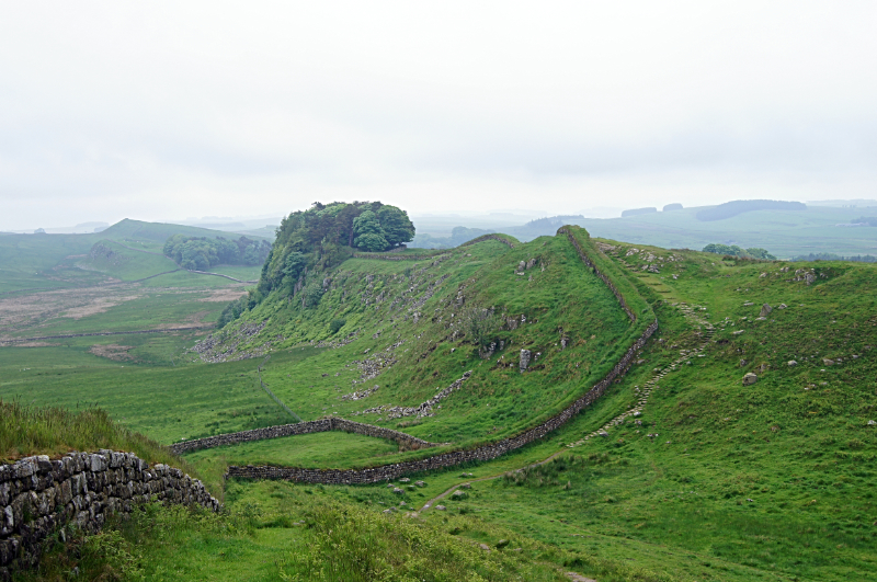 Hadrian's Wall
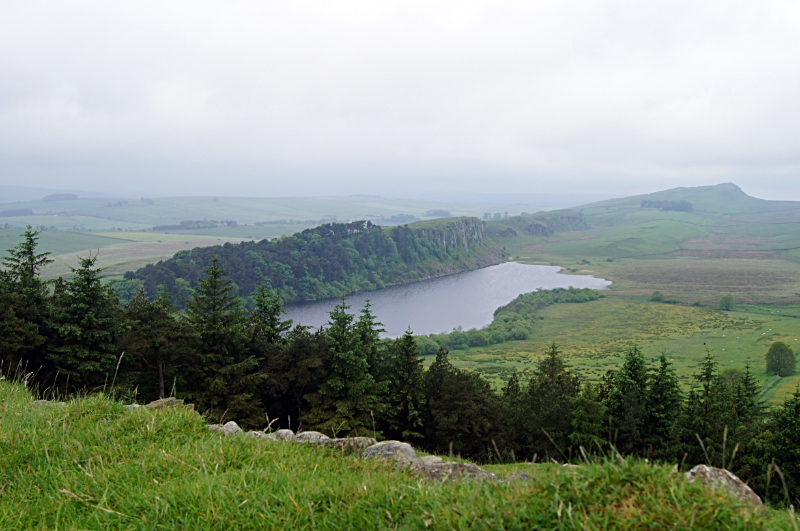 View to Crag Lough from Hotbank Crags
The path heads west, near the south side of Broomlee Lough and passes a disused limekiln, built on a limestone outcrop. During the early 19th century, limestone was quarried nearby and alternative layers of coal and limestone were fed into the kilns from above. Quicklime was drawn out from below and spread on the pastures to improve the quality of the grazing for sheep.
Approaching Hotbank Farm there are excellent views of Crag Lough. Like all the lakes in this area, it was formed out by glaciers carving out softer rocks. The rich vegetation here makes it important for waterfowl and other birds.
Hotbank Farm is a typical example of a Northumbrian hill farm, with its sturdy stone buildings grouped together around a yard, with steeply pitched slate roofs to allow winter snow to slide off easily. From the top of Hotbank Crags there is a small plantation of Scot's pine, Sitka spruce, oak, ash, birch and beech. Plantations such as this are established as shelter belts for hill pastures and farms.
On a clear day, the views stretch as far as the Lake District mountains to the south-west, the Pennines to the south, and the Cheviots far to the north-east. It is also the only place on the wall where the three waters of Crag Lough, Greenlee Lough and Broomlee Lough are all visible. From here, the path follows the wall along the airy crest of the Whin Sill to the fine viewpoint of Cuddy's Crags. After passing Housesteads Crags and passing through a shady wood the path soon returns to Housesteads Fort.
Acknowledgments: Text derived from the Out and Out Series; Discovering the Countryside on Foot. Pictures courtesy of Wikipedia.


