Craster, Embleton Bay and Dunstanburgh Castle
From a fishing village to a ruined castle on the Northumberland coast
Google Maps Open Source Maps| Statistics and Files | ||
|---|---|---|
| Start: Craster | Distance: 4.5 miles (7.2 km) | Climbing: 110 metres |
| Grid Ref: NU 25596 19854 | Time: 2-3 hours | Rating: Easy |
| GPX Route File | Google Earth File | About Craster |
| Statistics | |
|---|---|
| Start: Craster | Distance: 4.5 miles (7.2 km) |
| Climbing: 110 metres | Grid Ref: NU 25596 19854 |
| Time: 2-3 hours | Rating: Easy |
| GPX Route File | Google Earth File |
Ordnance Survey Explorer Map (1:25,000)
The Walk: Over a century ago, around the end of the 1800's, there were 27 traditional fishing boats or cobles in Craster's fishing fleet. Although there are now only a handful, they still venture out for lobster and herring. Lobster pots are a familiar sight along the harbour wall, built in 1906 in memory of a member of the Craster family the village is named after. Kippers are a Craster specialty. Visitors can look into the smoking sheds, where the herring are hung above smouldering oak chips. Local salmon is also smoked here.
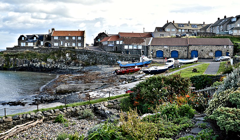 Craster
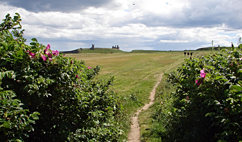 Walking from Embleton Bay to Dunstanburgh
Along the coast are the ruins of Dunstanburgh Castle. It was built on the instruction of Thomas, 2nd Earl of Lancaster in 1313, but he was executed a few years later. John of Gaunt prepared the castle for the Border Wars, and built another gateway in 1380. During the Wars of the Roses, the castle was a Lancastrian stronghold. But from the mid-1400's, it was redundant and was, in total, used for only 140 years. Now all that is left are the dramatic ruins and a number of ghostly legends.
An old whinstone quarry is now Craster's car park and the starting point of the walk. At the top end of the car park, the quarry face is now the home to gulls. Thew first part of the walk passes the Heughs, a line of gorse covered whinstone hills on the seaward side, and cornfields inland.
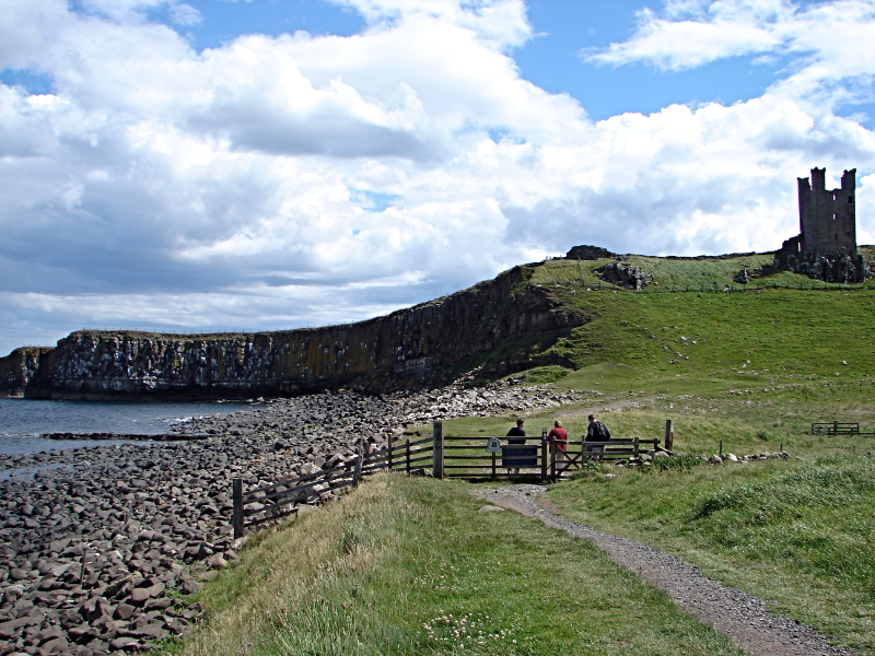 Rumble Churn and Dunstanburgh Castle
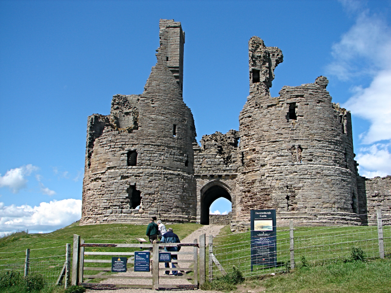 The entrance to Dunstanburgh Castle
After Dunstan Square Farm, the route is along a quiet, open lane between the cornfields. On the left, just after a pine plantation, and looking curiously out of place, is a World War II pillbox, a gun emplacement made from concrete filled sandbags. From the lane, there are tantalising glimpses of the sea at Embleton Bay, and the towers of Dunstanburgh Castle.
The route passes through the farmyard of Dunstan Steads Farm and afterwards a lane leads to the extensive sand dunes behind Embleton Bay. This is a conservation area owned by the National Trust. In summer, bloody cranesbill can be spotted, and the scrambling thorn bushes of burnet rose. The long, sandy beach of Embleton Bay marks the halfway point of the walk and the ideal spot for a picnic if conditions are right.
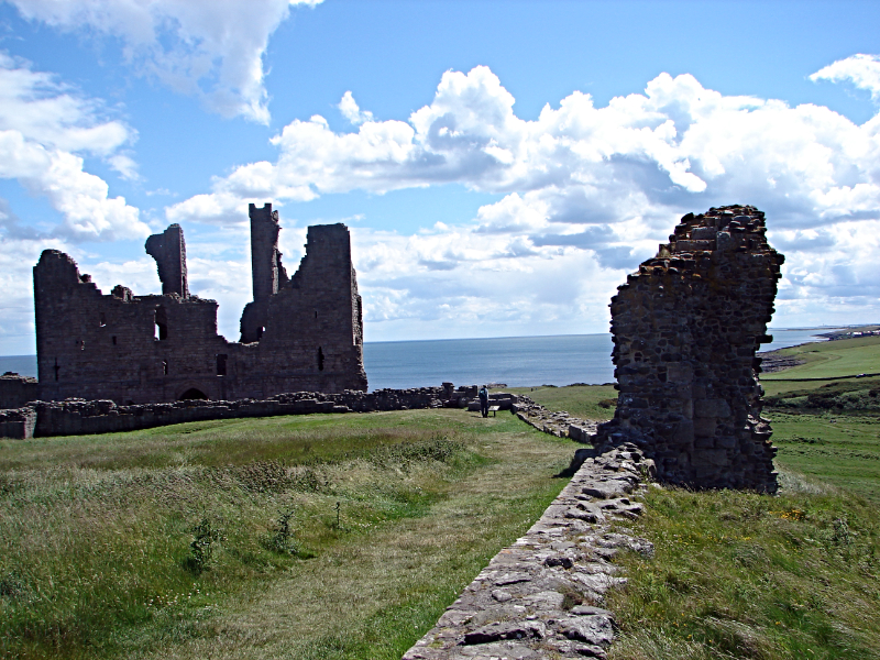 In the grounds of Dunstanburgh Castle
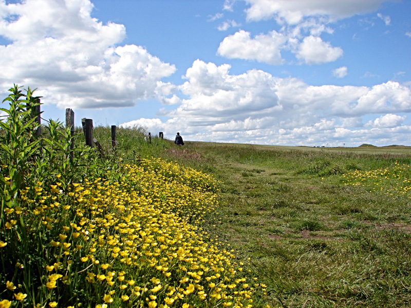 Colourful coastal path back to Craster
At the end of the beach, the sand gives way to rounded boulders of grey dolerite Here, the coastal path passes Greymare Rock, a distinct saddle shaped lump of limestone. Next to Greymare Rock is Rumble Churn, aptly name as the sound of crashing waves below Dunstanburgh Castle rumble in the natural amphitheatre.
As well as the rumble of the waves and the sea, the shrieks of hundreds of sea birds fills the air. They cover the face of Gull Crag below the castle. There are kittiwakes, fulmars, guillemots and shags. Sometimes puffins too. The top half of Gull Crag is dolerite, and below there is sandstone and shale. After the drama of the scene, the walk climbs past the east edge of Dunstanburgh Castle which can be visited. Afterwards, it is a lovely stroll along the coastal path southwards back to Craster.
See my extended walk of Craster and Dunstanburgh Castle, including the village of Embleton..
Acknowledgments: Text derived from the Out and Out Series; Discovering the Countryside on Foot. Pictures courtesy of Wikipedia.


