Harbottle, Drake Stone, Harbottle Lake and Low Alwinton
Woodlands, moors and a river valley on the edge of a National Park
Google Maps Open Source Maps| Statistics and Files | ||
|---|---|---|
| Start: NWT Car Park | Distance: 4.0 miles (6.5 km) | Climbing: 234 metres |
| Grid Ref: NT 92630 04882 | Time: 2 hours | Rating: Easy |
| GPX Route File | Google Earth File | About Harbottle |
| Statistics | |
|---|---|
| Start: NWT Car Park | Distance: 4.0 miles (6.5 km) |
| Climbing: 234 metres | Grid Ref: NT 92630 04882 |
| Time: 2 hours | Rating: Easy |
| GPX Route File | Google Earth File |
Ordnance Survey Explorer Map (1:25,000)
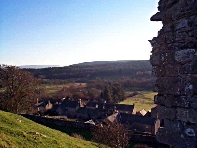
The Walk: The attractive village of Harbottle sits in a sparsely populated area on the edge of the Northumberland National Park. To the north and west are the mountain steams and pine forests of the isolated Cheviot Hills, and to the east is an exquisite pastoral landscape of rolling hills and deep meadows. The village is built of local sandstone and is surrounded by fields and old trees. It is overlooked by a ruined castle, and the beautiful River Coquet flows nearby. High moors with craggy outcrops dominate the skyline.
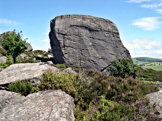 The Drake Stone
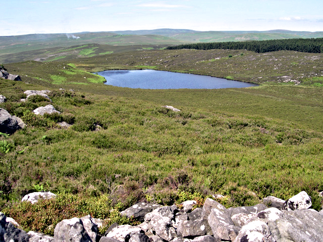 Harbottle Lake
The walk starts from a car park just a little north-west of the village, where there is a Northumberland Wildlife Trust Information Centre. A track leads up the hill through the trees to the open moorland of Harbottle Crags Nature Reserve, which covers 160 acres. The hillside is covered by a mixture of heather and bracken, along with patches of bilberry, sweet gale (bog myrtle) and tormentil.
In summer, you may hear the song of the willow warbler as you climb towards Drake Stone on the horizon. A few silver birches grow beside the path, and new seedlings are allowed to take root now that the reserve is no longer grazed by sheep. There are also a few boggy areas where sphagnum and hair moss flourish, along with cotton grass and sundew, whose sticky leaves trap and digest insects. Wheatears and grouse are often seen amongst the rocks.
Drake Stone is named from the Anglo-Saxon name for 'dragon' and is the county's largest isolated boulder. The broad ridge of Fell Sandstone it stands on was laid down 280 million years ago in an ancient estuary. Layers within the blocks show how irregularly the sand was deposited in piles on the sea floor, a feature known as cross-bedding.
The rock around Drake Stone was scoured away by glaciers in the last Ice Age. Lines called 'striae' gouged into the rock by the ice, are still visible. Millstones were cut from the hard rocks here and taken downhill on horse drawn sledges.
The views, which are magnificent, span the Cheviot Hills, the Coquet Valley east to Rothbury, the Alnwick Moors and the Simonside Hills. Harbottle village is very clearly visible in the valley beneath you.
Beyond Drake Stone is Harbottle Lake, with its swampy fringe of rushes and sedges. The route follows the edge of the lake, then turns right and through a forest to join a track on the far side, leading to the Harbottle to Alwinton road. Turning north, the road soon crosses the River Coquet, where otters are present but rarely seen.
 Harbottle
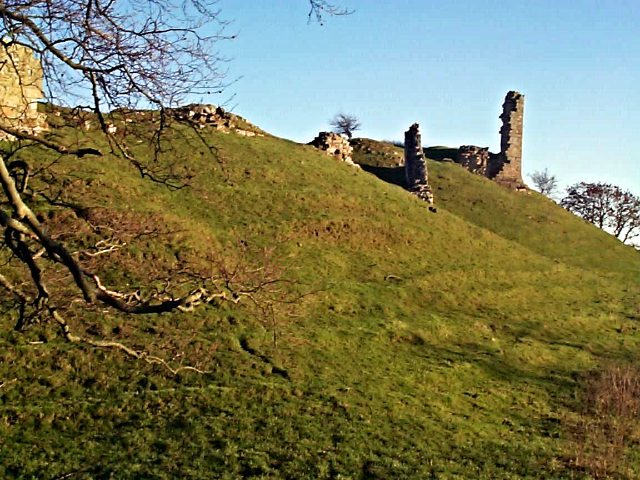 Harbottle Castle
At Low Alwinton the route follows a narrow road past a fine limekiln and up to Park House. Cutting on a path north from the track on a path before reaching Park House here will lead to the beautiful St Michael and All Angels Church. If you do, track back once you have enjoyed the church visit. After passing Park House, a rough track across pasture land yields fine views across to the Harbottle Hills and Drake Stone. After descending through woodland, the route follows the banks of the Coquet to a footbridge, and you cross the river to the present Harbottle Castle, built in 1829.
From here, you walk through Harbottle, which consists of a single street lined with neat cottages that mostly date from the early 19th century. The village, whose historic name 'Hir Botle' meant Army Station, originated in Saxon times, and was occupied by the Umfreville barons after the Norman Conquest. Henry II built a stone castle on the site of the original Norman fortification, following the transference of Northumberland from Scotland to England in 1159.
Acknowledgments: Text derived from the Out and Out Series; Discovering the Countryside on Foot. Pictures courtesy of Wikipedia.


