Elsdon and the Mote Hills
A village on the Scottish borders, with a violent past
Google Maps Open Source Maps| Statistics and Files | ||
|---|---|---|
| Start: Elsdon | Distance: 3.4 miles (5.5 km) | Climbing: 111 metres |
| Grid Ref: NY 93575 93204 | Time: 2 hours | Rating: Easy |
| GPX Route File | Google Earth File | About Elsdon |
| Statistics | |
|---|---|
| Start: Elsdon | Distance: 3.4 miles (5.5 km) |
| Climbing: 111 metres | Grid Ref: NY 93575 93204 |
| Time: 2 hours | Rating: Easy |
| GPX Route File | Google Earth File |
Ordnance Survey Explorer Map (1:25,000)
The Walk: It is hard to believe that the small village of Elsdon, with its Georgian cottages surrounding the village green, was once the capital of Redesdale. Situated close to the Scottish border, this remote area was far from any centre of civilisation, even by pre-industrial standards. It was terrorised by the Border Reivers, gangs of cattle and horse rustlers whose feuding and raiding gave the area a legendary lawlessness. It was also in the front line of more official land ownership disputes between England and Scotland. The village shows much evidence of this turbulent past.
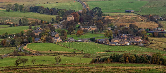 Elsdon
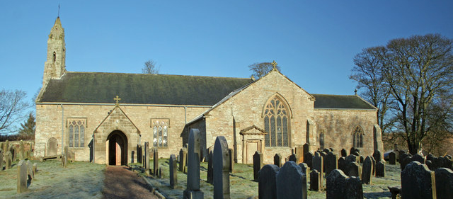 St Cuthbert's Church
The plan of the village, with the cottages facing inwards to the square village green, made for efficient defence. The Parish Church of St Cuthbert was placed within this perimeter. Built in the 14th century, it is typically Northumbrian: squat and strong with an elaborate bellcote rather than a true tower. It was to this church that the Scottish dead were brought for burial after the Battle of Otterburn in 1388.
On the northern edge of the village, just beyond the church, stands Elsdon Tower. Built around 1400, it is one of the county's best examples of a Pele Tower. These strong, stone built tower houses, with relatively small windows set in thick walls topped by battlements, were built as defensible residences by many of the local gentry during the troubled centuries before the Acts of Union. Many were inhabited by the clergy, including this one, which was used as the rectory until 1962.
The walk leads beyond the village to the top of a quiet farm track, where there are two impressive mounds known as the Mote Hills. These are all that remain of Elsdon Castle, a Norman made motte and bailey castle built by the d'Umfreville family shortly after the Norman Conquest.
After making the loop around the fields above the village, the route returns to the bottom edge of the village green, where there is an old, stone cattle pen. With walls five feet high, and only one narrow opening, it doubtless made a useful defence against sneak thieves trying to rustle a herd of cattle quickly and quietly into the dead of night.
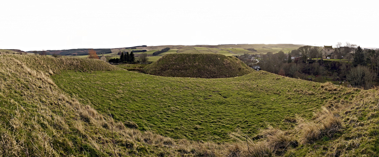 Elsdon Castle
Leaving the village again, this time on the road going south, the walk passes over a small but elegant double arched stone bridge before climbing a hill to a viewpoint that gives a fine perspective of the varied landscape. Elsdon stands close to where craggy sandstone topography to the north gives way to the gentler limestone belt running south. Here there is a hilly but tame moorland, with rough grazing on tussocky grass in the valley bottoms and heather clad tops. Wild rabbits abound, and the plaintive call of the curlew, the symbol of the Northumberland National Park, can sometimes be heard overhead.
From here, you follow a farm track past an old sheep wash at Shaw Cleugh, then head downhill and follow surfaced roads back into the village and your starting point.
Acknowledgments: Text derived from the Out and Out Series; Discovering the Countryside on Foot. Pictures courtesy of Wikipedia.


