The Simonside Hills Walk
A dramatic hike through the remote Simonside Hills in Northumberland
Google Maps Open Source Maps| Statistics and Files | ||
|---|---|---|
| Start: Car Park | Distance: 9.0 miles (14.5 km) | Climbing: 483 metres |
| Grid Ref: NZ 03694 99644 | Time: 4 hours | Rating: Hard |
| GPX Route File | Google Earth File | About the Simonside Hills |
| Statistics | |
|---|---|
| Start: Car Park | Distance: 9.0 miles (14.5 km) |
| Climbing: 483 metres | Grid Ref: NZ 03694 99644 |
| Time: 4 hours | Rating: Hard |
| GPX Route File | Google Earth File |
Ordnance Survey Explorer Map (1:25,000)
The Walk: To the south of the Coquet Valley is a small but dramatic upland area, the Simonside Hills. It is one of several small ranges formed from an arc of fell sandstone sandwiched between the Cheviot Hills and the limestone lowlands. This rock is noted for producing dramatic crags and heather moorland. It is also well suited to the cultivation of conifer plantations. Except for plantation activity, the area has escaped human influence for many centuries. As a result, it contains some precious prehistoric remains.
 Thompson's Rock on The Beacon
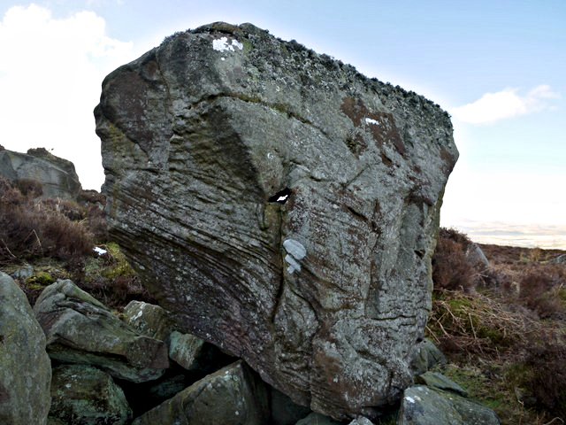
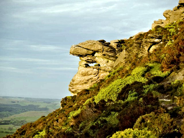 Outcrop on Tosson Hill
Starting from a remote forest car park, the walk sets out along a quiet moorland road to visit the Lordenshaw Iron Age Hill Fort. Surrounding the ditched mound are signs of an even earlier civilisation. A number of Bronze Age cairns can be seen, and there are cup and ring marks, saucer shaped depressions surrounded by circles, on the rocks. Although they are fairly common in Northumberland, no one is quite sure of the significance of these marks, which are also associated with the Beaker people of the Bronze Age, though they are believed to have some religious significance. The mounds and ditches of the hill fort are clear enough, but the cairns and cup and ring marked stones are less so. You should enjoy searching for them.
The walk begins its ascent to Simonside on a clear path through heather and gorse outcrops. Grouse are ever present here and it is not uncommon for one to rise from the thick heather close to you, spooking bird and you alike. The climb continues, following the top of the north facing escarpment, with superb views northwards over woodland to the Coquet Valley beyond. There are also good views eastwards, even to the Northumberland coast and the sea on a clear day. The route leads to fine rock formations on the Beacon, the highlight being Thompson's Rock, also known as Simonside Beacon Hill Solar Observatory. This is because a hole has been made through the rock which is believed to have been made for early times celestial observations. Dove Crag is another interesting rock outcrop on the Beacon.
The next highpoint of the walk after the Beacon is the summit of Simonside. The top of the hill provides an opportunity to take in magnificent views to the north-west over miles of Northumbrian landscape stretching to the Cheviot Hills which straddle England and Scotland.
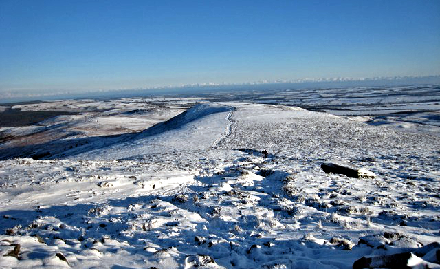 Simonside Hills in winter snow
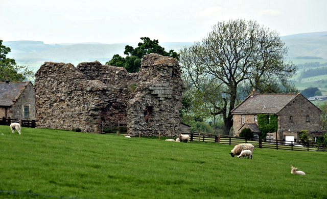 Great Tosson Tower
Next up, after a brief dip down to Bob Pyle's Studdie, is a continuous climb of seventy metres to Tosson Hill, the highest point of the Simonside Hills, appropriately marked with an Ordnance Survey triangulation pillar. Here, the views are at their best on the entire walk, a sumptuous 360 degree panorama. Once the feast to the eyes is enjoyed, backtrack to Bob Pyle's Studdie before heading down from the hill tops through plantation to the hamlet of Great Tosson. Oh, if you are distracted by sounds of small animals in amongst the trees, take heed and look carefully. You may be being watched by a red squirrel.
The highlight of the hamlet at the foot of the woodlands is Great Tosson Tower, the remains of a Peel Tower which has been reduced to ruins by the scavenging of its stone for more modern building works. Still, you can appreciate the scale of the original building as the evidence of eight feet thick walls show. From the tower the walk concludes with a stroll along the quiet country road back to the start. While strolling, listen out for woodland finches, crossbill and even the tiny goldcrest. All are resident here.
Acknowledgments: Text derived from the Out and Out Series; Discovering the Countryside on Foot. Pictures courtesy of Wikipedia.


