Ulverston, Ulverston Sands, Bardsea and Birkrigg Common
The fascinating history, natural landscape and wildlife of a corner of Furness
Google Maps Open Source Maps| Statistics and Files | ||
|---|---|---|
| Start: Market Street | Distance: 10.0 miles (16.0 km) | Climbing: 183 metres |
| Grid Ref: SD 28812 78356 | Time: 4-5 hours | Rating: Moderate |
| GPX Route File | Google Earth File | About Ulverston |
| Statistics | |
|---|---|
| Start: Market Street | Distance: 10.0 miles (16.0 km) |
| Climbing: 183 metres | Grid Ref: SD 28812 78356 |
| Time: 4-5 hours | Rating: Moderate |
| GPX Route File | Google Earth File |
Ordnance Survey Explorer Map (1:25,000)
The Walk: Ulverston is a lively market town just inland from an inlet of Morecambe Bay. This circular walk explores its history, in the form of a Bronze Age stone circle, several associations with the early days of the Quakers, and a rich industrial past. You pass through a variety of wild habitats: an abandoned canal; a quiet estuary where sandbanks are home to may wading birds; and a high limestone common where there is rich flora.
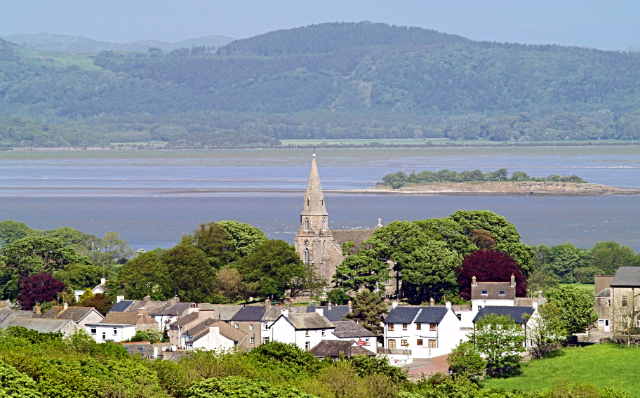
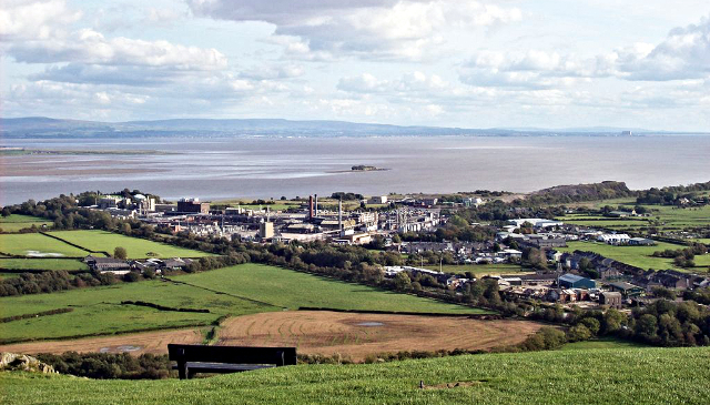 Ulverston and Morecambe Bay
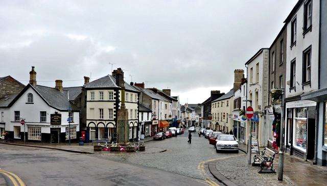 Market Street, Ulverston
Soon after the start in the town centre, the route continues with a stroll along the willow lined Ulverston Canal, a lovely stretch of water linking the town with the estuary. It was opened in 1796 to bring boats carrying coal, slate, copper, gunpowder and general wares to and from the factories that are now hidden by the vegetation on the far side of the cut.
At the other end of the canal - at just over 1.5 miles it is the shortest in England - are the remains of wooden lock gates. This entrance was finally sealed in 1948 by a wall of concrete, and today the only traffic on the canal consists of ducks, coots, moorhens, gulls and swans. It had been in decline since 1846, when the Furness Railway was opened. From here, there is a good view northwards to the Leven Viaduct, which carries the railway across the waters of the estuary.
The walk continues past the huge pharmaceutical factory of Glaxo Smith Kline, crossing Dragley Beck and continuing due south on the Cumbria Coastal Way, leading to another sign of Ulverston's industrial past; a slag bank, which is now covered with vegetation. To the left, a dismantled railway track is now a grassy highway, Brick Kiln Road, while to the right is all that remains of Ulverston's brickworks - a tall chimney built of red bricks, banded with yellow, which stands alone, forlorn but magnificent.
Ahead, through the trees, is Conishead Priory, a house built on the site of a monastic foundation dissolved by Henry VIII. It was the home of the Braddyll family from the mid 17th century, but has now reverted to religious purposes as a Buddhist centre. On the hill to the right is a hermitage, built by Colonel Braddyll in 1836 to house a hermit, whom he paid to live there.
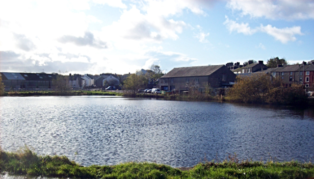 Ulverston Canal
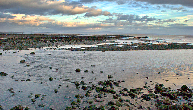 Cowp Scar Mussel Bed
Across the water from the pebbly beach of the estuary is Chapel Island, whose few trees frame a Romantic ruin, another folly commissioned by Colonel Braddyll, and built by Conishead's monks using stones from an actual disused chapel.
The shore path skirts the priory woodland, where willow warblers sing in spring. When the tide goes out, rocks and mussel beds are uncovered, and oystercatchers, curlews, dunlins, redshanks and eider ducks feed here and on the newly exposed sands.
The route heads inland to the village of Bardsea. The splendid church in the village was built on land obtained at auction in 1848 when Colonel Braddyll went bankrupt - perhaps owing to an over indulgence of architectural conceits. The focus of the village moved uphill around the church. In earlier times, when the village was more vulnerable to attack from the sea, its houses were huddled behind a hill.
 Bardsea and Chapel Island
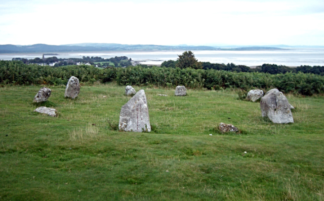 Druid's Circle on Birkrigg Common
From Bardsea, you climb steadily to Birkrigg Common, from which there are fine views over Bardsea and the estuary. Grassy tracks through the bracken lead you to a Bronze Age henge consisting of ten standing stones, a hamlet that was part of Bardsea Manor until about 1586. Lower Sunbrick Farm and Lower Sunbrick Cottage are dated 1655 and 1672 respectively. Just beyond the settlement, you pass a walled enclosure containing a small Quaker burial ground, the last resting place of Margaret, wife of George Fox, the founder of the Society of Friends (Quakers).
From the top of Birkrigg Common, the walk continues across country and through a housing estate to Swarthmoor Hall. This substantial three storeyed stone building was built by Judge Thomas Fell, the first husband of Margaret Fox. Close by, in Meeting Hall Lane, is a 17th century Quaker Meeting House.
From here, a footpath leads over Levy Beck and back into Ulverston. In the centre of the roundabout, close to the car park where the walk began, is a large stone. This was once used for communal clothes washing and as a podium for auctioneers selling sheep.
Acknowledgments: Text derived from the Out and Out Series; Discovering the Countryside on Foot. Pictures courtesy of Wikipedia.


