Stainforth, Stackhouse and Stainforth Force
Through the Ribble valley to Stainforth Bridge
Google Maps Open Source Maps| Statistics and Files | ||
|---|---|---|
| Start: Stainforth | Distance: 3.8 miles (6.2 km) | Climbing: 116 metres |
| Grid Ref: SD 82139 67364 | Time: 2 hours | Rating: Easy |
| GPX Route File | Google Earth File | About Stainforth |
| Statistics | |
|---|---|
| Start: Stainforth | Distance: 3.8 miles (6.2 km) |
| Climbing: 116 metres | Grid Ref: SD 82139 67364 |
| Time: 2 hours | Rating: Easy |
| GPX Route File | Google Earth File |
Ordnance Survey Explorer Map (1:25,000)
The Walk: Much of this walk is through the gently sloping valley of Upper Ribblesdale and takes in the beautiful riverside scenery along the River Ribble. Trout surface from deep pools in a river bed and at Stainforth Force the waters cascade over limestone steps. There is an abundance of bird life, including wagtails and busy dippers, which dive under water to search the river bed for food. Rarer breeds can also be spotted, such as herons and flycatchers. Kestrels hover above their hunting area and the call of skylarks, curlews and lapwings fill the air.
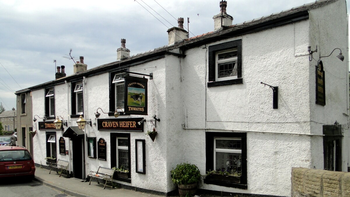 Craven Arms in the village of Stainforth
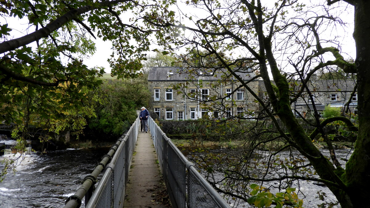 Footbridge over the River Ribble at Holmehead
Stainforth village, with its attractive 17th and 18th century stone cottages, is next to Little Stainforth, the twin settlement on the other side of the river. This little hamlet is known for its graceful bridge, which linked the two villages It was built by Samuel Watson, a Quaker, in 1675. The name Stainforth comes from the 'Stony Ford' which the packhorse bridge replaced. The river crossing was on a packhorse route between York and Lancaster, which was of major importance during monastic times. On the fell side above Stainforth, there are medieval cultivation strips, known locally as 'raines'.
Beneath the steep rocky face of Stainforth Scar, sheep grazed the fields. The main breed of the area is Dalesbred, Britain's hardiest breed. They are thought to have been bred by the monks of Fountains Abbey, founded in 1132. Remains of numerous 19th century lime kilns dot the area, and at Langcliffe Quarry there is a well preserved Hoffman lime kiln. This impressive structure was in use from 1873 to 1939 to produce a constant supply of lime which was used to fertilise the moors and improve grazing. There was a series of chambers in the oval shaped tunnel. The fire progressed slowly along the tunnel, firing each chamber in sequence.
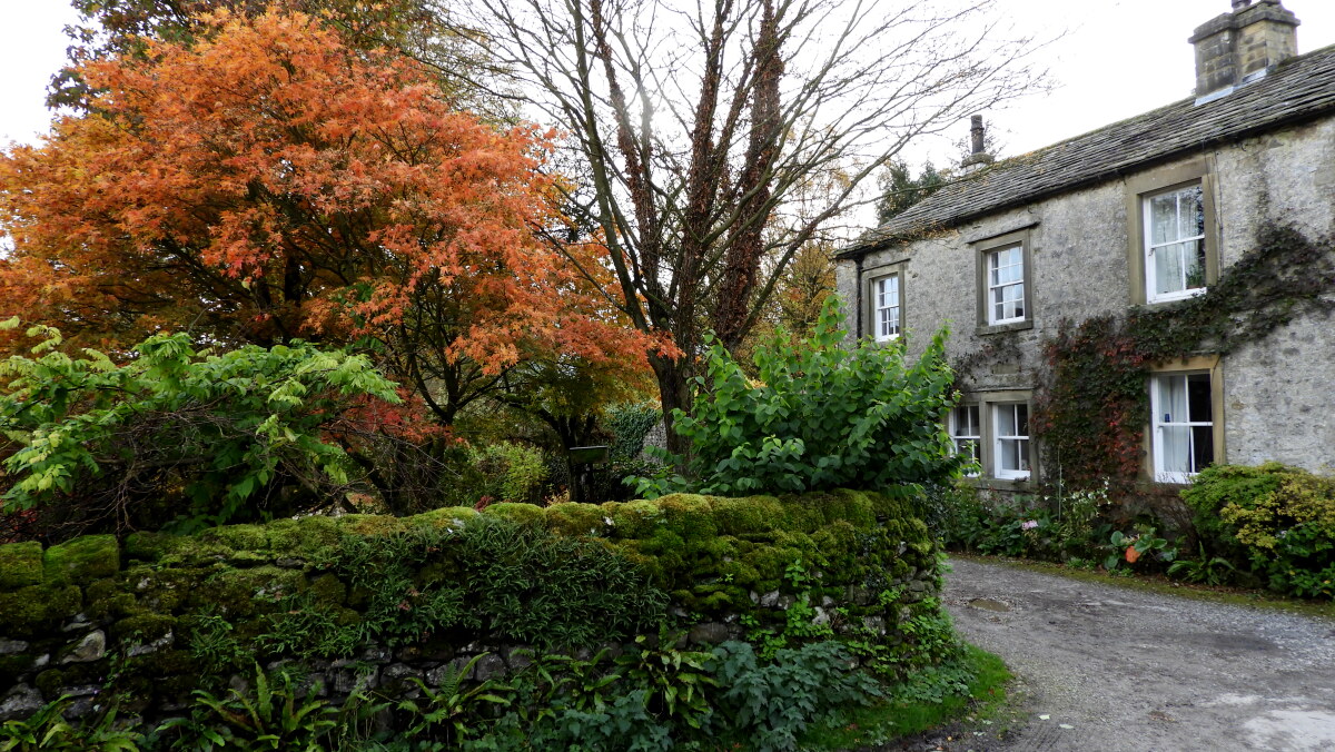 The hamlet of Stackhouse
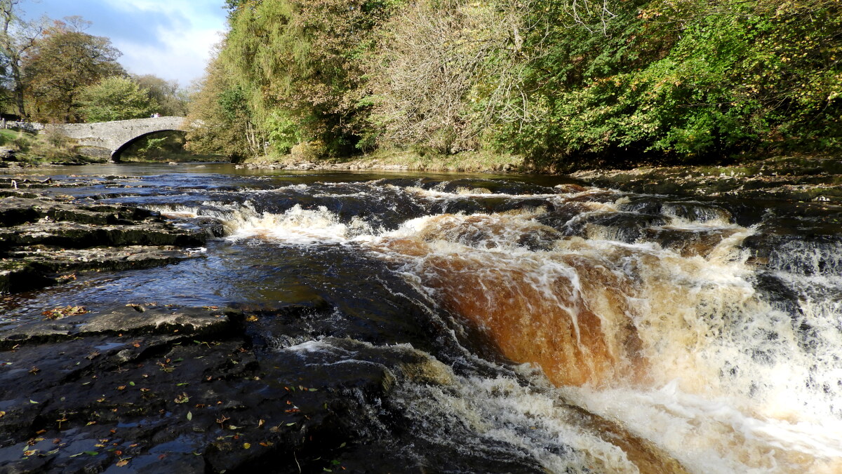 Stainforth Force
Halfway through the walk, after crossing the River Ribble by the Holmehead footbridge, lies the hamlet of Stackhouse. The hamlet is mentioned in the Domesday Book, as belonging to Roger de Poitu, though with no resident population. It still remains a tiny place today, just a series of houses set in a beautiful crescent just off the main road linking Little Stainforth with the market town of Settle.
A stretch of attractive woodland grows beside the River Ribble, containing fine specimens of beech, lime and sweet chestnut. Wild flowers abound; yellow ragwort, ox eye daisy, wild strawberry, clover and bird's foot trefoil can all be seen on the walk along the riverbank.
As well as trout, salmon can be found leaping at Stainforth Force during their breeding season. Shallow steps have now been built to bypass the weir at Holmehead, allowing the salmon access to make their way upstream to breed.
Acknowledgments: Text derived from the Out and Out Series; Discovering the Countryside on Foot. Pictures courtesy of Wikipedia.


