Richmond Castle and Easby Abbey
A medieval town, a forbidding castle and a ruined abbey
Google Maps Open Source Maps| Statistics and Files | ||
|---|---|---|
| Start: Richmond | Distance: 3.4 miles (5.5 km) | Climbing: 118 metres |
| Grid Ref: NZ 17138 00866 | Time: 2 hours | Rating: Easy |
| GPX Route File | Google Earth File | About Richmond |
| Statistics | |
|---|---|
| Start: Richmond | Distance: 3.4 miles (5.5 km) |
| Climbing: 118 metres | Grid Ref: NZ 17138 00866 |
| Time: 2 hours | Rating: Easy |
| GPX Route File | Google Earth File |
Ordnance Survey Explorer Map (1:25,000)
The Walk: The ruins of Richmond Castle and Easby Abbey are linked by riverside paths through woods and meadows. Both Castle and Abbey have a peaceful history. Despite the castle's forbidding appearance on a cliff, above the River Swale and commanding the entrance to Swaledale, it was never involved in war. It was founded in 1071 by Alan Rufus, one of William the Conqueror's followers.
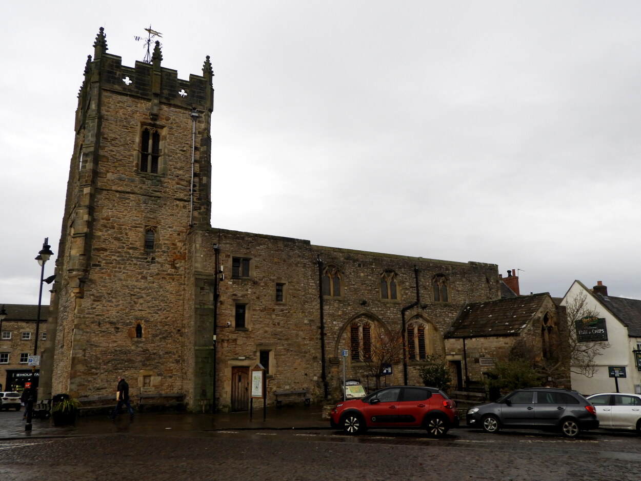 Richmond Market Square and Church
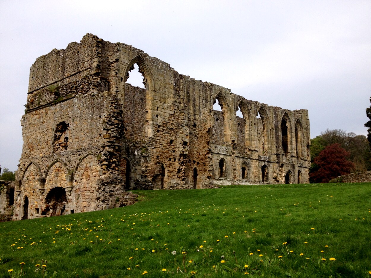 Easby Abbey
In the south-east corner of Richmond Castle is the two storied Scollond's Hall, which was built at the same time and is probably the oldest hall in England. After 1485, the castle belonged to the Crown, when Henry Tudor, Earl of Richmond became King Henry VII. The boundaries of the Market Place follow the line of the castle's outer bailey, from which medieval streets radiate. The walk starts here and passes the church that houses the Museum of the Green Howard's.
The River Swale begins at the height of over 2,000 feet on Birkdale Common as a moorland beck. It is fed by numerous small streams in Upper Swaledale, maturing as it passes through Keld, Reeth and Richmond, before entering the Vale of York. It continues through rich agricultural land to join the River Ure, and eventually enters the Humber and the North Sea.
Easby Abbey owns its existence to Roald, Constable of Richmond. He founded the monastery in 1151. The monk's wore white habits, and were known as the White Canons. As the endowments were increased, the monks were able to increase their numbers from 19 to 29. They led a tranquil existence in this quiet spot, although the peace was shattered by Scottish raids in the 14th century, Damage was also inflicted by English troops billeted here on their way to fight the Scots. A considerable amount of the ruins, however, remain today.
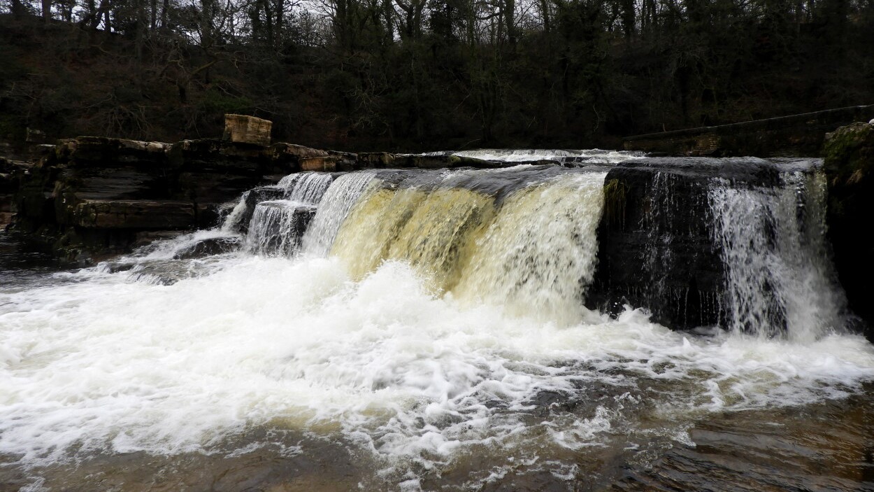 River Swale at Richmond
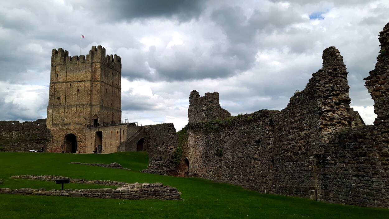 Richmond Castle
The parish church of St Agatha stands next to the abbey. It dates mainly from the 13th century, but the foundation of the church dates back further than the Abbey itself. Near the altar is a replica of the Easby Cross, a piece of Anglo-Saxon sculpture which dates him back to the 7th or 8th century. The original was found in two pieces in 1932, and it is now in the Victoria and Albert Museum in London. The discovery of the cross suggests that there was once an Anglo-Saxon church or monastery on the site. Another unusual feature is the detailed 13th century wall paintings which have survived the centuries.
The return route is over the old railway bridge and along the opposite river bank following the line of the former railway. There are fine views of the abbey in its riverside setting. Further on, there are dramatic prospects of the castle, perched high on a cliff above the river. After re-crossing river back to the town, the way to the market place is up the steep Cornforth Hill and through a gate in one of the sections of the medieval town walls.
Acknowledgments: Text derived from the Out and Out Series; Discovering the Countryside on Foot. Pictures courtesy of Wikipedia.


