Port Mulgrave and Runswick Bay
A cliff top walk along a heritage coast to a beautiful village
Google Maps Open Source Maps| Statistics and Files | ||
|---|---|---|
| Start: Port Mulgrave | Distance: 3.7 miles (6.0 km) | Climbing: 290 metres |
| Grid Ref: NZ 79586 17503 | Time: 2 hours | Rating: Moderate |
| GPX Route File | Google Earth File | About Port Mulgrave |
| Statistics | |
|---|---|
| Start: Port Mulgrave | Distance: 3.7 miles (6.0 km) |
| Climbing: 290 metres | Grid Ref: NZ 79586 17503 |
| Time: 2 hours | Rating: Moderate |
| GPX Route File | Google Earth File |
Ordnance Survey Explorer Map (1:25,000)
The Walk: In summer, the cliff tops near Port Mulgrave abound in wildflowers, butterflies and moths. At the stile near the start of the walk and along to the steep valley, there is a profusion of lime loving plants, including wood vetch - its lilac flowers cascading down the cliffs - zigzag clover, common spotted orchid, kidney vetch, salad burnet, rough hawkbit, hairy St John's wart, hoary ragwort and fairy flax.
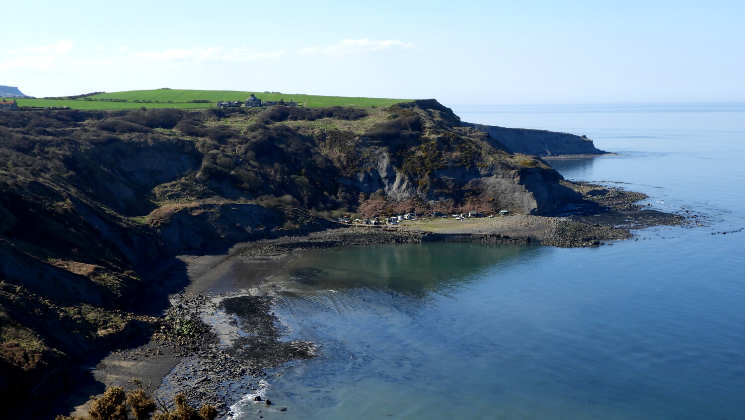 Port Mulgrave
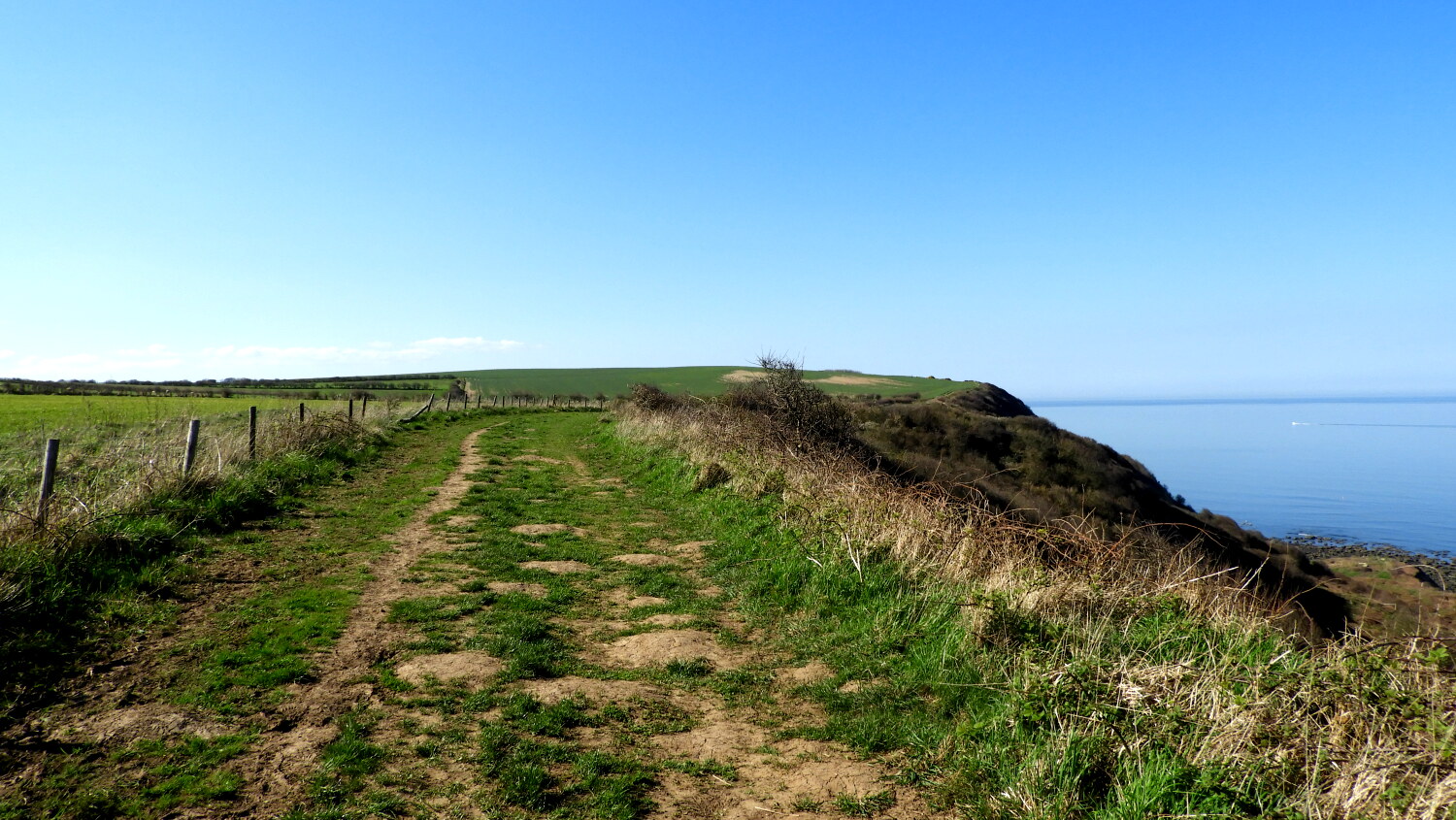 Yorkshire coast footpath
In many respects, Runswick Bay is reminiscent of the fishing villages of Devon and Cornwall. Palm trees flourish in many of the gardens, and plants such as mind-your-own-business and silver ragwort have escaped to grow wild around the village where there were cultivated. Another plant unusual in the north east is old man's beard, which grows by the wooden bridge over Lingrow Beck, and sweet scented wallflowers are a riot of colour up the cliffs in springtime.
One night in 1664, while most of the villagers were attending a wake, the village began to slide down the cliff. By the morning, all the houses had fallen into the sea, except that of the dead man. The original village was to the north of the present one. The track that leads into the village today is the old road, which was the only access to the place before 1962.
Originally each cottage had a stone outside it, 2.5 feet high, called a 'bink'. This was used for tasks such as washing clothes. Most have now disappeared, but there is still one outside the cottage called 'Ocean View'. The Methodist Chapel was built in 1829 by the women of the village. And beyond the chapel is 'Spout House' where the spring is situated. Until the 1950's, many of the cottages relied on the spring for their water. The population of Runswick Bay had shrunk to about 40 permanent inhabitants by the 1990#s, the majority of the cottages having become holiday homes.
 Runswick Bay
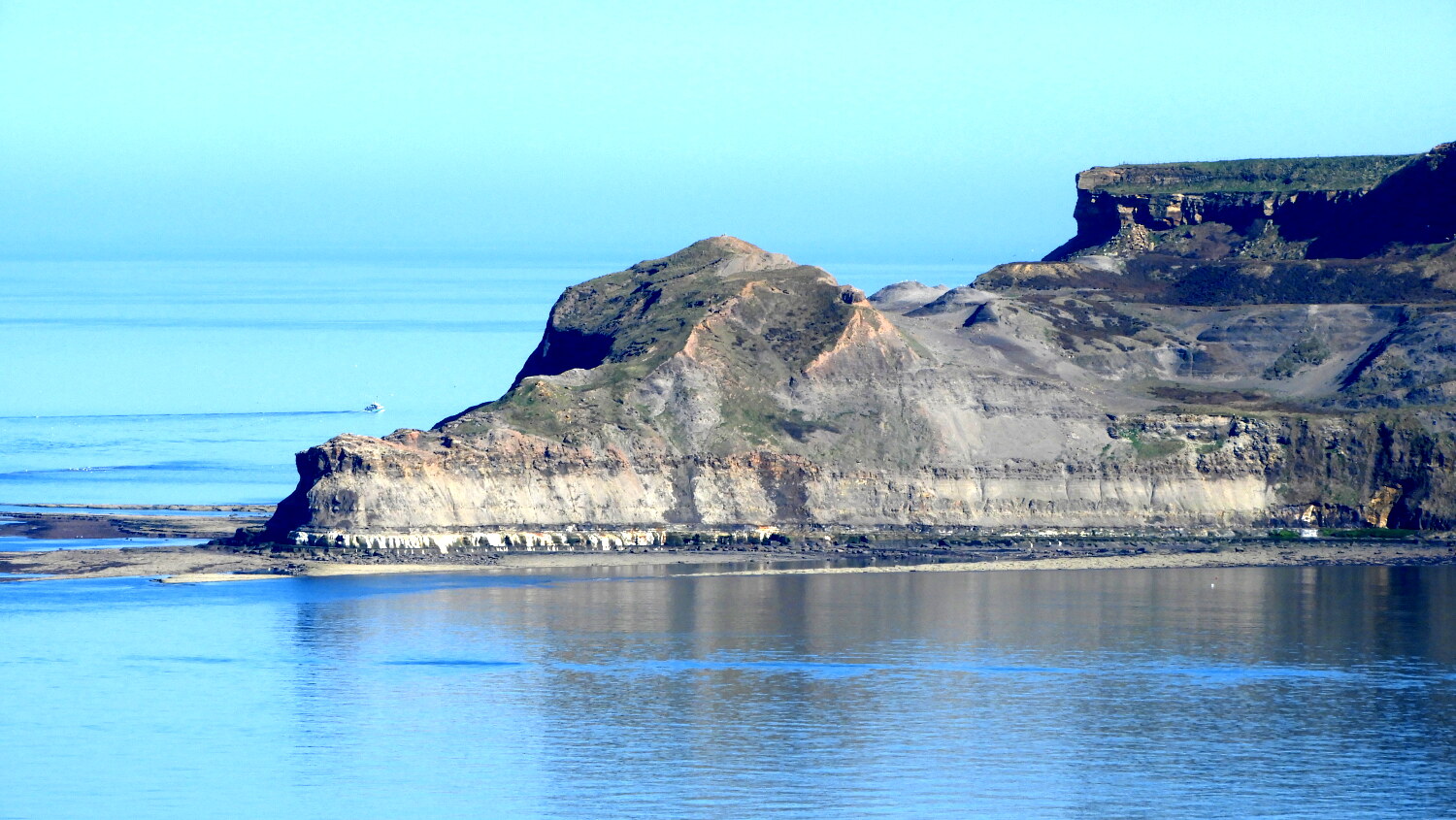 Kettle Ness
The coast from Rosedale Wyke to Port Mulgrave is formed of rocks of the Lower Jurassic Age. The strata are shale with sandstone above. The shale contains a wealth of fossils of marine molluscs, especially ammonites such as dactylioceras. These coiled shellfish are related to modern squids. Also in the same rocks, there are seams of jet, a type of impure coal that is used in jewellery. In the shale there are small cubic and octahedral crystals of iron pyrites (fool's gold).
Port Mulgrave is the shadow of its former glory, when ironstone was shipped from the harbour. This was brought from mines inland, through a tunnel, the bricked up entrance of which is still visible below the cliffs near the harbour ruins.
Acknowledgments: Text derived from the Out and Out Series; Discovering the Countryside on Foot. Pictures courtesy of Wikipedia.


