Malham, Gordale Scar, Malham Tarn and Malham Cove
Through a limestone landscape to a dramatic dry waterfall
Google Maps Open Source Maps| Statistics and Files | ||
|---|---|---|
| Start: Malham Village | Distance: 7.5 miles (12.0 km) | Climbing: 307 metres |
| Grid Ref: SD900427 | Time: 3-4 hours | Rating: Hard |
| GPX Route File | Google Earth File | Public Transport |
| Statistics | |
|---|---|
| Start: Malham Village | Distance: 7.5 miles (12.0 km) |
| Grid Ref: SD900427 | Time: 3-4 hours |
| Climbing: 307 metres | Rating: Hard |
| GPX Route File | Google Earth File |
Ordnance Survey Explorer Map (1:25,000)
The Walk: The village of Malham, in the Yorkshire Dales, is the gateway to an area of great scenic diversity. The underlying geology consists of water soluble Great Scar limestone over a bed of impermeable Silurian slate. This has created a unique landscape of gorges and cracks, potholes and pavements, lakes and waterfalls. The circular walk begins in Malham itself. Despite its popularity with tourists, the village retains its charm. A clear stream runs through its centre, and on either side is a collection of attractive buildings that reflect the rich character of the area in their white limestone walls, mullioned windows, flag roofs and mellow, brown gritstone lintels and cornerstones.
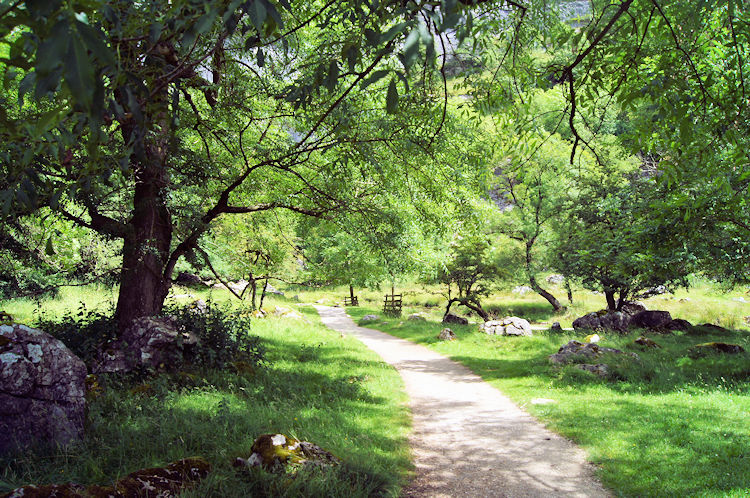
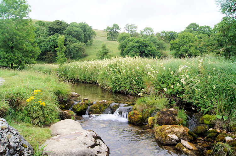 A view between Malham and Janet's Foss
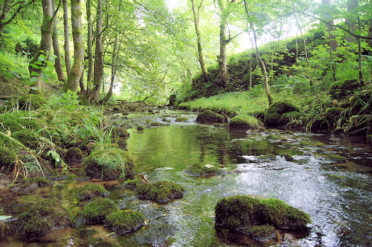 Gordale Beck runs through Wedber Wood
Though Iron Age tools have been discovered in nearby caves, the village itself dates from the 7th and 8th centuries, when the Angles established a wooden township here. In the Middle Ages, it was divided down the center. The land to the west of Malham Beck belonged to Fountain's Abbey, while those to the east were part of the domain of Bolton Abbey. Behind the Old Smithy, a stone footbridge leads you out into the upper countryside. The route goes through a network of small fields, marked out by drystone walls. Many of them contain old stone barns, whose lintels were carved with 18th and 19th century dates. Near the limpid waters of Gordale Beck, the route passes through stands of oak and sycamore. From March to May, these resound to the distinctive drumming of green woodpeckers.
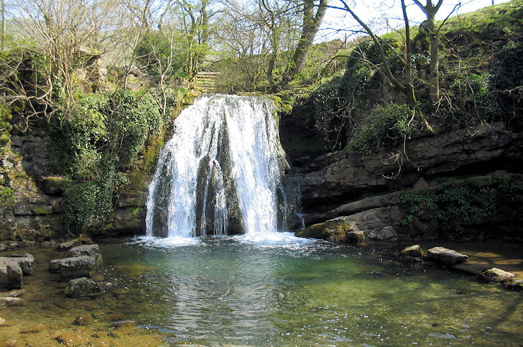 Janet's Foss
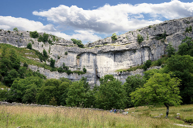
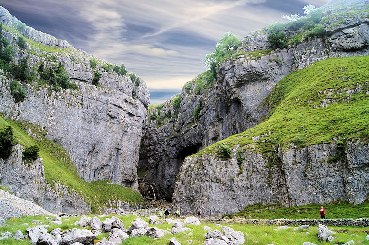 Gordale Scar
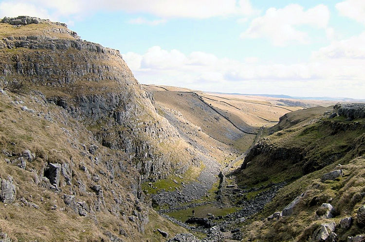
Soon, you reach Janet's Foss, a waterfall, which, despite a relatively modest drop of 30 feet, provides a fine spectacle. According to local legend, Janet is the queen of the fairies, said to live in a cave behind the wall, while Foss is the Viking word for waterfall; many place names in the area have a Scandinavian influence. The pool below the waterfall was once used for dipping sheep. Workers would fortify themselves with strong ale before plunging into the cold waters. The path briefly emerges on the road which bypasses Gordale Bridge, a limestone arch over the beck. It was built for pack horses and is two narrow for vehicles. From here, it is a short walk across open ground to the dramatic gorge of Gordale Scar. Two waterfalls, one above the other, cascade into a cleft some 150 feet deep and just 30 feet wide at the base. The walls rise sheer and even overhang in places.
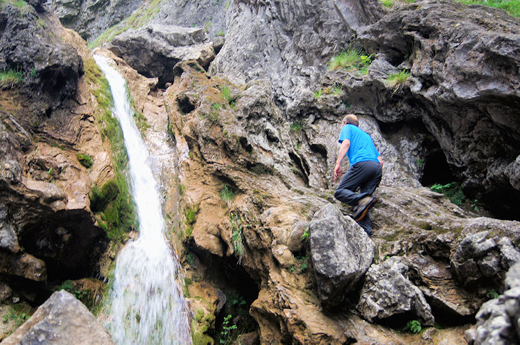 Climbing through Gordale Scar
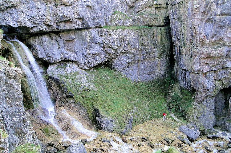 Gordale Scar Upper Waterfall
The water issues from a hole in the rock. Today, there is a stream in the deep, narrow-sided valley above the scar, but prior to 1730 there was a lake there. In that year, there was a great flood which built up so much pressure on the damming rocks that it burst through them, sending the contents of the lake rushing through the ravine. The lower fall has deposited the tongue of tufa, a light, airy limestone, that precipitates out of lime rich water as it tumbles through the air. You scramble up this to the base of the upper falls and climb a series of steps to the top. The sun illuminates the gorge and the falls in the afternoon, though at any other time, and on grey days, it can be relief to climb out of the darkness of the gorge into the light of the open moor above.
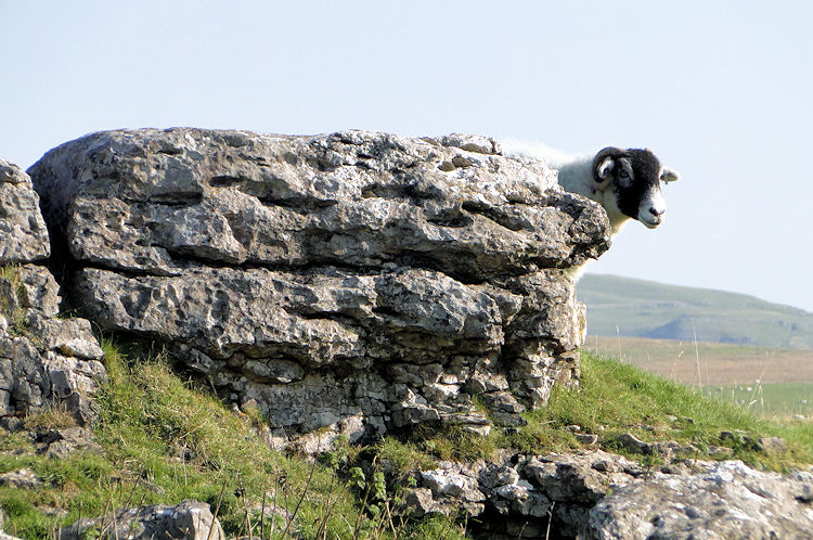 Swaledale Sheep in Limestone
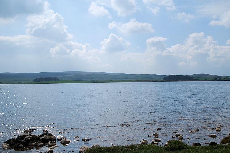 Malham Tarn
The path leads through jagged outcrops of gleaming white stone before joining the surfaced road beneath the flanks of Seaty Hill. The summit of the hill is crowned by the grassy mound of a Bronze Age round barrow. At Street Gate ahead, a crossroads slightly off the route, many old tracks intersect. Most important is Mastiles Lane, which runs across Malham Moor from Ribblesdale to Kilnsey. The route is probably ancient, but today's lane dates from the 13th century, when the monks of Fountains Abbey used it to drive cattle and sheep to and from their lands in the Lake District. The walk bears left around a walled plantation to the shores of Malham Tarn. This beautiful lake owes its existence to an outcrop of a bed of Silurian slate that prevents the water from running away. The wetlands on the western shore make up an important nature reserve, home to many different types of wildfowl. Nestling in the woods to the north is Malham Tarn House, a National Trust property that is now a field study center, providing much information concerning the area's wildlife.
 Ing Scar Crag and Watlowes
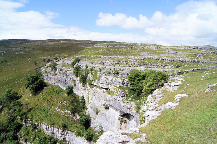 Malham Cove
The route follows the course of a stream issuing from the tarn. This healthy bubbling beck suddenly disappears into potholes in the limestone, at the well named Water Sinks, and continues its course under the ground. The path continues into the dry valley of Watlowes, following a dry stone wall along the former course of a stream long since gone underground. Steep cliffs pocked with caves rise upon either side of the dry valley.
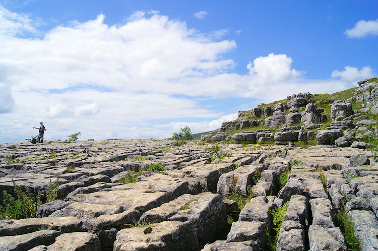 Limestone Pavement on top of Malham Cove
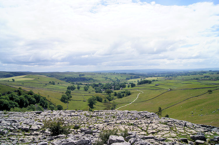 View from Malham Cove to Malhamdale
At the end of the dry valley is a limestone pavement, formed by the action of rain water on hairline vertical cracks in the exposed stone. Rain seeps into the cracks and gradually widens them. The blocks left behind are known as clints and the deep fissures are known as grikes. While the bleached white clints exposed to wind and weather are hard as iron, the grikes form a stable sheltered micro environment for several plants. Spleenworts thrive here, and the long, shiny leaves of hart's tongue fern are unmistakable.
 Beautiful trees near to Malham Cove
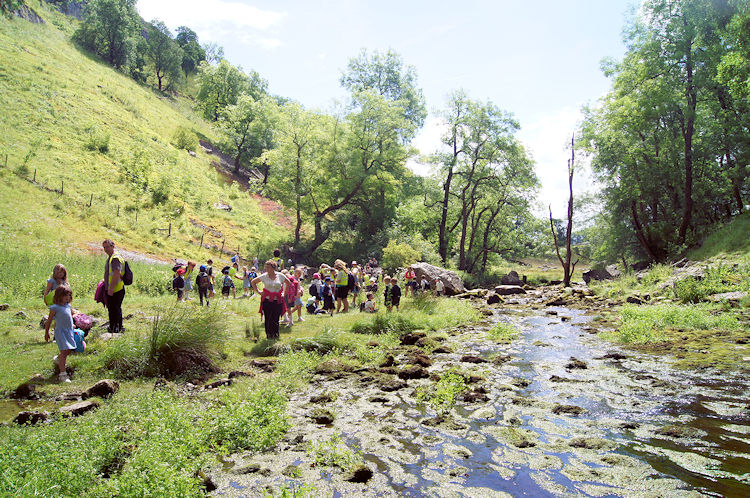 Studious schoolchildren at Malham Cove
From the pavement, there is an easy descent into the rock amphitheater of Malham Cove, which has inspired poems by both William Wordsworth and John Ruskin. Massive faults in the limestone blocks have led to them falling away vertically, leaving cliffs some 300 feet high. The sheer white walls are festooned with brightly clad rock climbers for much of the year, while swifts make their nests in the rock face cracks in summer. Peregrine Falcons are also found here, and there are usually bird watchers, armed with long telescopic sights, observing their goings on.
 Source of the River Aire
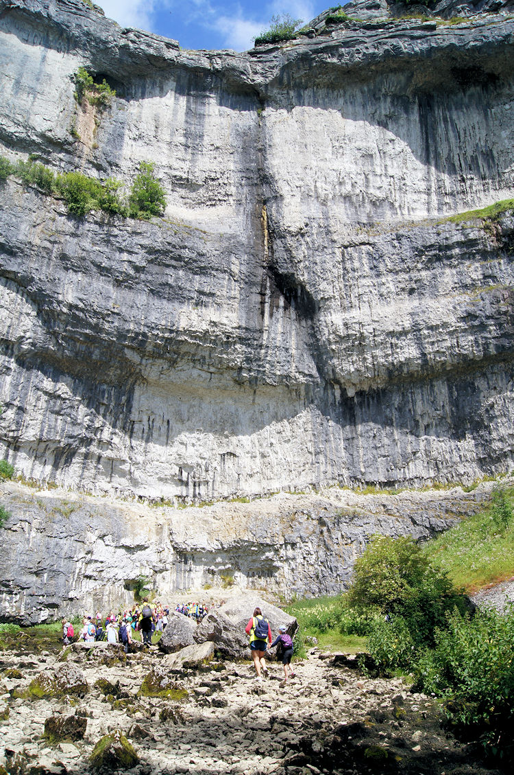 The limestone face of Malham Cove
The waterfall that was once here may well have resembled Niagara. Today, the water that fed it has found a new way down off the moors to leave it dry. The bright clear stream that appears at the bottom of the cove, Malham Beck, does not come from Malham Tarn above, but from the disused mines of Pipelaw Hill a little to the west.
(Story: Malham Cove waterfall in North Yorkshire has been dry for hundreds of years but appears to have been brought back to life by Storm Desmond this weekend after heavy rain helped it to flow again. Before storms tore through, the tallest unbroken waterfall in England was Hardraw Force, about 27 miles away from the cove, which stands at around 100ft. It is believed that it is the first time in several hundred years that water has surged over the cliffs of Malham Cove).
 Malham Cove, the perfect view
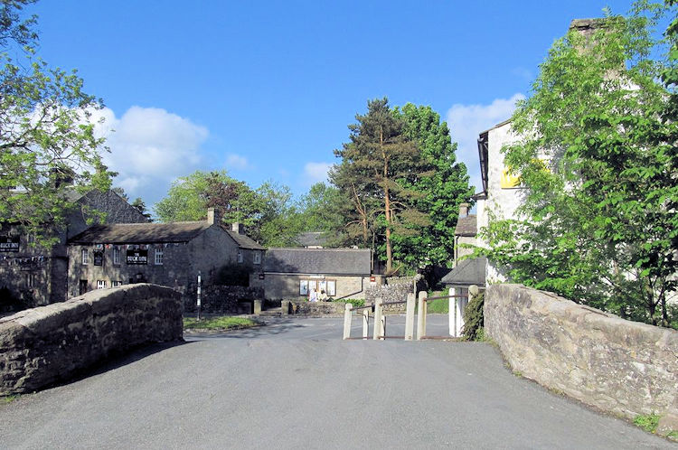 Malham Village
From the foot of Malham Cove, there is a gentle walk along the valley bottom and a road, past the distinctive architecture of Town Head Farm, back into the village of Malham. Time for well deserved refreshments.


