Hawes, Sedbusk, Pike Hill and Hardraw
A walk on the moors near a market town in the Yorkshire Dales
Google Maps Open Source Maps| Statistics and Files | ||
|---|---|---|
| Start: Hawes | Distance: 7.2 miles (11.6 km) | Climbing: 352 metres |
| Grid Ref: SD 87441 89801 | Time: 3-4 hours | Rating: Moderate |
| GPX Route File | Google Earth File | About Hawes |
| Statistics | |
|---|---|
| Start: Hawes | Distance: 7.2 miles (11.6 km) |
| Climbing: 352 metres | Grid Ref: SD 87441 89801 |
| Time: 3-4 hours | Rating: Moderate |
| GPX Route File | Google Earth File |
Ordnance Survey Explorer Map (1:25,000)
The Walk: Wensleydale, which carves a bold path through the heart of the Yorkshire Dales, is characteristically broad and well-wooded. During the Middle Ages, it was known as Yoredale, after the River Yore, now Ure, which runs through it. The dale's current name comes from the small market town of Wensley at its eastern end. This walk investigates the area on many levels, from the high tops and limestone scars of North Rakes Hill, complete with sinister swallow holes, through wooded dales to the time honoured wide green field enclosures in the valley bottoms.
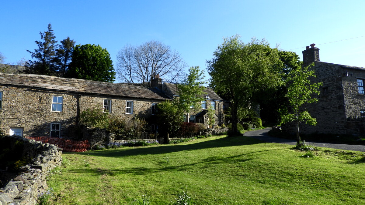 Sedbusk village
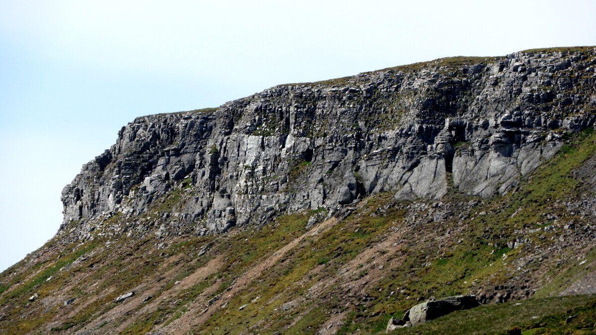 High Clint overlooks Wensleydale
At the center of the dale is the small market town of Hawes, which sprang up relatively recently, following the grunting of its market charter by William the third in 1700. Previously it was a small farming village, like many others in the area. Derived from 'Hals', meaning a pass between mountains, Hawes is a favorite stopping point for all who pass through.
The walk begins from the Upper Dales Folk Museum, housed in an old station building; the railway is long gone. The hustle and bustle of the market town is soon left behind as the route winds along a part of the Pennine Way National Trail footpath. Before Hayland's Bridge was constructed in 1820, wheeled vehicles had to ford the River Ure here. Now the area is used for recreation, with fishing in the river, a cricket pitch on one side and a small nine hole golf course on the other.
Throughout April and May, the low lying meadows around the River Ure resound to the bleating of newborn lambs, which chase around the fields madly, and may even approach and investigate your boots. Although there are plenty of sheep around Hawes, milk is its main produce, and has been since the railway came in 1878. Every night, a train full of milk left horse for London. And even now, milk is very important. Not least in the production of the world famous Wensleydale Cheese.
Beyond the village of Sedbusk, the route heads up North Rakes Hill, past some lime kilns, evidence of an industry that thrived here over 150 years ago, along with lead mining. Fortunately for the dale, demand fell, and the local economy returned to the more pastoral employment of farming. The wild moorland of North Rakes ill is the preserve of the Curlew whose wailing cry epitomizes the atmosphere of these high tops. The males announced their readiness to take a mate and own a territory by gliding from the clear skies on outstretched wings. Their strongly downcurved bills making them unmistakable.
From the Cairns on High Clint, there are spectacular views, if the weather is kind. Ahead are the flat top heights of Ingleborough and the steep slope of Pen y ghent. Down below, the tiny houses of Hawes nestle on the bank of the impressive River Ure. From this remote vantage point, the villages along its course appear totally insignificant. Behind you are the rambling moors of Abbotside Common, where a multitude of becks and springs bisect the peaty soil and keeps the sphagnum beds moist. Care must be taken here, as numerous swallow holes are formed in the limestone bedrock. At these points, foaming moorland becks plunge deep underground and dance around the cave systems. Any apertures without a disappearing stream are known as Shake Holes; the waters that created them have been commandeered by new swallow holes further upstream.
While carefully crossing the narrow fast flowing beck, appropriately named Shivery Gill, glance upstream to see a small, attractive waterfall that tumbles furiously from the fells through a narrow, limestone ravine. Beginning near the summit of Lovely Seat, the waters endured a punishing journey from Sod Hole Gill to the relatively tranquil reaches of the Ure.
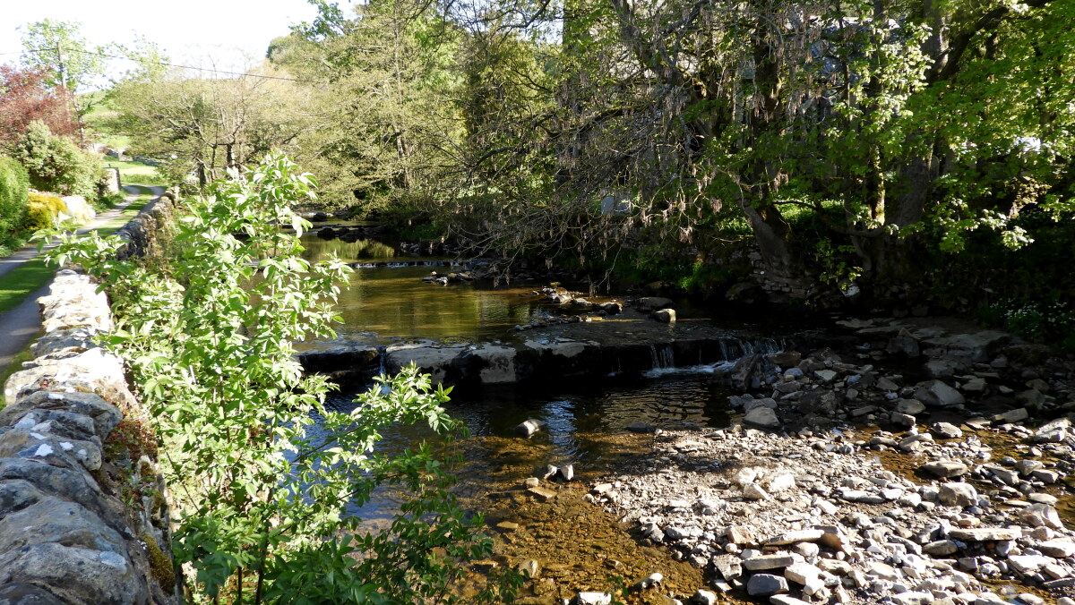 Hardraw Beck
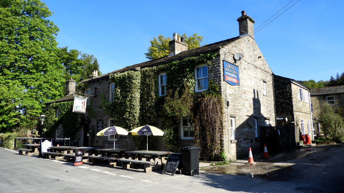 Green Dragon, Hardraw
On the road heading south to Hawes, pause at the signposted viewpoint of Sowry Head and look across to the Hearne Coal Road, which runs north-west beyond Fossdale Farm. At the beginning of the century, villagers made regular trips along this route by horse and cart to purchase coal from small mines close to the top of Great Shunner Fell. Around this time, one enterprising man started a coal delivery round and simply doubled the price of the coal to cover the cost of his services.
Quite soon, the route leaves the road and passes through fields before dropping via a wooden stair, which needs to be descended with care, to a magical wooded riverbank. The path is paved, but this does not detract from the feeling of undisturbed natural beauty that fills the valley. In June, the scent of wild garlic mingles with the sweet smell of honeysuckle to provide a perfect aromatic accompaniment for the Upper Hardraw Falls, which cascade over great slabs of rock. Primroses punctuate the green carpet and toothwart, one of the few plants that are parasitic, grows in the rocky crevices. Pied flycatchers nest in the tree holes, dippers walk among the mini rapids and woodpeckers hammer noisily in the tree canopy.
After paying a small fee and passing through Hardraw village pub, the Green Dragon Inn, it is a short walk to the majestic Hardraw Force, which highlights perfectly the power of the dale. In Victorian times, the acoustic qualities of the enclosed ravine were recognized and regular brass band competitions were held. These have now been revived and provide an added attraction for the tiny hamlet of Hardraw. To listen to the melodic strains of a brass band is an ideal way to end an entertaining day on the high fells, and to prepare for the walk along an easy section of the Pennine Way back into the town of Hawes.
Acknowledgments: Text derived from the Out and Out Series; Discovering the Countryside on Foot. Pictures courtesy of Wikipedia.


